
GRAND RAPIDS, Mich. — West Michigan has already seen some strong storms move through this week, and while a few gusty storms may be possible in the early AM hours of Saturday, it is the storms coming through Saturday night and into early Sunday that presents the biggest risk so far.
Saturday will be hot and humid, with the morning drying out from overnight showers and storms that may bring a gusty area of wind or two. The daytime hours will largely be sunny, with cloud cover increasing ahead of late evening and overnight storms.
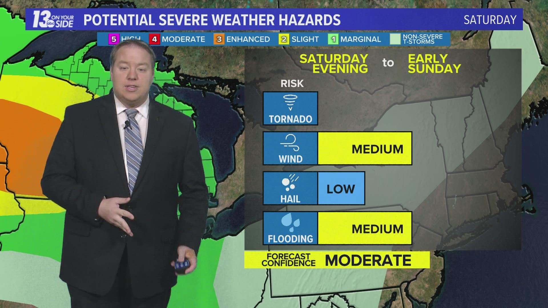
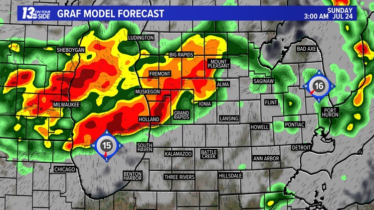
Storms will be the most severe across the lake in Wisconsin, where a level 3 of 5 risk is in place as of Friday, with a level 1 of 5 risk covering all of Michigan on Saturday evening and through the overnight. The largest concerns are for wind and heavy rain, with other severe weather threats having lower risk factors.

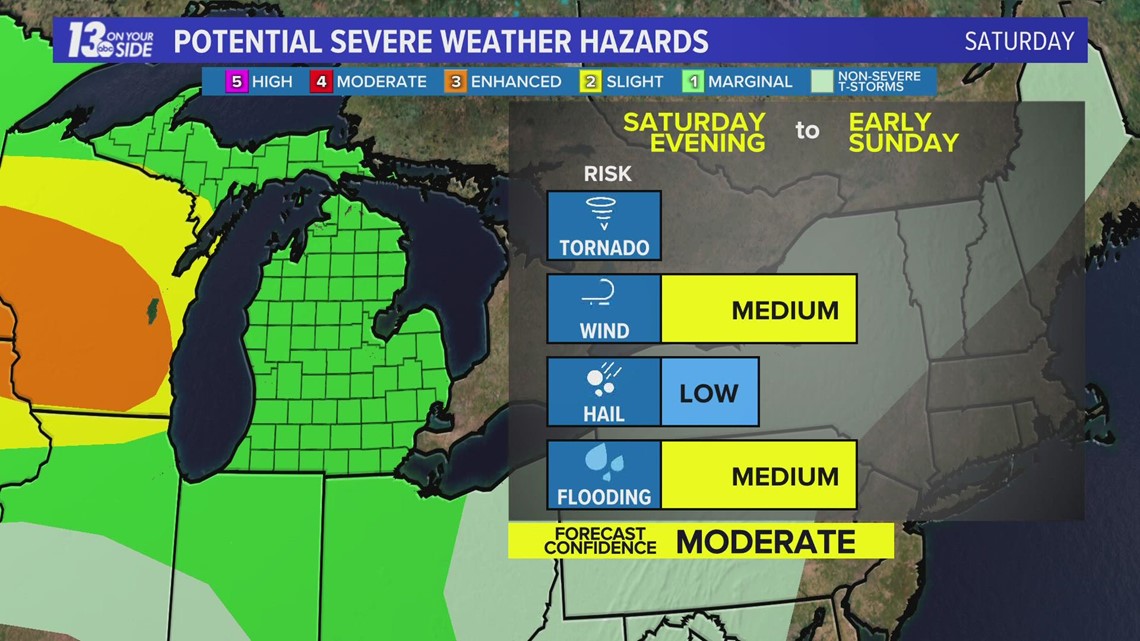
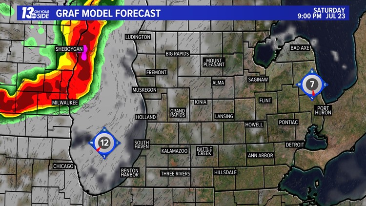
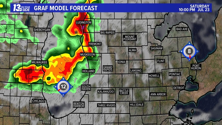
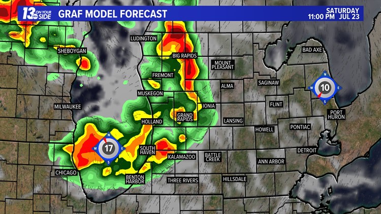
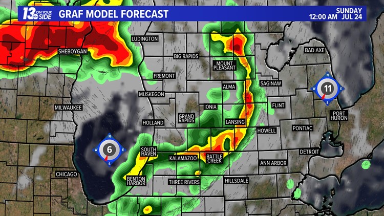
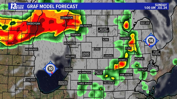
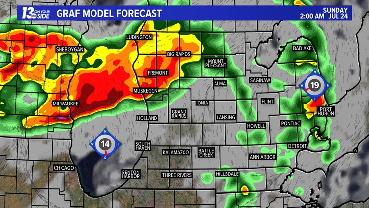
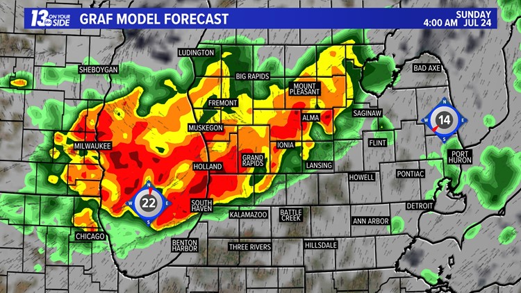
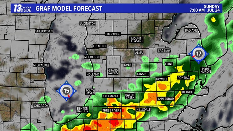
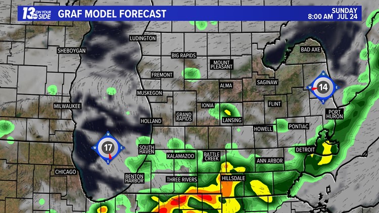
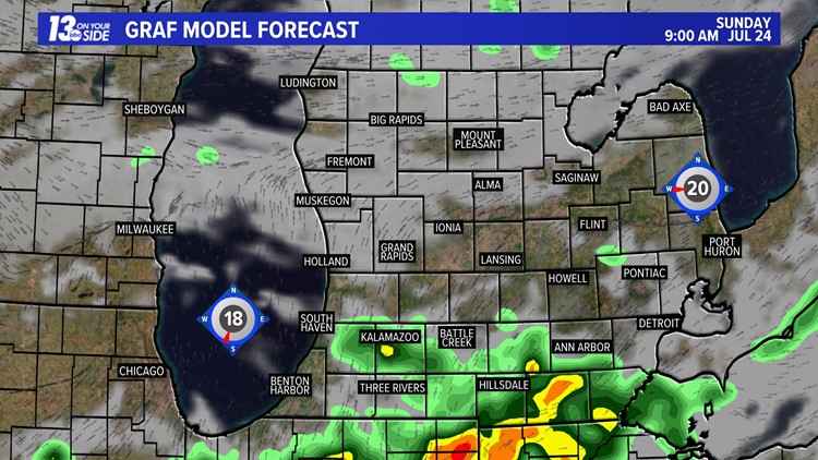
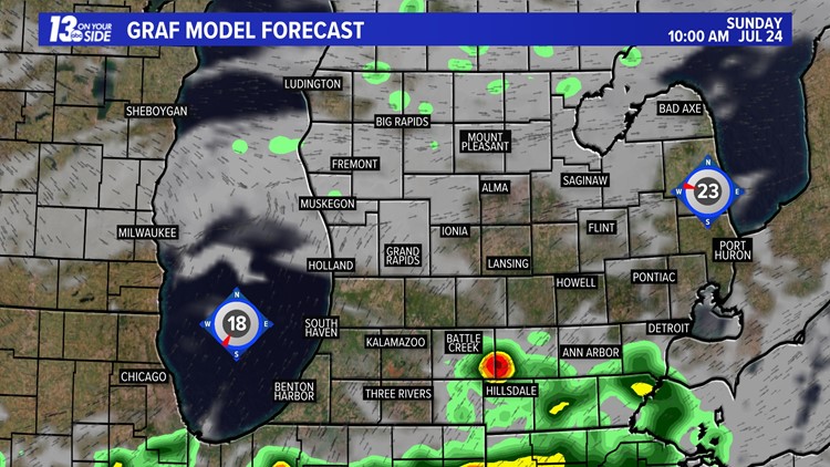
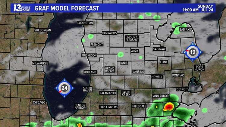
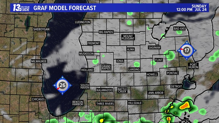
As far as the timing of events goes, we should expect to see at least two waves of storms. One will come between 8 p.m. and midnight Saturday, with more waves of showers and storms coming between midnight and the later morning hours of Sunday.
We could see several hours of heavy rainfall around West Michigan, which could lead to some potential flooding, especially in lower lying areas and those that usually flood in heavy rainfall.
Below is a timeline of how the storms could play out Saturday night and into early Sunday.
Storm Forecast: 7/23/2022


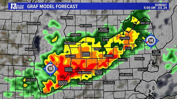

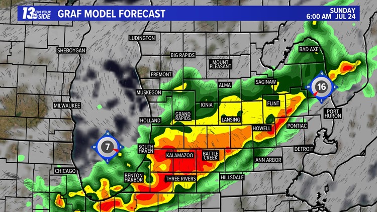


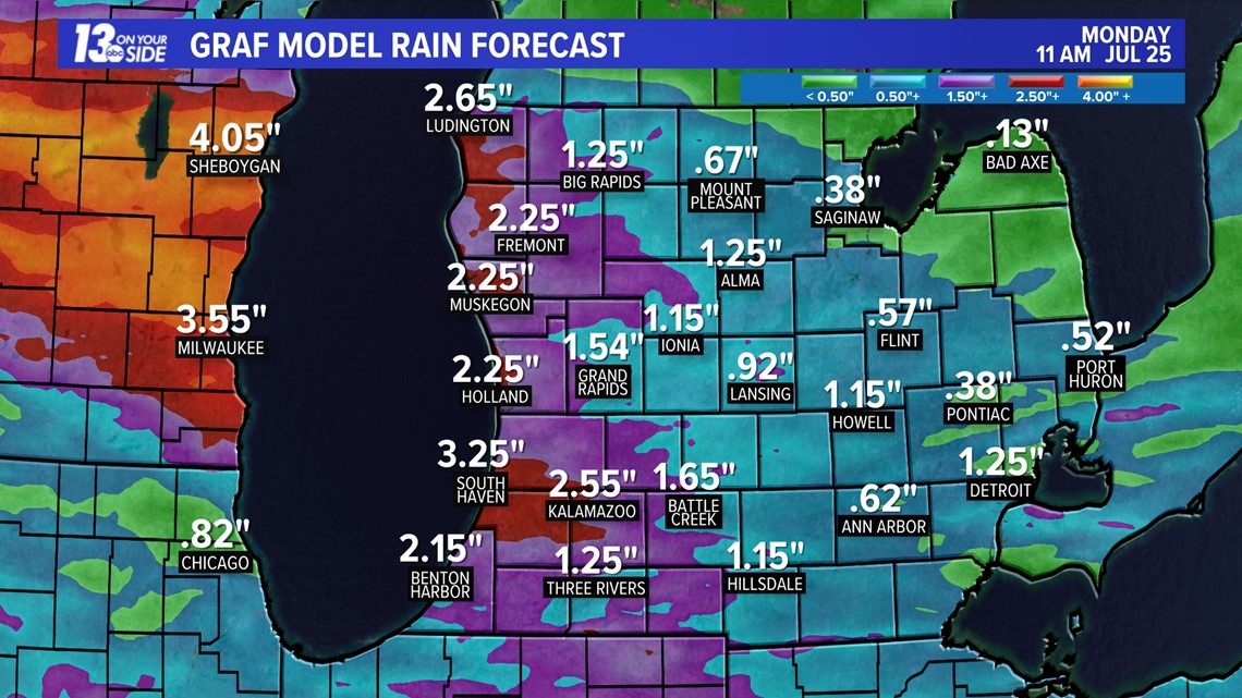
In terms of rainfall, some areas could quickly pick up 1 to as high as 3+ inches from Saturday morning through Sunday afternoon. This will be a widespread rainfall, but if any areas of training storms develop, localized flooding risks will likely develop.
Below is a forecast projection on potential rainfall totals.

As these storms are expected to be the strongest overnight, make sure you have a reliable way to receive weather information. NOAA weather radios and the 13 ON YOUR SIDE Weather App are two ways to do this.
We will be monitoring these storms all weekend long, so make sure you stay weather aware and with us for the very latest!
-- Meteorologist Michael Behrens
Follow me on social media! Facebook Meteorologist Michael Behrens, Twitter @MikeBehrensWX, and Instagram @MikeBehrensWX.
Email me at: MBehrens@13OnYourSide.com
Have a 30-second video or still photo to share? We'd love to share it with everyone! Email your image to Weather@13OnYourSide.com or post it to our 13OnYourSide Facebook Page.
►Make it easy to keep up to date with more stories like this. Download the 13 ON YOUR SIDE app now.
Have a news tip? Email news@13onyourside.com, visit our Facebook page or Twitter. Subscribe to our YouTube channel.