
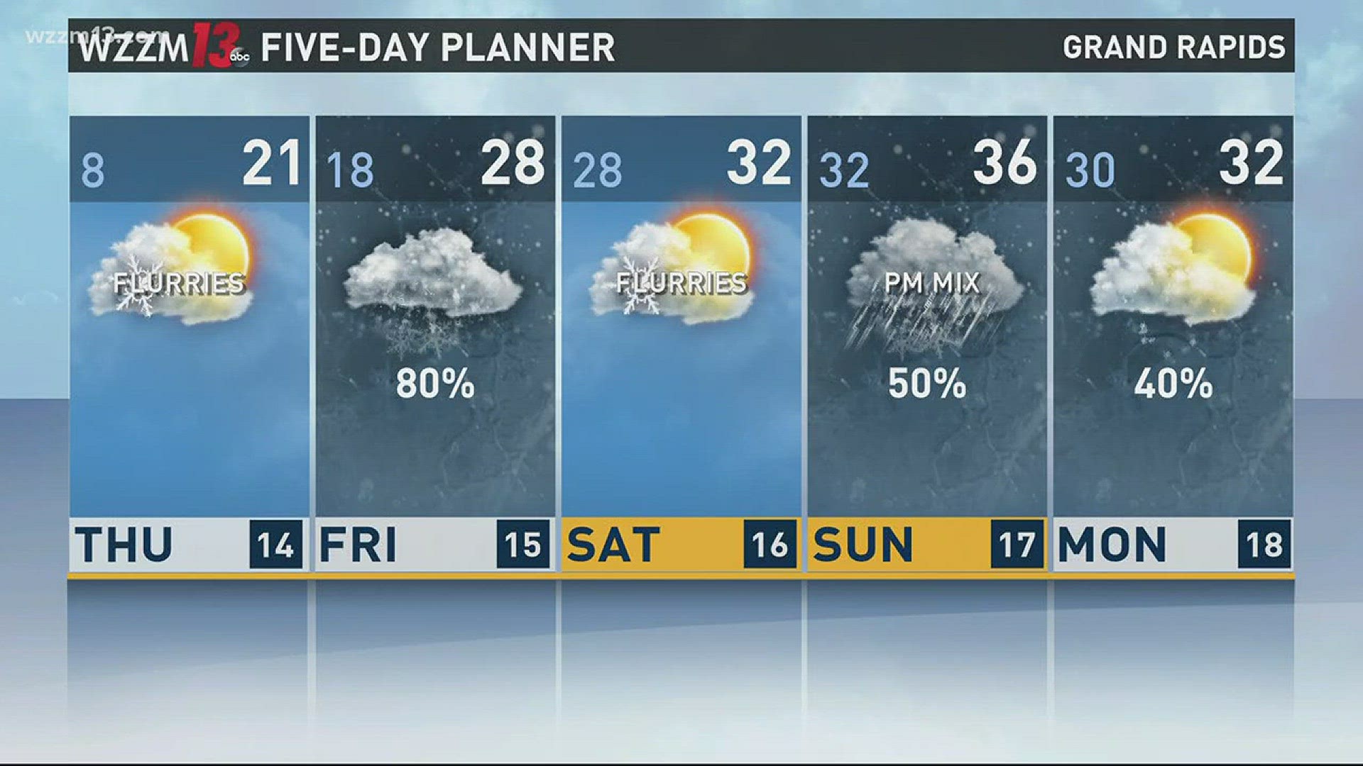
If you don't have enough snow already, several more inches are on the way for West Michigan on Wednesday, Dec. 13!
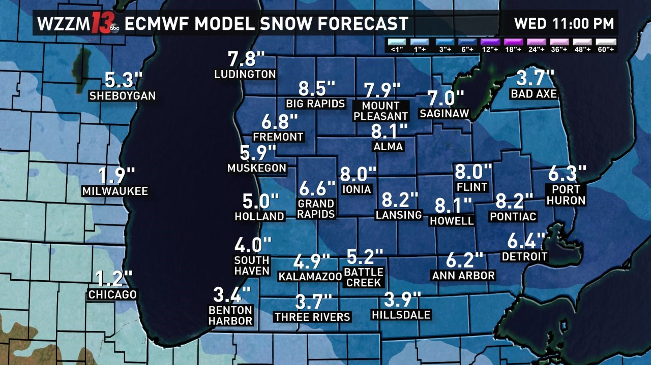
An Alberta Clipper (a fast-moving snow system originating from Alberta, Canada) will pass through the Great Lakes, and those north of I-96 will have a half-foot or more of new snow by the end of the day.
Snow showers will edge into West Michigan during the late morning hours, but by the afternoon, snow showers become heavy. Accumulations could be as high as an inch per hour. The snow showers will move east early Wednesday night.
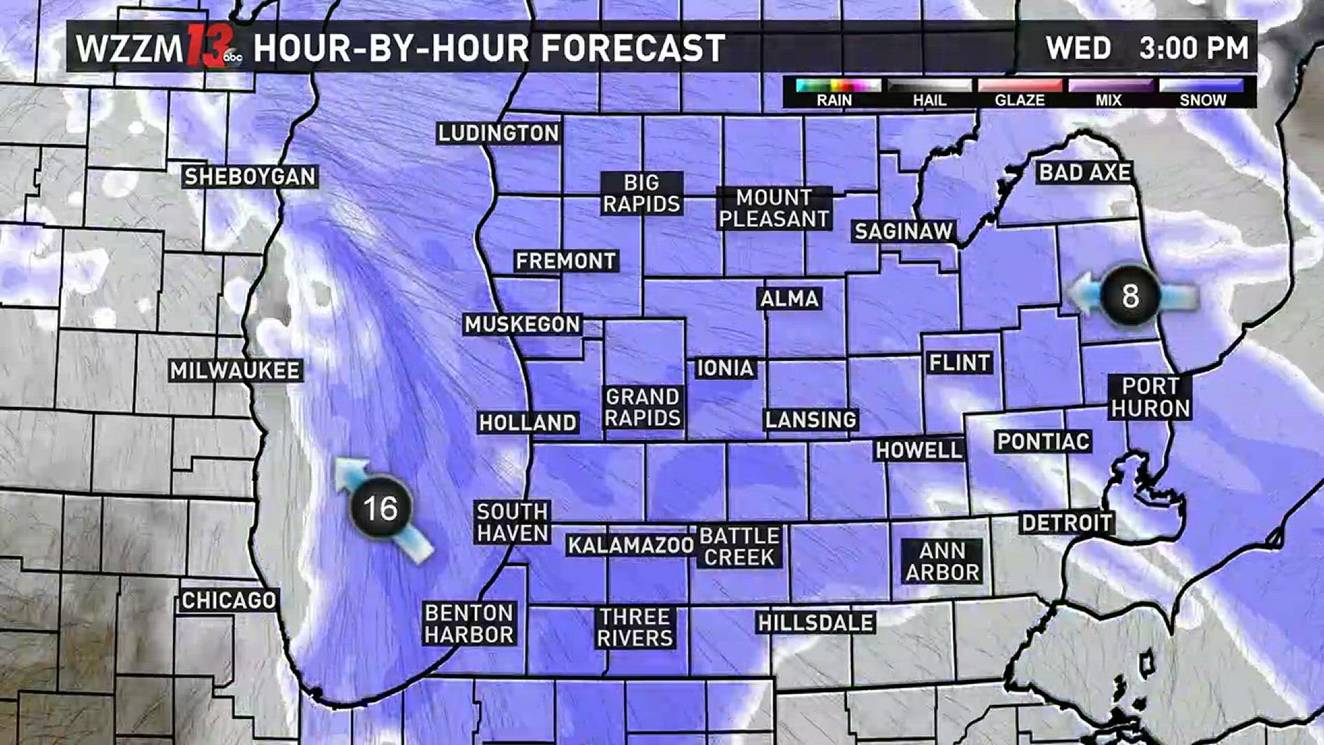
Snowfall totals will be highest north of I-96. 6-8" of new snow is expected. South of I-96, the snow totals will still be plow-worthy, with 2-5" of snow.
Winter storm warnings and advisories are in effect until 11 p.m. Wednesday.
Snow plows may have a hard time keeping up with the rapidly falling snow, so expect a potentially slower commute home this evening.
►Make it easy to keep up to date with more stories like this. Download the WZZM 13 app now.
Laura Hartman is a meteorologist at WZZM 13. You can contact her by email at lhartman@wzzm13.com, or follow her on Facebook or Twitter.