GRAND RAPIDS, Michigan — With the holidays just around the corner, it can be challenging deciding to attend a larger family or friend event, however, a new interactive tool shows how risky it could be to attend a large gathering.
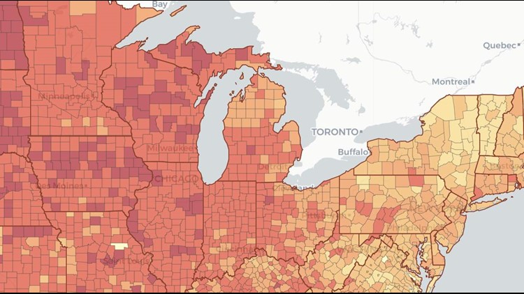
Researchers at Georgia Tech released a "COVID-19 Risk Assessment Planning Tool," a peer-reviewed resource that tells you the risk of being around someone with COVID-19, by the event size, in each U.S. county, in real time.
According to the data, as of Nov. 13, at an event with 10 people, the risk of a person present with COVID-19 is 19% in Wayne County, 30% in Macomb County and 24% in Oakland County.
If that event is with 25 people, the risk increases to 41% in Wayne County, 59% in Macomb County and 37% in Oakland County.
In Kent County, the risk of COVID-19 is 92% and Ionia County is 99%. At an event with 100 people, risk levels in almost every Michigan county surpasses 80%.

Click here to see the tool in action.
The number of confirmed cases of COVID-19 in Michigan has risen to 236,225 as of Thursday, including 7,811 deaths, state officials report.
Thursday's update represents a one-day record of 6,940 new cases and 45 new deaths.

►Make it easy to keep up to date with more stories like this. Download the 13 ON YOUR SIDE app now.
Have a news tip? Email news@13onyourside.com, visit our Facebook page or Twitter. Subscribe to our YouTube channel.