
GRAND RAPIDS, Mich. — So far, winter 2020-21 has been pretty easy on us here in West Michigan. We've had well below average snowfall, and temperatures that have trended near to above average.
We told you the other week part of this stability has been due to a strong polar vortex, but that vortex has now entered a weaker and wavier pattern, which can allow for areas of arctic air to break off and travel down into the United States.
RELATED: What Exactly Is The Polar Vortex?
That's what we are going to see happen over the coming days.
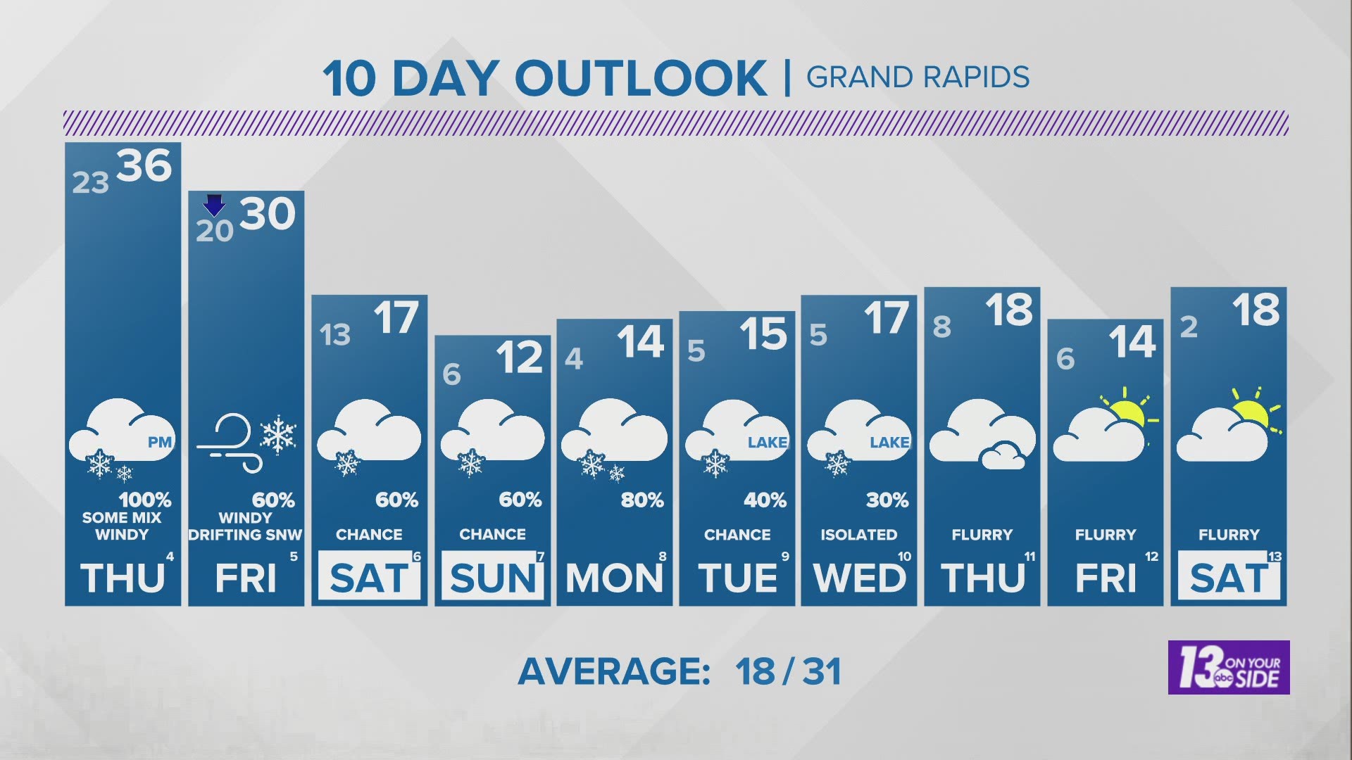
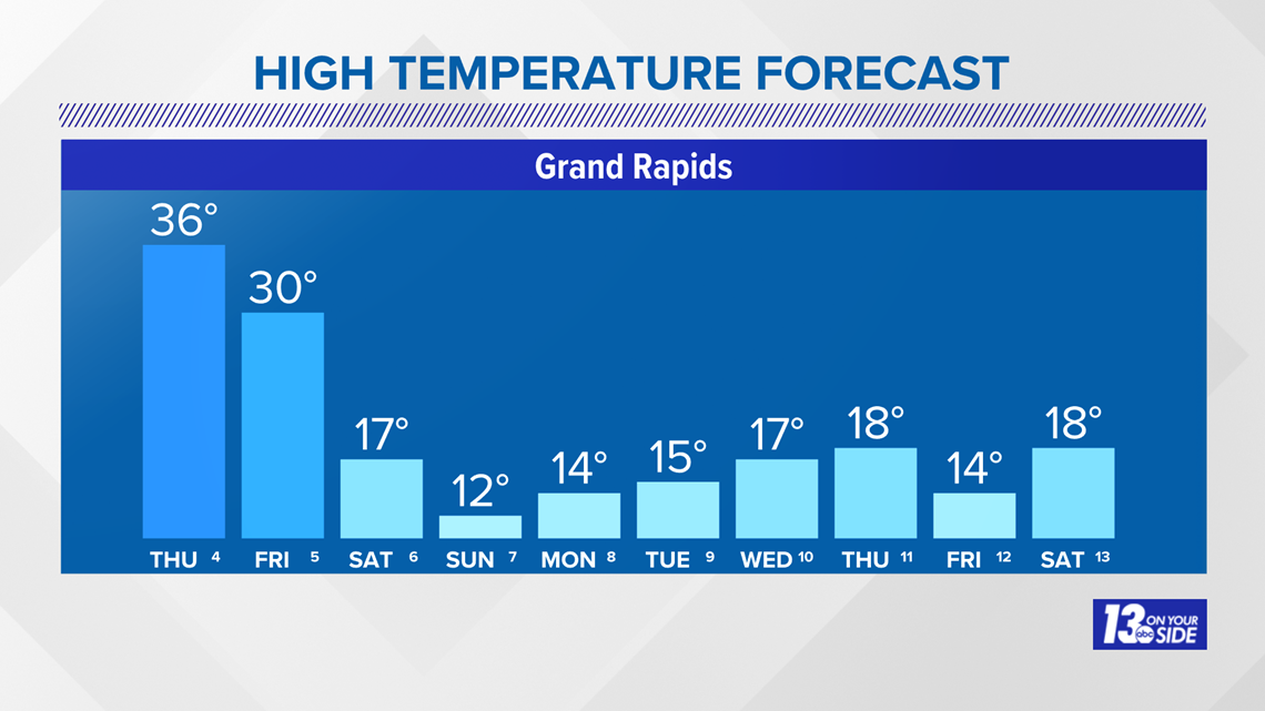
After a weather system bringing wintry mix and snow Thursday turning to all snow Friday moves through, our temperatures are set to fall and fall to levels not seen so far this winter.
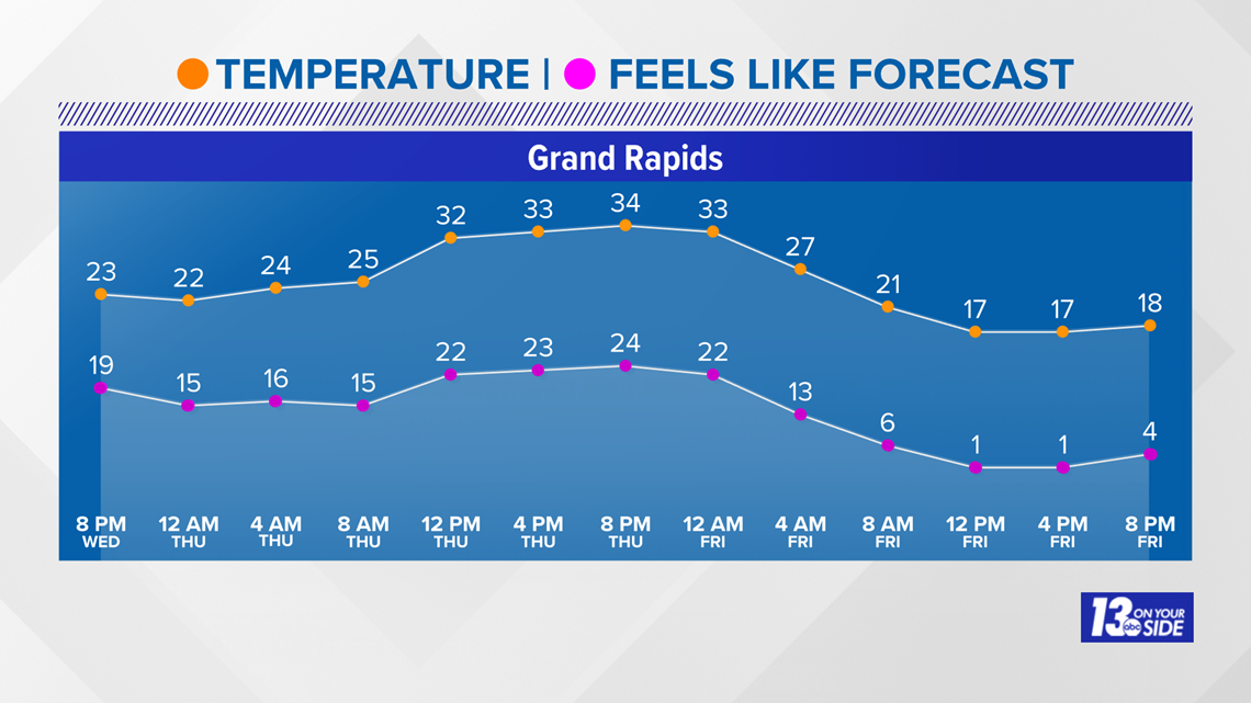
In fact, our forecast calls for highs that have not been this cold since 2019.
Below is our forecast highs over the next 10 days.

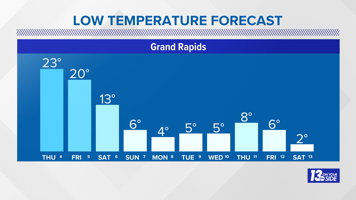
If you think that looks cold, you should check out the lows! We could be looking at single digit to near sub-zero morning lows by this time next week!
We haven't seen lows this cold since 2019 either.

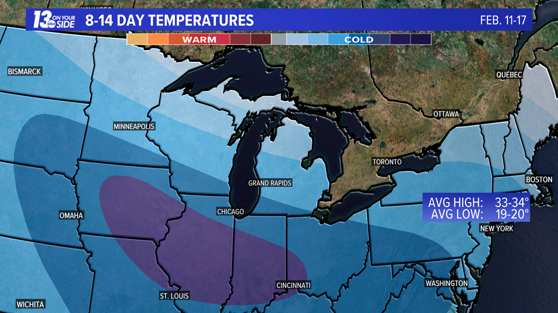
While temperatures start to climb some by late next week, the extended pattern is still looking to be set up for colder than average temperatures. The Climate Prediction Center places West Michigan with a decent shot at continued colder than average temperatures through at least Feb. 17.

In addition to temperatures that will get bitterly cold on their own, winds look set to make things even worse around West Michigan.
Winds will gust into the 30-40+ mph range Thursday night and Friday, with gusts staying above 20 mph into the weekend. This will push wind chill values into the low single digits, to at times, sub-zero range.

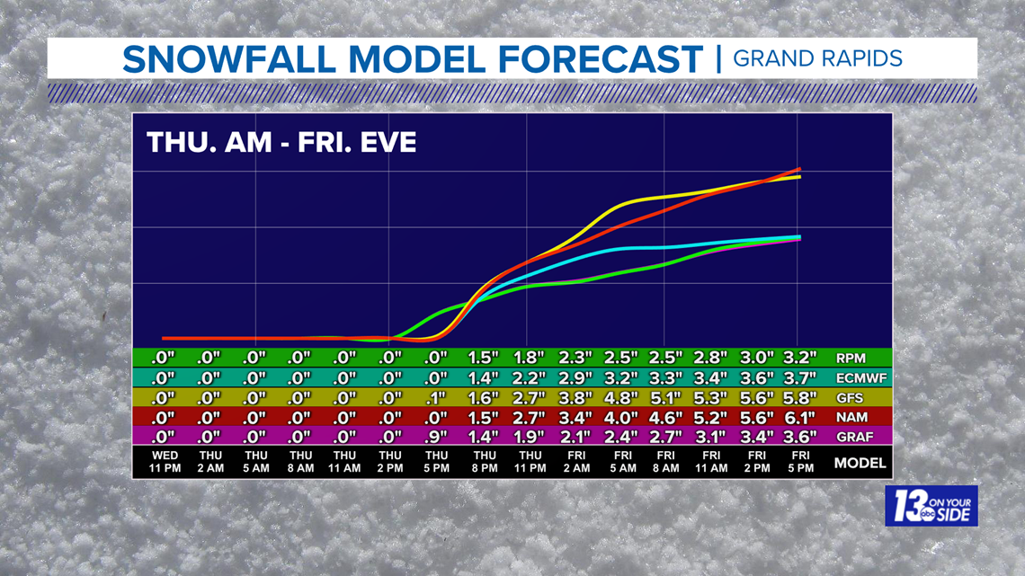
On top of the persistent cold air, we are also looking at several rounds of accumulating snow potential, the first of which arrives with the initial blast of cold air Thursday evening going into Friday.
3+ inches look likely for most of West Michigan in this first round, with some areas seeing over 6 inches. Additional rounds of accumulating snowfall will be possible through the weekend and into next week.
Here's the model comparison on totals for Grand Rapids from Thursday morning through Friday evening.

So with that in mind, make sure you keep an eye on the 13 On Your Side forecast for the latest details as you plan your next few weeks! We'll make sure to keep you informed.
-- Meteorologist Michael Behrens
Follow me on social media! Facebook Meteorologist Michael Behrens, Twitter @MikeBehrensWX, and Instagram @MikeBehrensWX.
Email me at: MBehrens@13OnYourSide.com
Have a 30-second video or still photo to share? We'd love to share it with everyone! Email your image to Weather@13OnYourSide.com or post it to our 13OnYourSide Facebook Page
►Make it easy to keep up to date with more stories like this. Download the 13 ON YOUR SIDE app now.
Have a news tip? Email news@13onyourside.com, visit our Facebook page or Twitter. Subscribe to our YouTube channel.