
GRAND RAPIDS, Mich. — Here we are, the busiest travel day of the year! With that in mind, the last thing anyone wants to deal with is travel delays thanks to the weather, causing them to miss out on time with family or a delicious Thanksgiving meal!
This year it looks like we have some good news! A largely quiet weather pattern has set up across the U.S. and this includes almost all of the major air hubs as well!
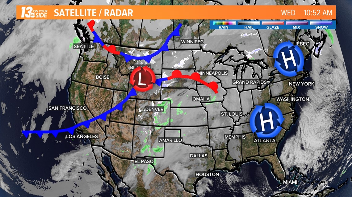
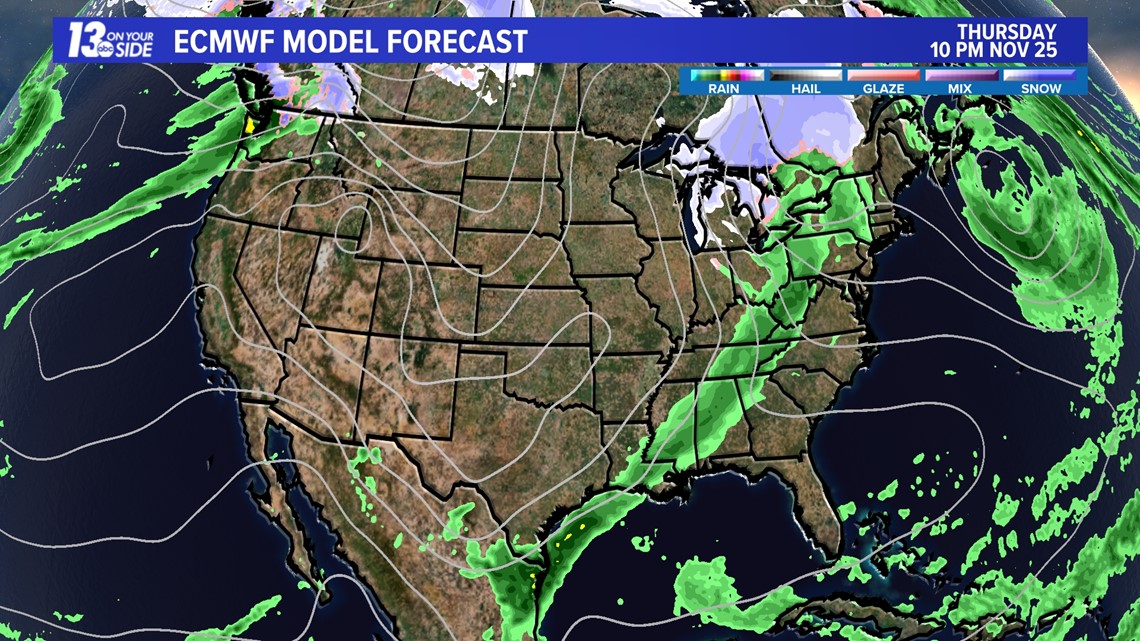
High pressure is dominating the eastern third of the country, with the only major weather system in play right now being relatively unimpressive and creating mostly just clouds over the middle section of the nation. The only major airport that may see some weather impacts would be Denver, though these are not likely to be major.
This means any travel delays should be from congestion and not the weather!

That system out west will start to generate some additional impacts heading into Wednesday night, though most of this should come in the form of light rain. The good news, nothing in this change looks to be majorly disruptive to air travel.

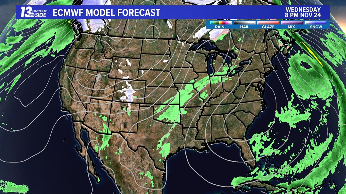
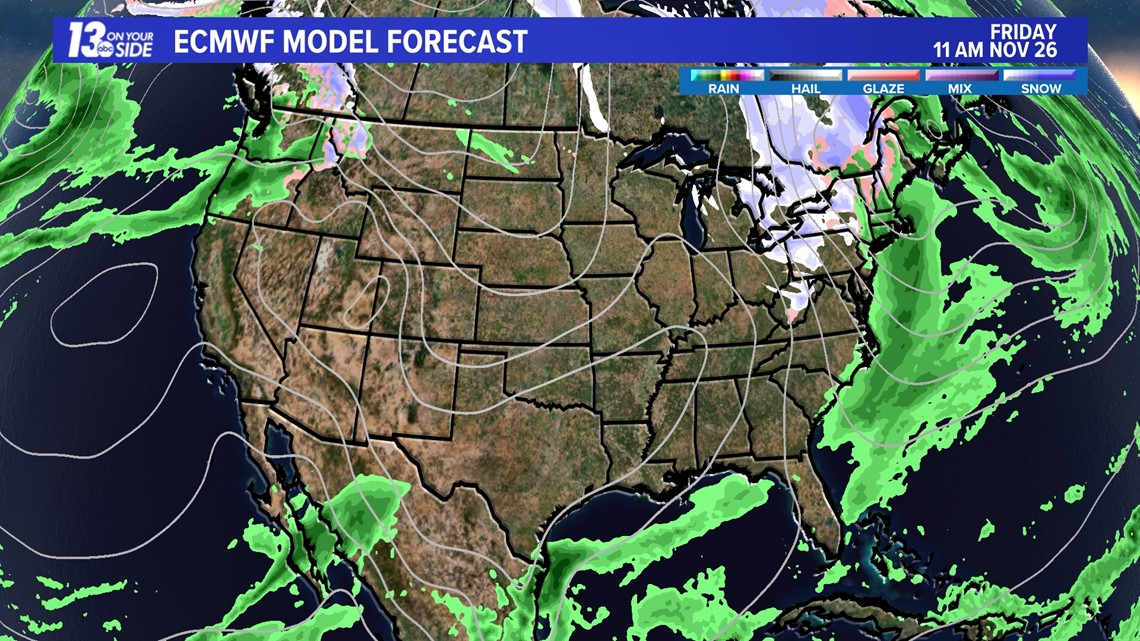
By Thanksgiving morning an elongated area of showers will be around from Michigan and Western New York all the way down through Texas. Some snow may be possible in Wisconsin and the U.P., with additional rain/snow in Washington state.
Overall impacts are still minimal for major travel hubs.

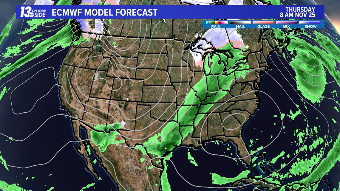
A very similar pattern continues as we head into Thanksgiving night, with snow potential now entering lower Michigan. Impacts should largely be minimal.

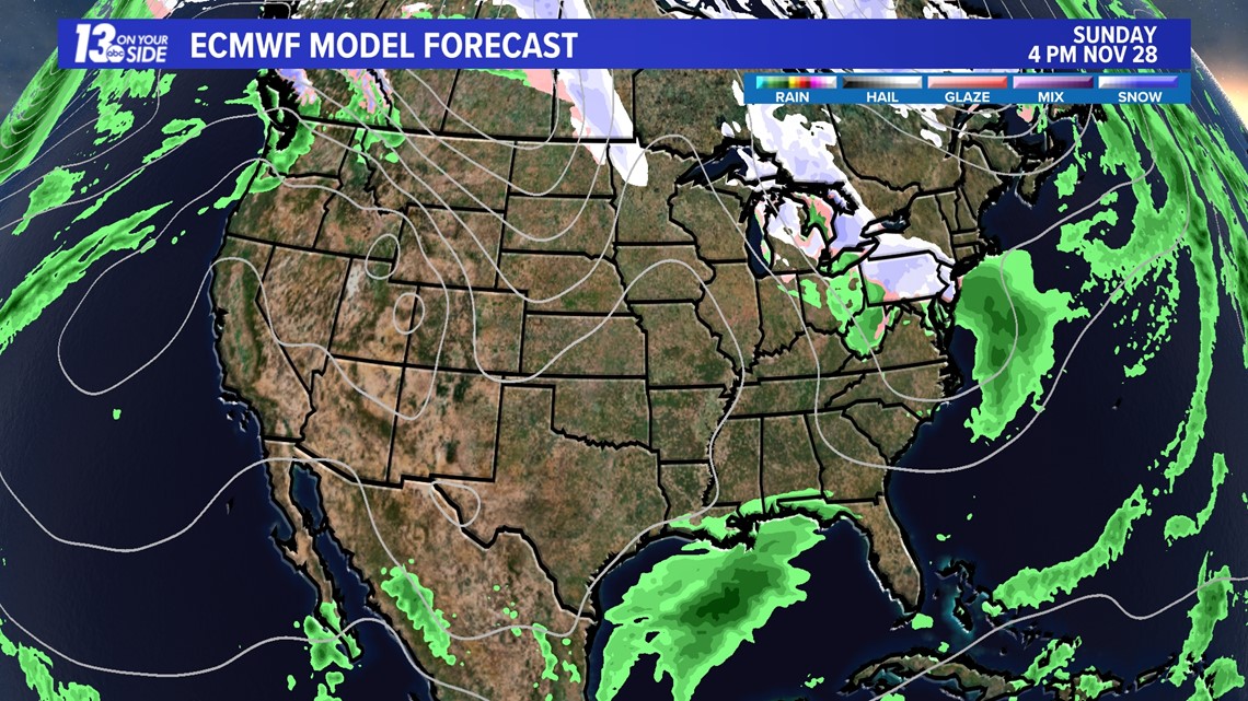
Heading into Black Friday we could start to see some additional rain/snow impacts, especially in the Northeast and Pacific Northwest. This may cause some travel concerns in particularly snowy areas, but most of the country will remain quiet.

Heading toward the end of the holiday weekend another area of rain/snow is expected to form from Michigan into the northeast. This could produce some light accumulations.
Some impacts to travel could occur, though it would depend on how this system evolves. Again, a good portion of the country will remain quiet and snowfall/rainfall totals and locations will likely shift some between now and Sunday.
This system will be worth keeping an eye on over the next few days, and the 13 On Your Side Weather Team will be tracking it as we head into the weekend!

No matter where you go this holiday season, make sure you have the 13 OYS News and Weather apps installed on your phone for weather alerts, radar, and traffic all right in your pocket. We've got you covered West Michigan!
-- Meteorologist Michael Behrens
Follow me on social media! Facebook Meteorologist Michael Behrens, Twitter @MikeBehrensWX, and Instagram @MikeBehrensWX.
Email me at: MBehrens@13OnYourSide.com
Have a 30-second video or still photo to share? We'd love to share it with everyone! Email your image to Weather@13OnYourSide.com or post it to our 13OnYourSide Facebook Page.
►Make it easy to keep up to date with more stories like this. Download the 13 ON YOUR SIDE app now.
Have a news tip? Email news@13onyourside.com, visit our Facebook page or Twitter. Subscribe to our YouTube channel.