GRAND RAPIDS, Mich — Get ready for a chilly night!
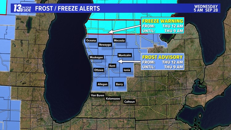
Wednesday morning, the National Weather Service issued Frost Advisories for a majority of the area and Freezing Warnings for northern portions of West Michigan. This comes as temperatures drop into the low to mid-30s, causing potential frost.

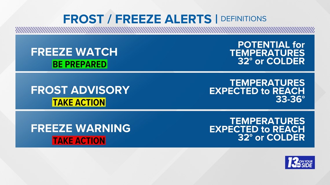
The Frost Advisory and Freeze Warnings go into effect from midnight to 9 a.m. Thursday morning. With temperatures near and below freezing, plants and other sensitive vegetation could be harmed.
In order to prevent any damage, shelter potted plants by bringing them indoors. You can use blankets or sheets to cover large areas. Also, watering the leaves of outdoor plants can help heat transfer heat and prevent freezing.


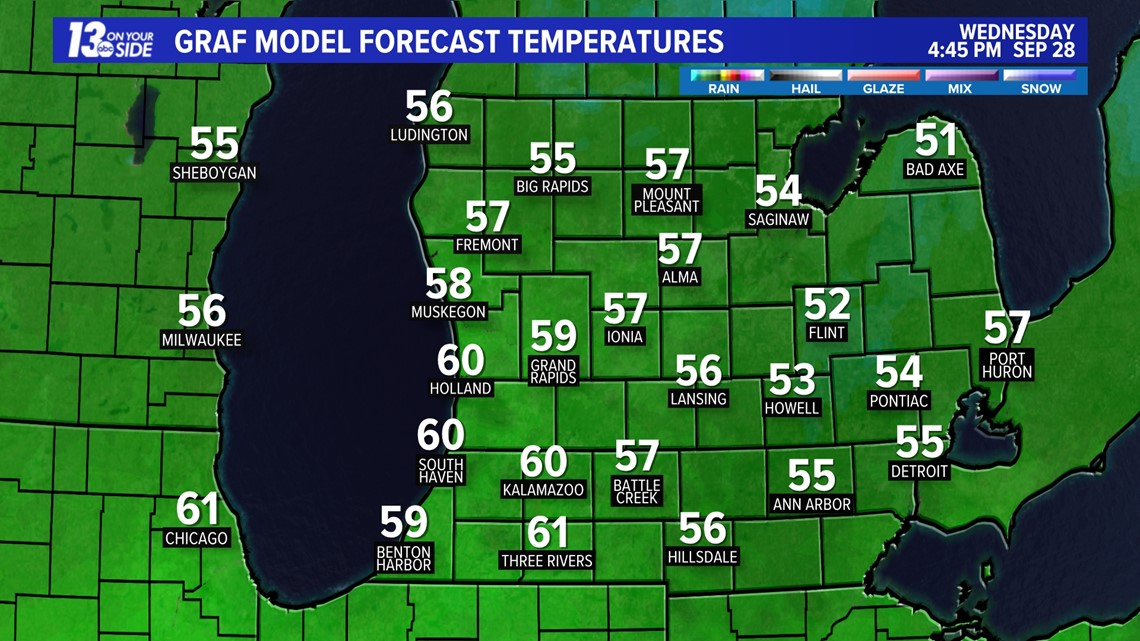
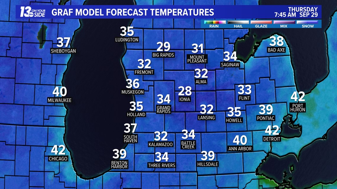
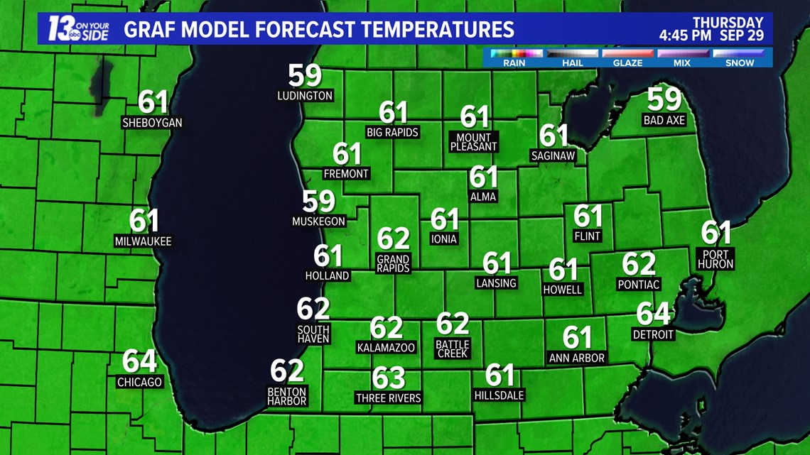
Here's a look at modeled temperatures into the overnight hours. The good news is that these frosty conditions won't last long as sunshine will dominate the forecast on Thursday, bringing our high back into the low 60s.


After this cold and damp stretch, the next 6 to 10 day forecast calls for above average temperatures and below average precipitation. Average highs are around 65-67° with an average precipitation of 0.65". That continues for the next 8 to 14 days. With above average temperatures and below average precipitation. Average highs are around 63-66° with an average precipitation of 0.90".
Have a 30-second video or still photo to share? We'd love to share it with everyone! Email your image to Weather@13OnYourSide.com or post it to our 13OnYourSide Facebook Page
►Make it easy to keep up to date with more stories like this. Download the 13 ON YOUR SIDE app now.
Have a news tip? Email news@13onyourside.com, visit our Facebook page or Twitter. Subscribe to our YouTube channel.