
5 a.m. - West Michigan was spared the worst of the heavy storms that moved through the Midwest Monday.
The thunderstorms brought heavy rain to much of the area, causing some minor localized flooding.
Winds weren't nearly as bad as those seen in Nebraska, Iowa, parts of Wisconsin, and Indiana. The wind storm had power similar to an inland hurricane, according to the Associated Press. It blew over trees, flipped vehicles, and caused widespread property damage. Tens of thousands of homes were without power.
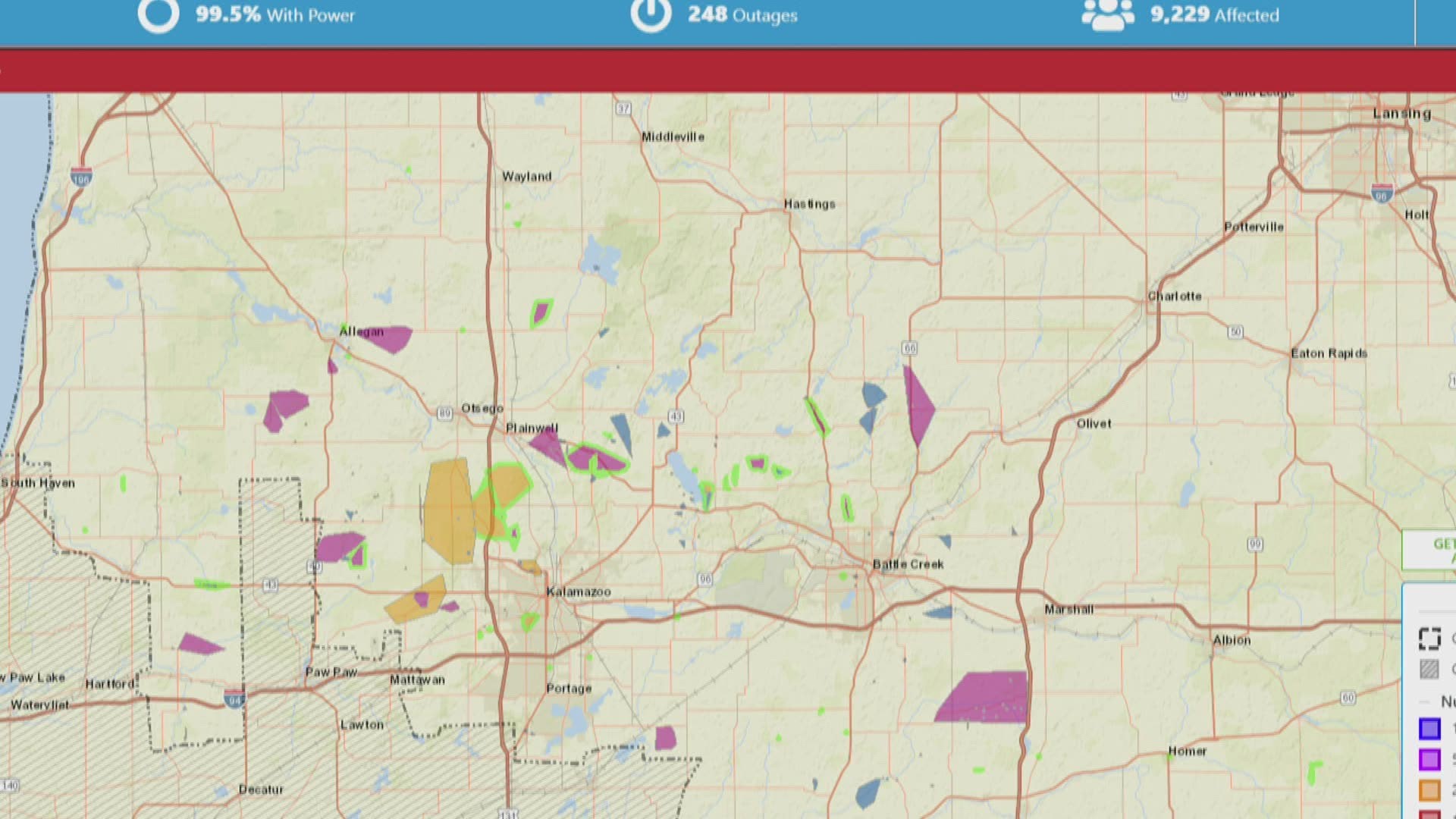
This morning, around 12,000 Consumers Energy customers in West Michigan were left in the dark. The hardest hit area were south of Grand Rapids.
8:30 p.m. - Wind gusts reached 45 mph in Grand Rapids and Kalamazoo. The strongest gusts were recorded in Benton Harbor and closer to the Michigan-Indiana border.
A flood advisory has been issued for Muskegon County.
Consumers Energy now estimates about 20,000 are without power.
8 p.m. - Thousands of West Michigan residents are without power after strong storms whipped through the region.
According to the Consumers Energy outage map there are about 18,000 without power across the state.
-----
5 p.m. - Severe thunderstorms are expected to hit West Michigan shortly after 6 p.m. Monday.
The National Weather Service said the storms are crossing Lake Michigan, and as they approach the lakeshore there will be abrupt rises in water levels.
A severe thunderstorm watch has been issued for Southwestern Michigan and northern Indiana until 12 a.m. The storms may produce strong winds that could damage trees, power lines and buildings.
►Make it easy to keep up to date with more stories like this. Download the 13 ON YOUR SIDE app now.
Have a news tip? Email news@13onyourside.com, visit our Facebook page or Twitter. Subscribe to our YouTube channel.