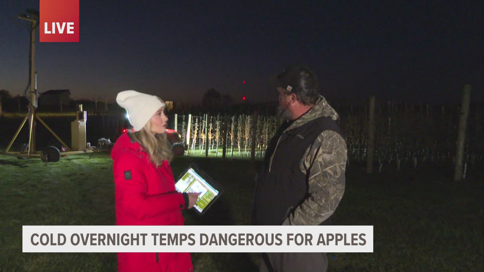
GRAND RAPIDS, Mich. — After a pretty quiet weekend in West Michigan, the work week will start to pick up the pace in terms of our forecast.
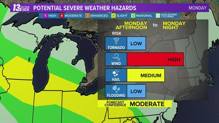
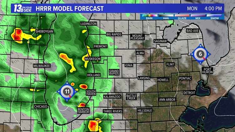
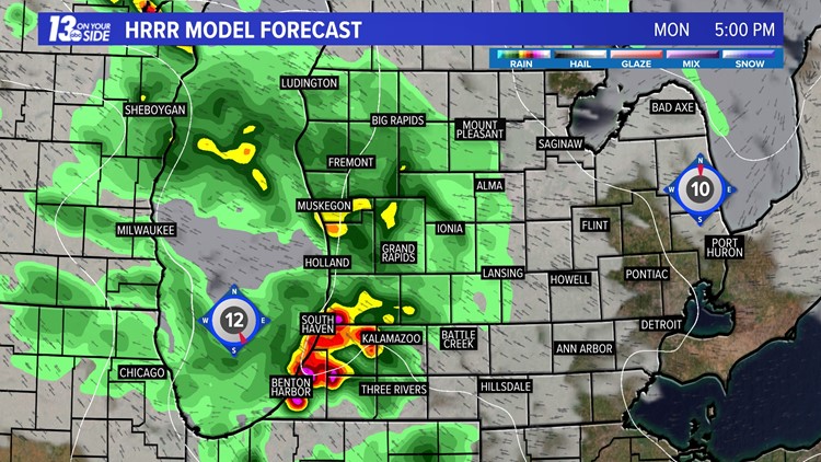
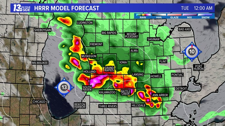
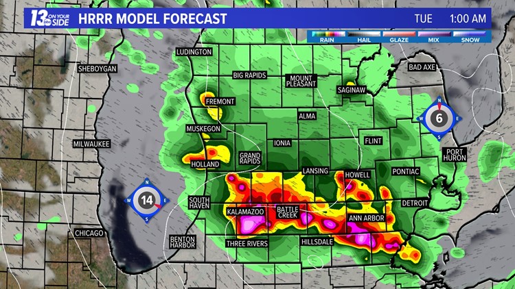
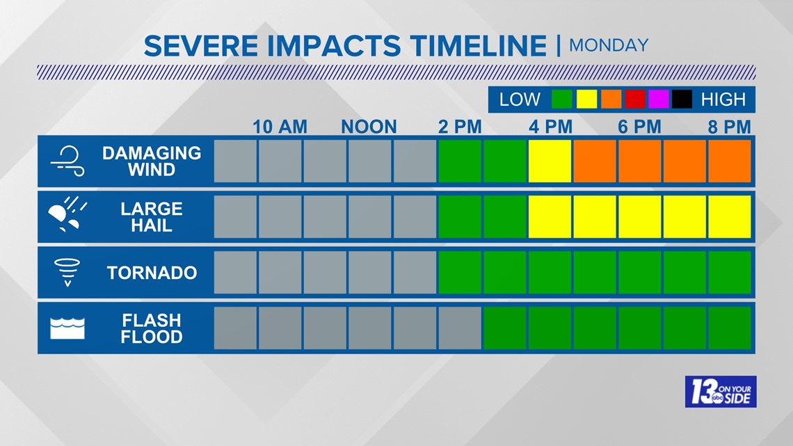
This will start on Monday afternoon when we are under the gun for possible severe weather across the region. We will be watching storms that form on the other side of the lake and then rush across into Michigan. These storms will bring with them the risk for strong damaging winds, possible large hail, and the potential for flooding rains and a tornado or two.
Hour-by-hour Forecast: 6/13/22


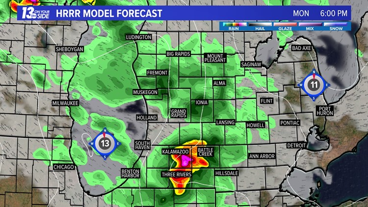

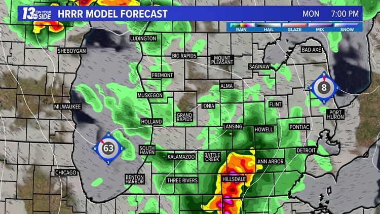

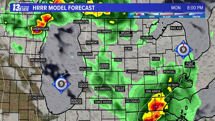

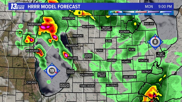

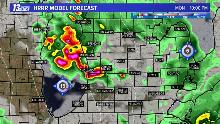

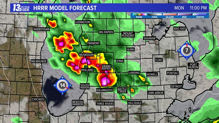


The risk for severe weather will be highest in areas south of Grand Rapids, which will be under a level 2/5 risk for severe weather on Monday. Areas further north will be under a level 1/5 risk for severe weather.
The likelihood for severe weather will start to rise as we head into the afternoon, peaking during the late afternoon and into the evening. Damaging winds will be our biggest threat, but all types of severe weather will be possible.

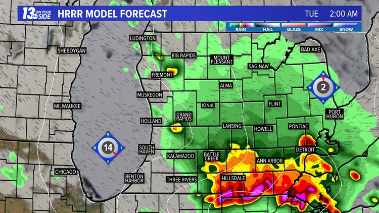
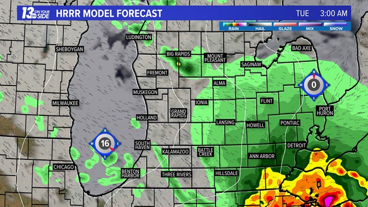
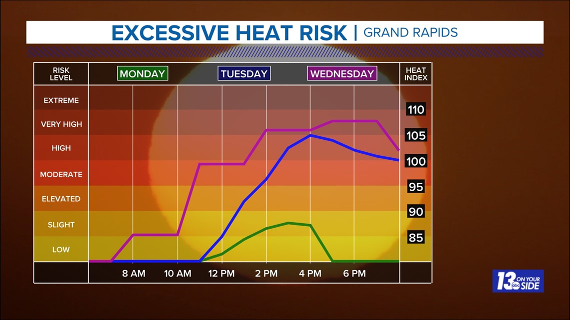
Storms will move out of West Michigan as we head into the overnight hours, and the weather for Tuesday is expected to be dry. That doesn't mean the weather will be pleasant though, as that is when high levels of heat and humidity move in.
On Tuesday and Wednesday we should expect to see temperatures in the 90s with dew points in the 70s.

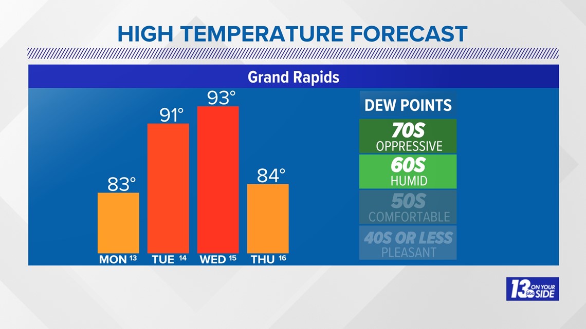
These conditions will push "feels like" temperatures up into the upper 90s and low 100's. It will be important to take breaks, stay cool, and drink plenty of water if working outside or in areas without air-conditioning.

The 13 On Your Side Weather Team will be tracking both the heat and the storms as we head into this week, so make sure to stay weather aware and with us for the latest details! Remember, downloading the 13 On Your Side News & Weather apps will allow any weather alerts to go right to your pocket in real time!
-- Meteorologist Michael Behrens
Follow me on social media! Facebook Meteorologist Michael Behrens, Twitter @MikeBehrensWX, and Instagram @MikeBehrensWX.
Email me at: MBehrens@13OnYourSide.com
Have a 30-second video or still photo to share? We'd love to share it with everyone! Email your image to Weather@13OnYourSide.com or post it to our 13OnYourSide Facebook Page.
►Make it easy to keep up to date with more stories like this. Download the 13 ON YOUR SIDE app now.
Have a news tip? Email news@13onyourside.com, visit our Facebook page or Twitter. Subscribe to our YouTube channel.