
GRAND RAPIDS, Mich — Snow is guaranteed if you live in the Midwest, especially if you live downwind of one of the Great Lakes.
Lake-effect snow attributes to a large percentage of seasonal snowfall in West Michigan, especially for those near the lakeshore.
But lake-effect snow trends have been changing. Some in West Michigan are getting more snow in recent years all thanks to lake-effect snow while others are declining.
RELATED: What is lake effect snow?
Season snowfall data in the National Climate Assessment Midwest Historical Climate report observed that snow from low pressure systems is declining in recent years. However, lake-effect snow is a larger percentage of season snowfall over time (observation period from 1961-2010).

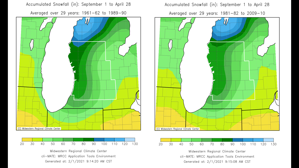
This research also exhibits lake-effect snow bands are pushing farther downwind of Lakes Michigan and Superior.
But a close view indicates immediate lakeshore communities are trending down when it comes to snow amounts.
We examined season snowfall data of both Grand Rapids and Muskegon. The data was observed over two 30-year periods: 1961-1990 and 1991-2020.
Starting with Grand Rapids, seasonal snow totals between the two periods increased over time.

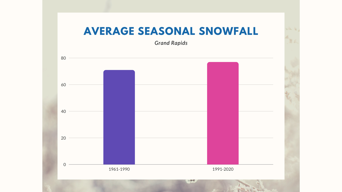
Grand Rapids averaged 70.9" of snow annually between 1961-1990. That increased in the next three decades to 76.9".
A lot of the snow increased in the months of January and February. The average went up by six inches, from 33.3" (1961-1990) to 39.7" (1991-2020).
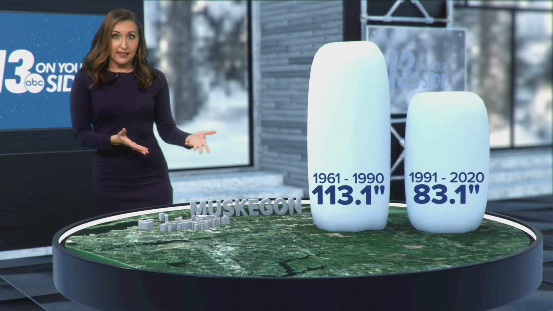
Muskegon, on the other hand, decreased in average seasonal snowfall during the same timeframe.

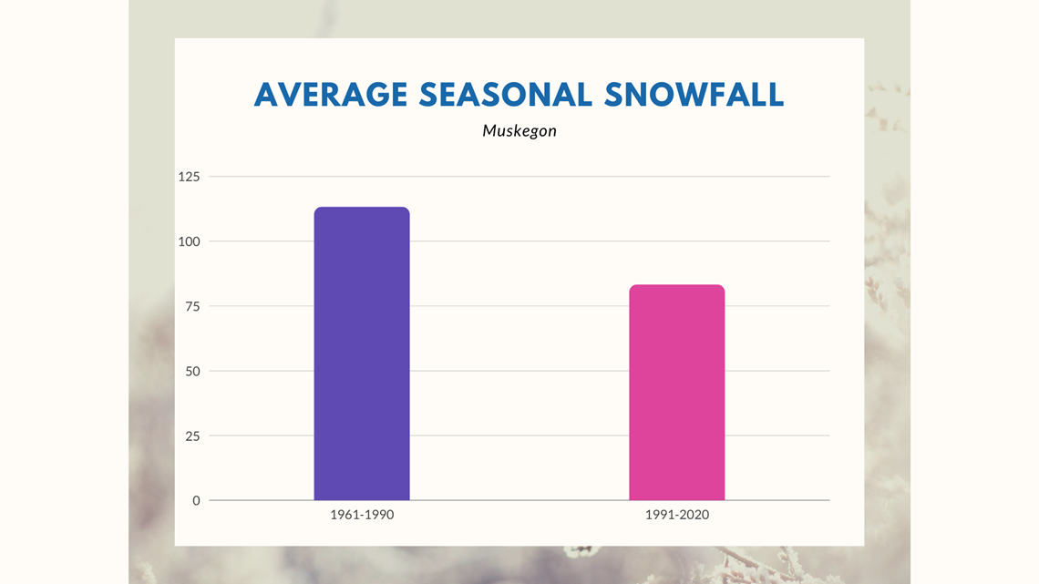
Muskegon averaged 113.1" of season snow from 1961-1990. The average snowfall dropped by 26% (83.1", 1991-2020).

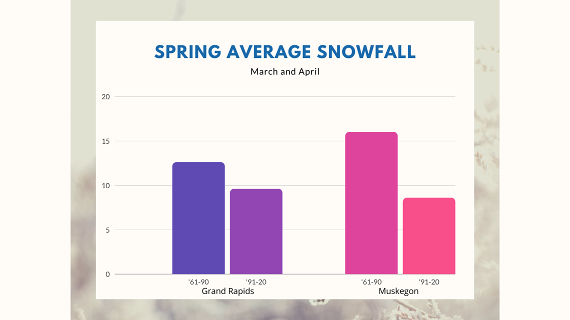
Perhaps the biggest reveal is the drop in average snowfall in the months of March and April.
Both Grand Rapids and Muskegon had declines in average snowfall. Grand Rapids saw snow totals decrease by 25%, while Muskegon decreased by nearly 50%.
Changes in snowfall trends are caused by several factors.
Temperatures are warming faster in the winter than in other seasons and cold snaps aren't lasting as long. This is likely why spring snowfall in West Michigan is declining.
However, warmer temperatures "hold" more moisture and that can mean more snow while temperatures remain below freezing.
Warmer temperatures also mean early and late season storms are more likely to be a mix of snow and rain or all rain, effectively shortening the stretch of snowy months.
Lake Michigan ice coverage also plays a role in season snowfall.
Once the lake freezes in the late winter, the moisture from the lake is essentially shut off and lake-effect snow can no longer form. But lake ice has declined in recent years. With wide-open waters late into the season, winds keep pushing lake-effect snow inland and away from the immediate lakeshore.
RELATED: Arctic Air Dives Into West Michigan
►Make it easy to keep up to date with more stories like this. Download the 13 ON YOUR SIDE app now.
Have a news tip? Email news@13onyourside.com, visit our Facebook page or Twitter. Subscribe to our YouTube channel.