
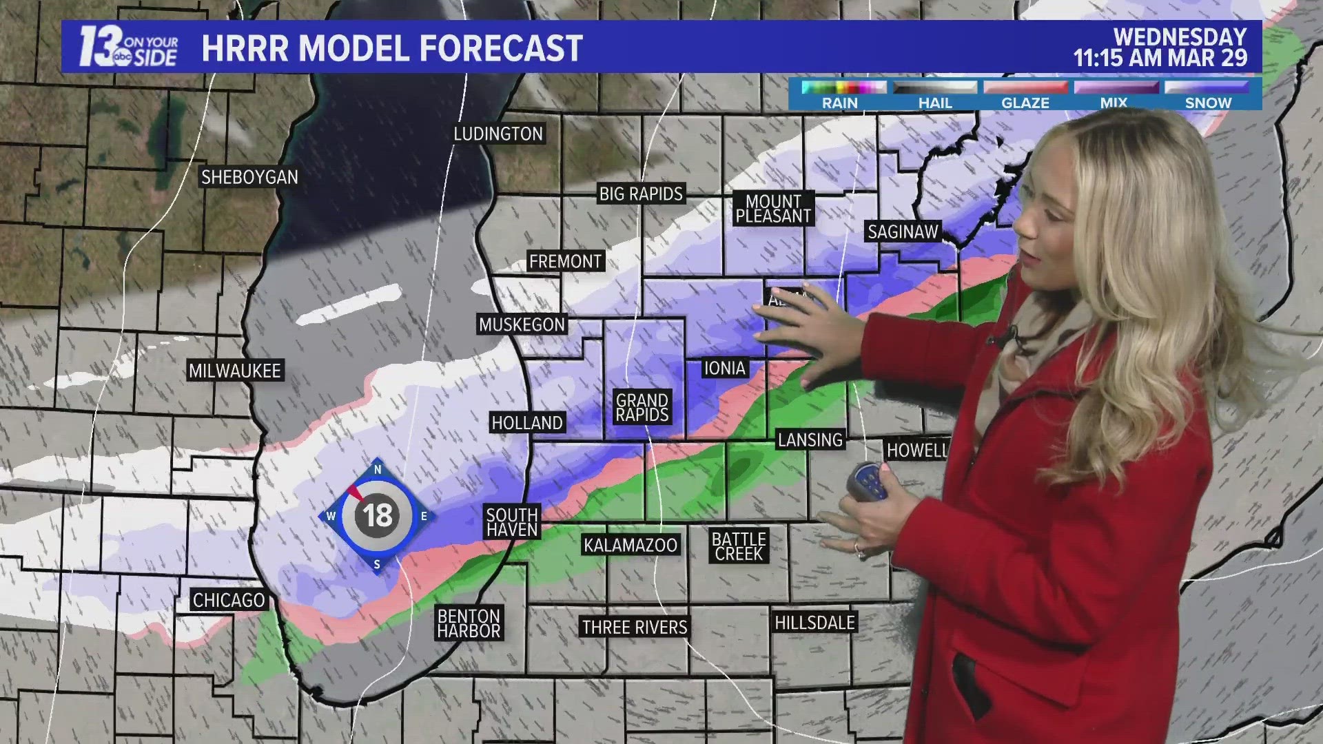
GRAND RAPIDS, Mich. — After a beautiful two-day stretch, we have a quick-moving cold front that will end our spring-like weather and bring a taste of winter. From 7 a.m. to 2 p.m., the front will pass throughout the region. As it does so, it will first bring snow to NW portions of the area, traveling southeast, and exiting our region by 3 p.m.
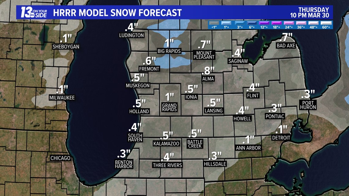
Snowfall totals will not exceed one inch with a trace to an inch expected for the entire region. Although, with the March sun angle and our temperatures being slightly above freezing, this snow will struggle to stick to anything more than grassy surfaces. The leading edge of this could also come as rain before mixing with snow, which would also lower the totals.

As the front clears out, so will our skies, leading way to a mostly sunny end to the day. This will allow our temperatures to warm slightly but remain in the 30s all day long.

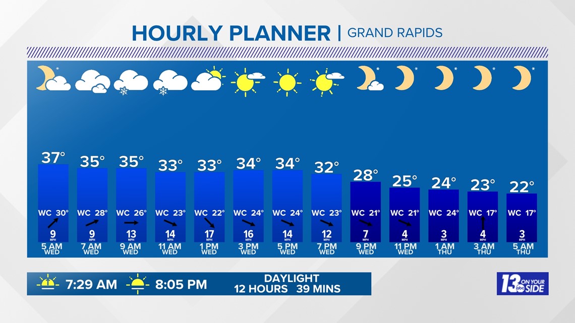
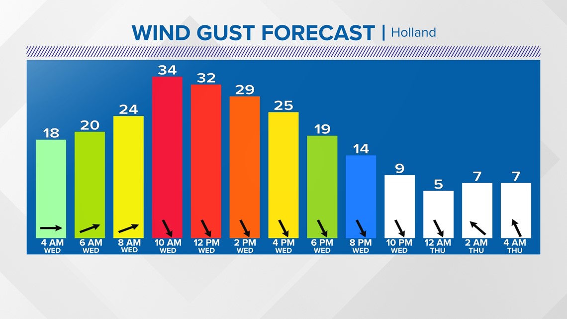
Winds will be breezy as the front passes out of the SW at 6-12 mph turning NW at 8-16 mph. Gusts will likely exceed 30 mph.

In true spring fashion, sunshine and warmer temperatures return for Thursday, but dry skies won't last for very long! A low-end severe weather threat is possible come Friday for portions of West Michigan.
A strong low-pressure system drives temperatures in the 60s, bringing strong winds and thunderstorms. If we do see any severe weather it will likely be Friday afternoon due to gusty winds or hail.

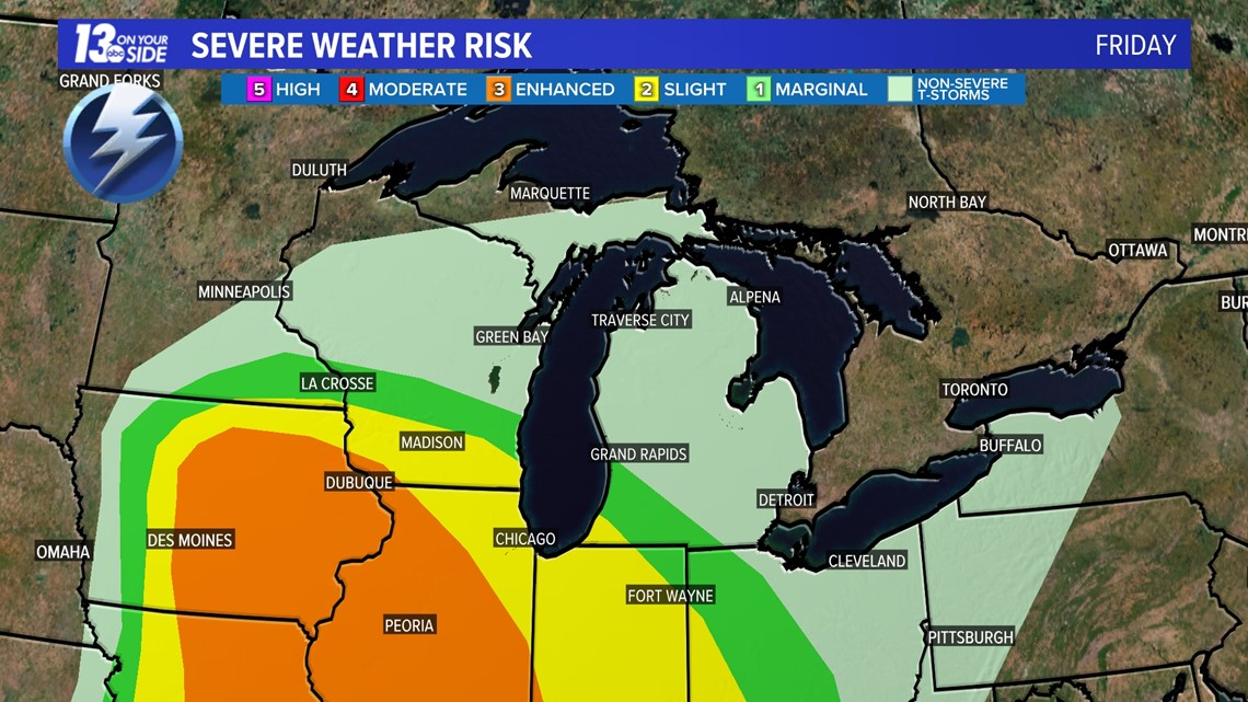
Please continue to check back in for more updates on this potential severe weather threat.
6-10 Day Outlook
Mon. Apr. 3 through Fri. Apr. 7 calls for above average temperatures and above average precipitation. Average highs are around 52-54° with an average precipitation of 0.60" and average snowfall of 0.5".
8-14 Day Outlook
Wed. Apr. 5 through Tue. Apr. 11 calls for above average temperatures and above average precipitation. Average highs are around 53-56° with an average precipitation of 0.89" and average snowfall of 0.6''.
Have a 30-second video or photo to share? We'd love to share it with everyone! Share your images by texting your name and location to 616.559.1310 or email to Weather@13OnYourSide.com or post it to our 13OnYourSide Facebook Page
►Make it easy to keep up to date with more stories like this. Download the 13 ON YOUR SIDE app now.
Have a news tip? Email news@13onyourside.com, visit our Facebook page or Twitter. Subscribe to our YouTube channel.