
GRAND RAPIDS, Mich. —
Track and Timing
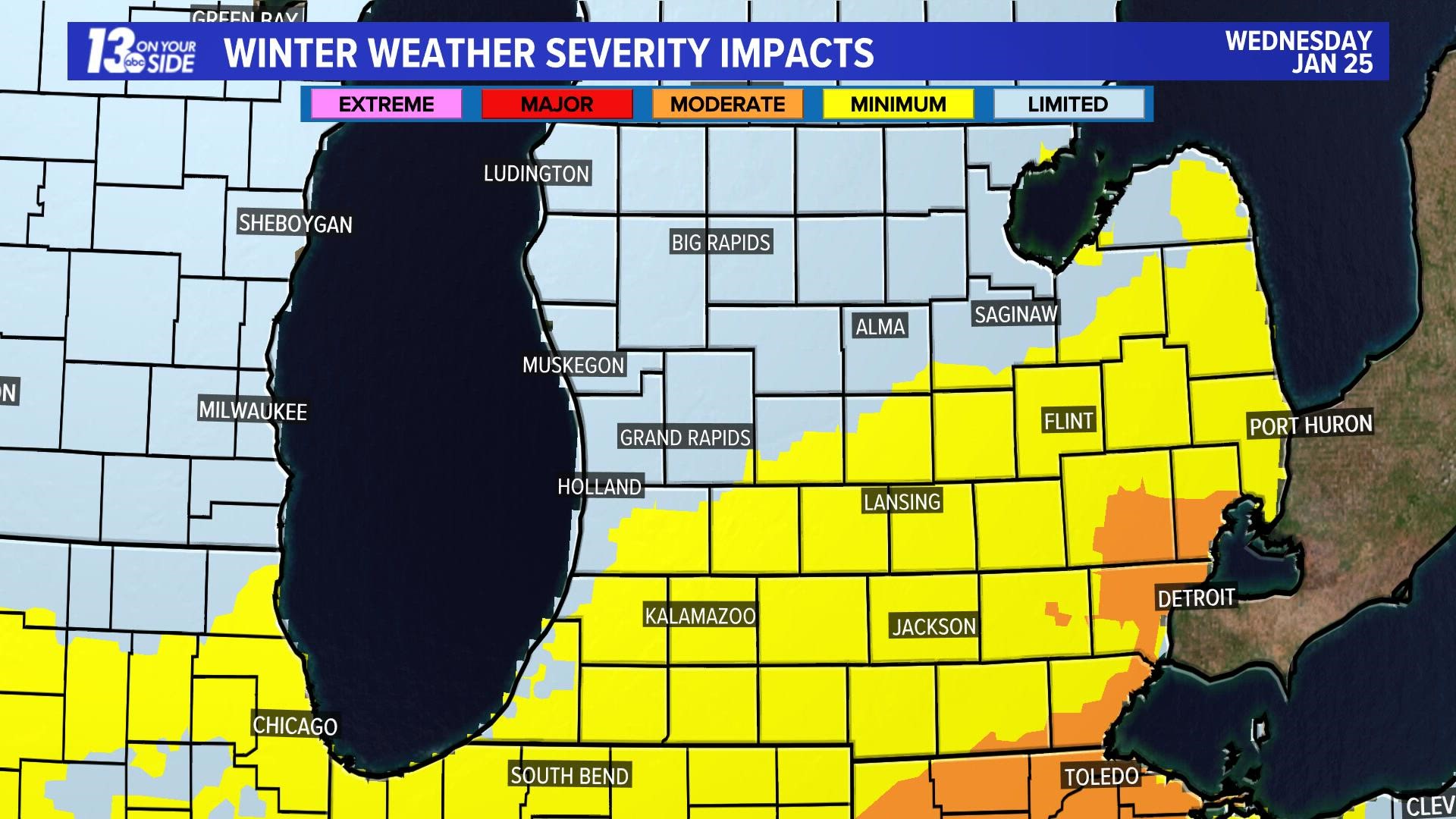
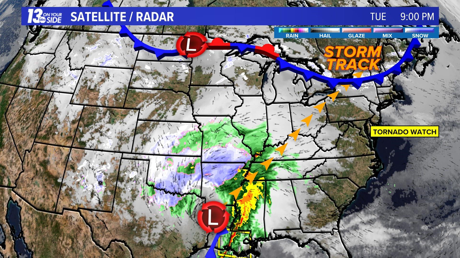
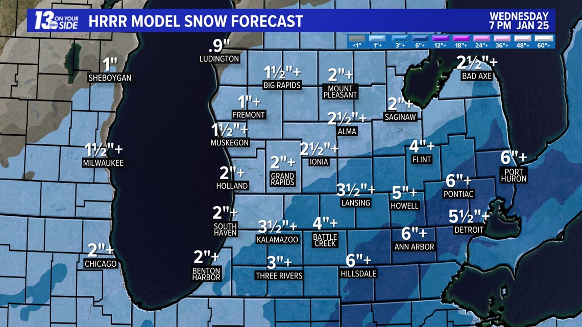
The first of three snow events moves across West Michigan on Wednesday - likely bringing the most snow to the area since the pre-Christmas blizzard. The track of the first system snow takes the heavier snow south and east of West Michigan as it moves from western Tennessee to northeast Ohio.
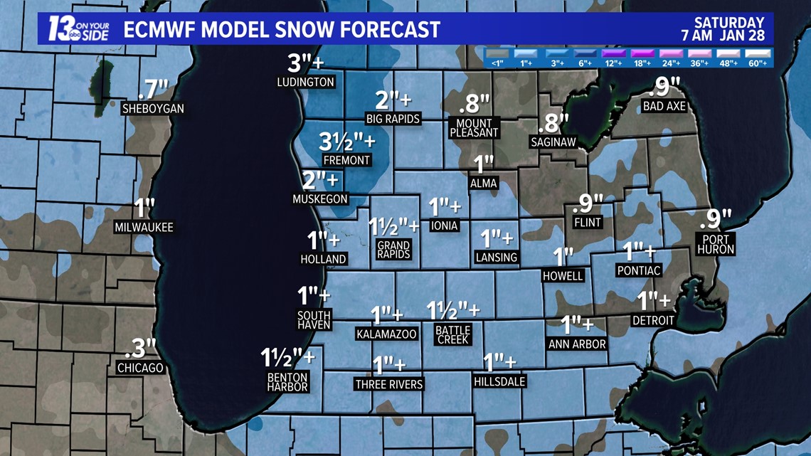
A second round is expected Friday as an Alberta Clipper combines with lake-effect snow to produce more snow focused more on West Michigan than other parts of Lower Michigan.
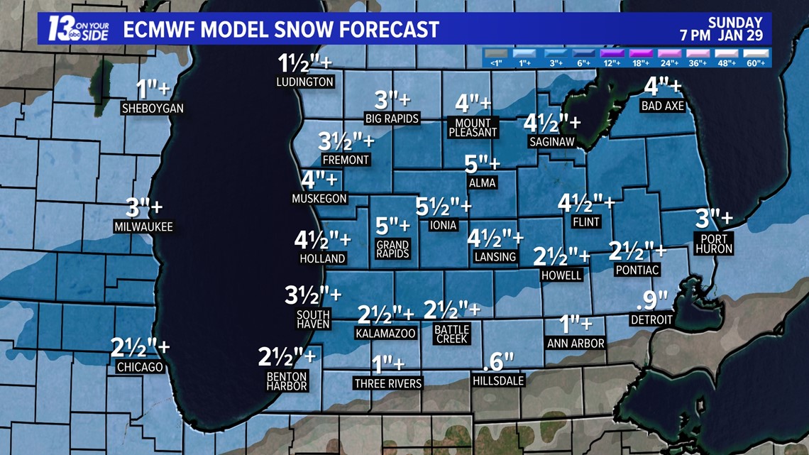
A third round is expected Saturday night through Sunday that may bring as much snow as the first two rounds combined.
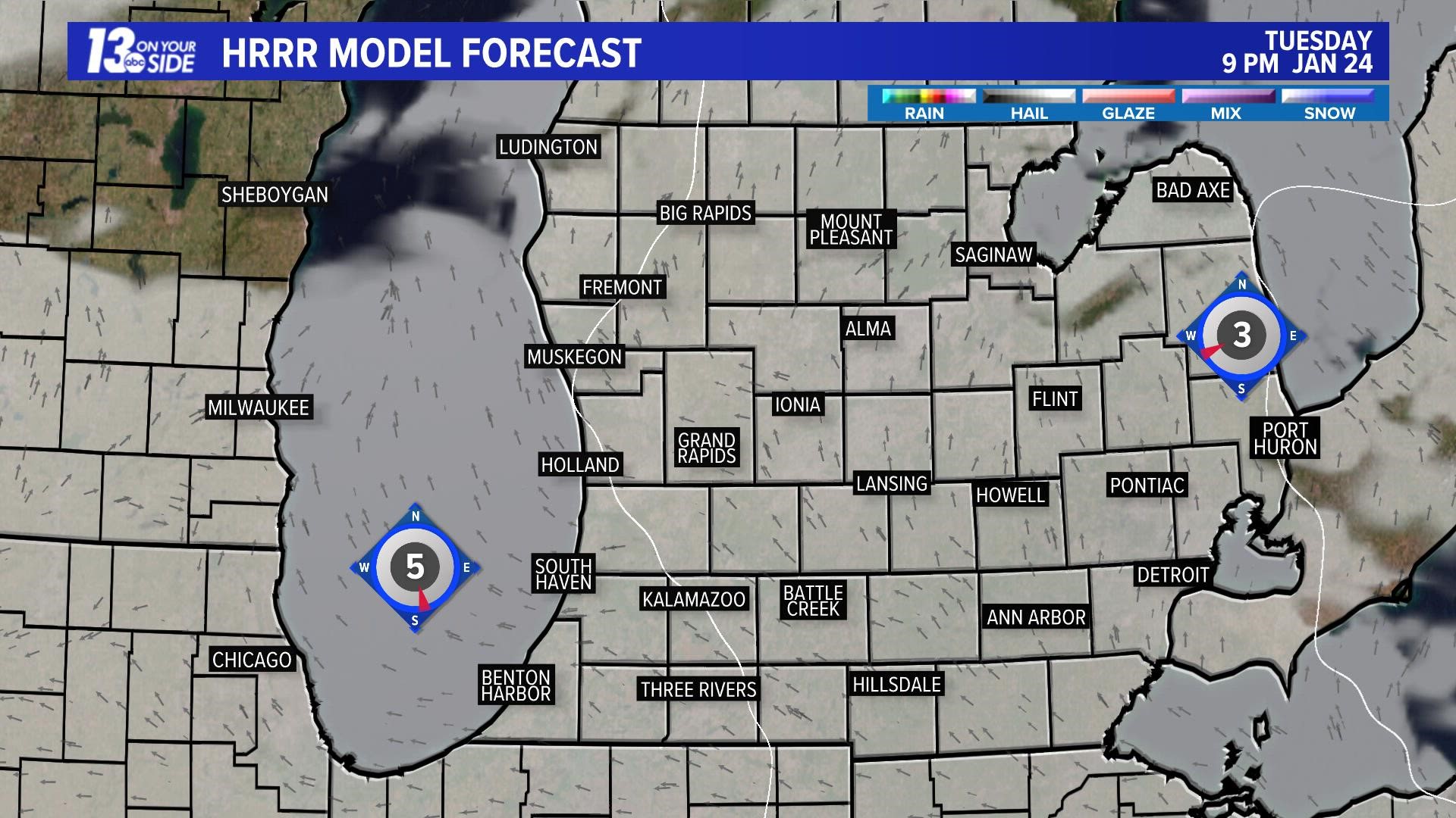
The snow will spread from south to north early Wednesday, reaching the I-94 corridor around 3 am and the US-10 by 7 a.m.
Accumulation and Impacts
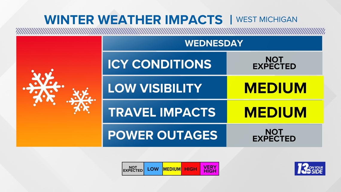
This will bring medium impacts to travel with occasional low visibility around 1 mile or less at times. Plan on extra time to travel to your destination.

Snowfall amounts will be around 1"+ over the NW counties and 3+" over the SE counties with higher amounts over SE Lower Michigan.

Further Ahead
The second round of snow arriving Friday lasting through Friday night could produce more widespread snow with 3"+ amounts over the NW counties and 1"+ elsewhere right before the weekend starts.

A third round of snow arriving Saturday night and lingering through could produce additional snow up to 5"+ across nearly all of central Lower Michigan.

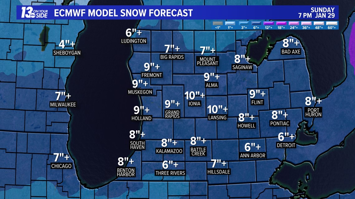
All three snow events could produce a total of 9"+, with the snow likely to stick around as temperatures are expected to hover close to freezing through the end of the month.

As always, stay up to date by watching 13 On Your Side mornings, noon and nights!
Make it a great rest of the week!
Chief Meteorologist George Lessens
George is a graduate of Penn State University working for 13 On Your Side for over 42 years. He is a Certified Broadcast Meteorologist (CBM), a twelve-time MAB® Weathercast Award Winner and two-time EMMY® Award Winner.
Contact me at: GeorgeLessens@13OnYourSide.com
Follow me on Twitter @glessens and Facebook GeorgeLessensWZZM
Have a 30-second video or photo to share? We'd love to share it with everyone! Share your images by texting your name and location to 616.559.1310 or email to Weather@13OnYourSide.com or post it to our 13OnYourSide Facebook Page
►Make it easy to keep up to date with more stories like this. Download the 13 ON YOUR SIDE app now.
Have a news tip? Email news@13onyourside.com, visit our Facebook page or Twitter. Subscribe to our YouTube channel.