A spring storm with strong winds is expected to impact the entire state of Michigan on Monday. The National Weather Service is warning the winds could lead to thousands of people losing power and more lakeshore erosion.
WINDS
Wind gusts are expected to exceed 50 mph in most parts of the state. An NWS representative said this storm could be similar to one in November that knocked out power to 100,000 people.
"We are going to have a lot of wind tomorrow," he said. "It's not the most power outages we've seen, but it's a lot."
Large branches could take down power lines, and it's common for these types of winds to shut down the Mackinac Bridge.
NWS also said these winds could impact temporary tents that have been put up outside hospitals as a part of the COVID-19 response.
A wind advisory as been issued for West Michigan starting at 8 a.m. on Monday until 8 p.m.
Consumers Energy said it is preparing for the wind storm in case of power outages. However, because of COVID-19, the utility said it has implemented some precautions to ensure the safety of crews and communities.
Crews will be practicing social distancing in their vehicles and other work locations. They will also be medically screened prior to their shift and vehicles will be regularly cleaned.
Residents are asked to stand at least 6-feet away from crews and equipment. "During this COVID-19 situation, crews would appreciate if customers would give them a wave from the front door instead of greeting them outside," Consumers Energy said.
The public is asked to stay 25 feet away from a downed wire and anything it is touching. Downed wires can be reported by calling 911 and Consumers Energy at 800-477-5050.
EROSION
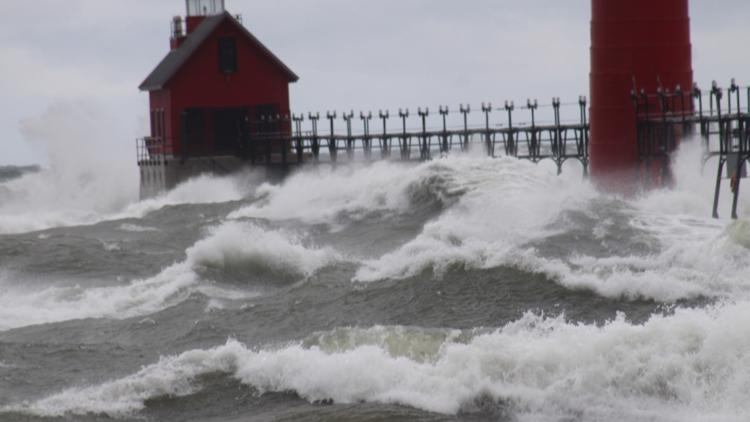
Because of the winds, the entire Lake Michigan shoreline will be battered again. Waves are expected to reach 10 feet on Lake Michigan and could get as tall as 15 feet.
NWS described it as a "grim day" for lakeshore flooding and property loss due to erosion, especially on the southern half of the lake near Holland. Wind gusts could exceed 60 mph, even 70 mph, on the lakeshore Monday morning.
"There is going to be a big push of water coming in with this," NWS said.
The Nov. 27, 2019 storm created water levels that have not been seen since 1985. NWS said on Dec. 2, 1985, the levels reached 583.15 feet. In late November, they reached 582.98 feet—only a couple of inches behind the record.
Water levels on the Great Lakes remain high and are expected to remain above average for the next several months.
SNOW
It's unlikely that the most of the Lower Peninsula will see snow, with the majority of the precipitation manifesting as rain. However, NWS said the western half of the Upper Peninsula could see a foot of snow in the Marquette area.
Between the strong winds, and the heavy, wet snow that usually comes with a spring storm, it could knock out power in the U.P.
"Travel will be near impossible up here," NWS said.
After the storm moves out late on Monday into Tuesday, winter-like temperatures will follow through the week.
More stories on 13 ON YOUR SIDE:
RELATED VIDEO:
►Make it easy to keep up to date with more stories like this. Download the 13 ON YOUR SIDE app now.
Have a news tip? Email news@13onyourside.com, visit our Facebook page or Twitter. Subscribe to our YouTube channel.