GRAND RAPIDS, Mich. — Tuesday marks another day to be weather aware with the combination of warm daytime temperatures, hazardous beach conditions along Lake Michigan and a late evening risk of severe weather.
The severe weather risk late Tuesday into tonight remains the focus of the forecast with a Slight Risk (level 2 out of 5) issued for all of West Michigan.


Beforehand, it’s one more warm late May day – upper 80s to near 90° by afternoon. It’ll be humid as well, with dew point temperatures climbing into the 60s.


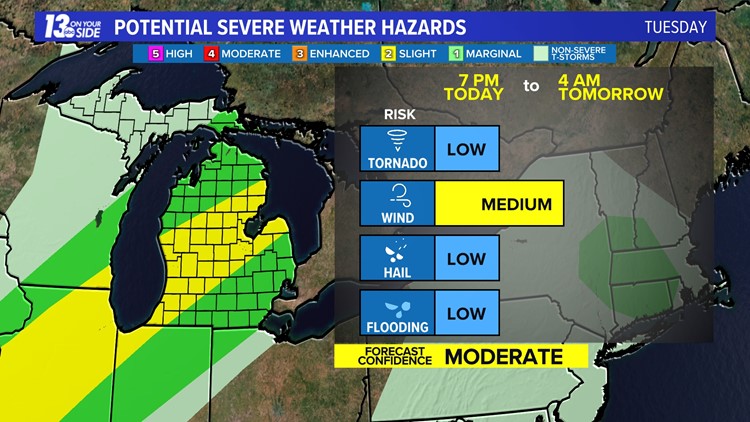
Instability from daytime heating, an incoming cold front and a few other factors in the atmosphere sets up the thunderstorm risk. Some model output is suggesting an isolated thunderstorm risk in the afternoon to early evening (2 p.m. – 7 p.m.), but the primary timeframe for thunderstorms, and potential severe weather, will be from 7 p.m. Tuesday until 4 a.m. Wednesday.
As like many severe weather risks in West Michigan, the setup is not a slam dunk. The incoming cold front won’t arrive until late this evening (after sunset), which is usually not great timing for severe weather here. Non-severe thunderstorms are still likely, but the late evening timing could create a more stable atmosphere, lessening the extent of the severe risk.
Regardless, enough ingredients in the atmosphere support a few strong to severe storms. Strong to damaging wind gusts remains the main risk. Hail, even an isolated tornado, remain on the table but are a lesser threat.
Bottom line – we have decent ingredients for storm activity, especially if storms can build a touch earlier in the evening. Uncertainty lies in the coverage of storms with the late evening timing of the cold front.
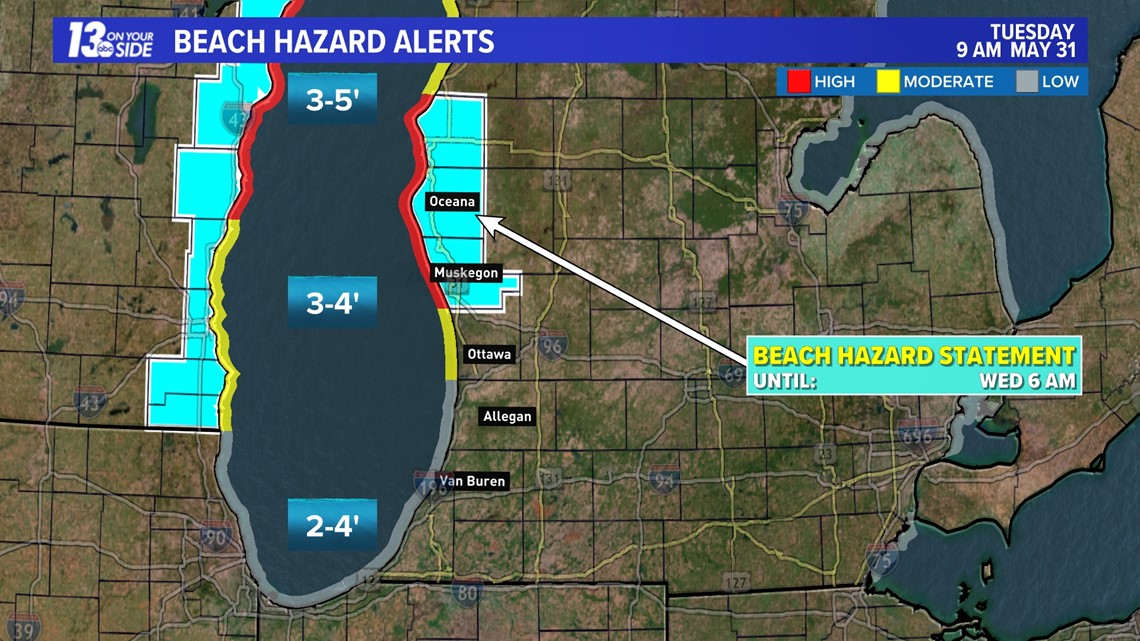
On another note, hazardous beach conditions persist for Ottawa, Muskegon, Oceana and Mason counties. Continued high waves and cold water temperatures will create dangerous swimming conditions. Winds will be out of the southwest at 10-20 mph, with gusts near 30 mph.

Stick with the 13 ON YOUR SIDE Weather Team for up to date weather forecasts!
►Make it easy to keep up to date with more stories like this. Download the 13 ON YOUR SIDE app now.
Have a news tip? Email news@13onyourside.com, visit our Facebook page or Twitter. Subscribe to our YouTube channel.