GRAND RAPIDS, Mich. — It's been a long, cold and snowy winter this year, but the weather pattern is about to change! The first 60° temperatures of the year are about to blossom!
We are forecasting 60°+ temperatures on Friday, March 31 and possibly Tuesday, April 4, the warmest so far this year.
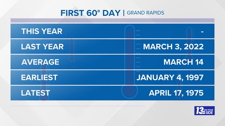
First 60° Day
The average date of the first 60° day is March 14. Last year it was eleven days early, arriving on March 3. The earliest 60° temperature in history occurred on January 4, 1997 while the latest and first 60° day was on April 17, 1975.


First 70° Day
The average date of the first 70° day is April 4. Last year it was 19 days late, arriving on April 23. The earliest 70° temperature in history occurred on March 3, 1983 while the latest, first 70° day was on May 3, 1950.


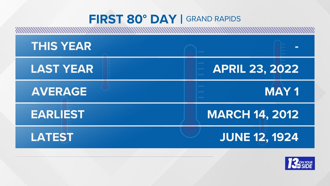
First 80° Day
The average date of the first 80° day is May 1. Last year it was on the same day as the first 70° day, arriving on April 23. The earliest 80° temperature in history occurred on March 14, 2012 while the latest, first 80° day was on June 12, 1924.

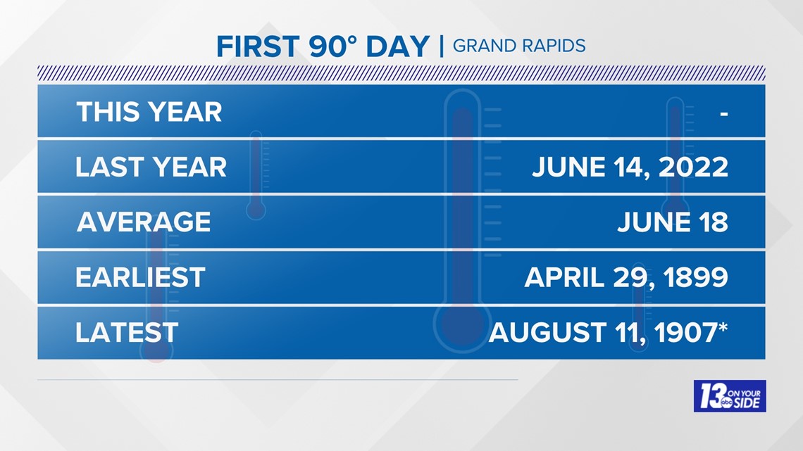
First 90° Day
The average date of the first 90° day is June 18. Last year it was four days early, arriving on June 14. The earliest 80° temperature in history occurred on April 29, 1899 while the latest, first 90° day was on June 11, 1907 (though, in 1951 and 2014, it never reached 90°).

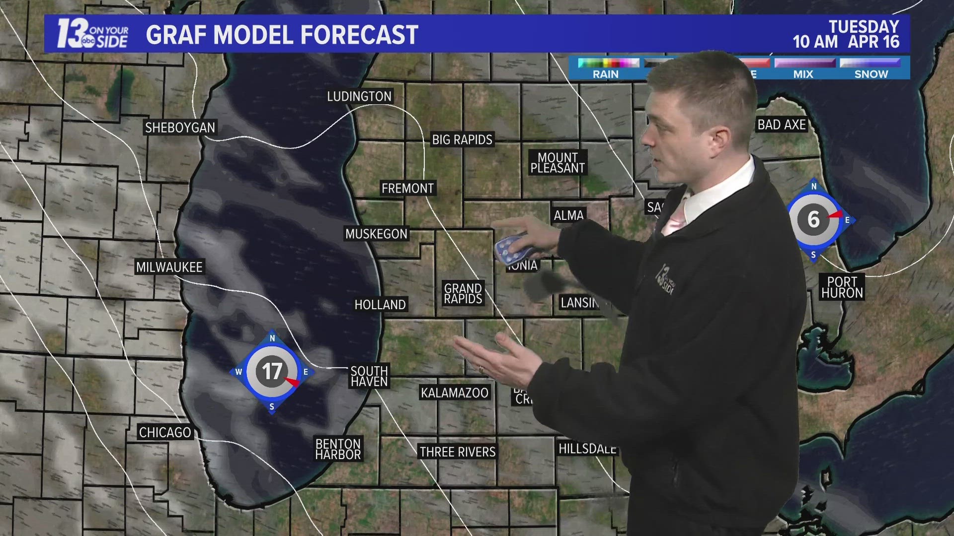
The weather pattern is changing (if only for a week to ten days) to a warmer pattern. We'll see how long that lasts.
6-10 Day Outlook
Tue. Apr. 4 through Sat. Apr. 8 calls for near average temperatures and above average precipitation. Average highs are around 53-55° with an average precipitation of 0.62" and average snowfall of 0.5".
8-14 Day Outlook
Thu. Apr. 6 through Wed. Apr. 12 calls for below average temperatures and above average precipitation. Average highs are around 54-56° with an average precipitation of 0.91" and average snowfall of 0.6''.

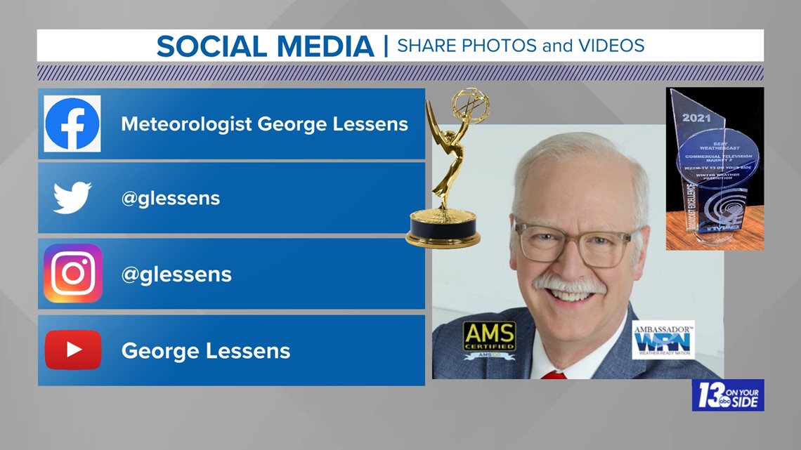
Chief Meteorologist George Lessens
George is a graduate of Penn State University working for 13 On Your Side for over 42 years. He is a Certified Broadcast Meteorologist (CBM), a twelve-time MAB® Weathercast Award Winner and two-time EMMY® Award Winner.
Contact me at: GeorgeLessens@13OnYourSide.com
Follow me on Twitter @glessens and Facebook GeorgeLessensWZZM
Have a 30-second video or photo to share? We'd love to share it with everyone! Share your images by texting your name and location to 616.559.1310 or email to Weather@13OnYourSide.com or post it to our 13OnYourSide Facebook Page
►Make it easy to keep up to date with more stories like this. Download the 13 ON YOUR SIDE app now.
Have a news tip? Email news@13onyourside.com, visit our Facebook page or Twitter. Subscribe to our YouTube channel.