
GRAND RAPIDS, Mich. — West Michigan will be a battleground Tuesday as a strong low pressure system showcases a clash of the seasons.
A wintry mix begins early Tuesday morning. Light and scattered showers will be around through the morning commute.

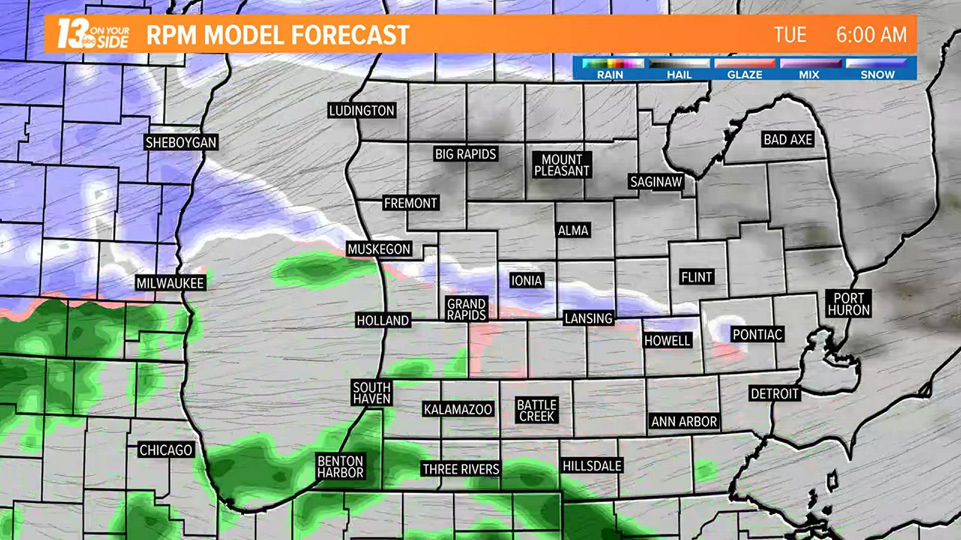
Later in the day, showers will become heavier and more widespread. Weather computer models consistently keep the freezing temperature line near and just south of US-10. This will translate to mainly snow in that area and north, with southern locations getting mostly rain. Light freezing rain is also possible where the snow-rain line sets up.
An isolated thunderstorm is possible in southeastern communities.

Precipitation will become snow for all Tuesday night. By Wednesday morning, snow accumulations are likely, with the highest totals in the north. Snow showers will wrap up later on Wednesday with several inches possible in northern communities, and amounts tapering to the south.
►Make it easy to keep up to date with more stories like this. Download the WZZM 13 app now.
Have a news tip? Email news@wzzm13.com, visit our Facebook page or Twitter.