MICHIGAN, USA — Old Man Winter is returning to West Michigan as snow and wind make way for a stretch of high-impact weather.

OVERVIEW
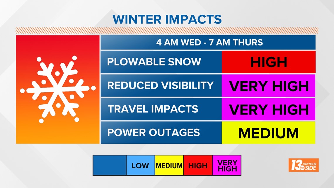
The incoming storm system (low pressure) will work into the Great Lakes region overnight Tuesday, bringing hazardous conditions across West Michigan on Wednesday. As the system departs overnight Wednesday, impacts will shift closer to the lakeshore (near/west of US-131) on Thursday. A combination of snowfall and gusty winds will create dangerous travel conditions, periodic whiteout visibility, and scattered power outages.
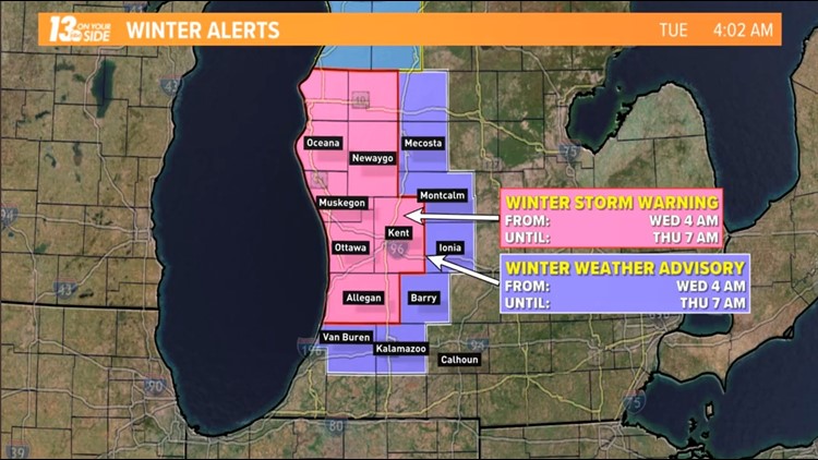
Winter Storm Warnings will be in place Wednesday into Thursday for numerous counties across West Michigan, with a Winter Weather Advisory for surrounding counties.
SNOW
Expect snow to pick up on Wednesday as low pressure works through the Great Lakes. During the daylight hours, narrow bands of snow will push well inland due to the strong winds. Snowfall amounts won’t be excessive for many during the day, but the snow squall nature of the narrow bands will create quick-hitting impacts.
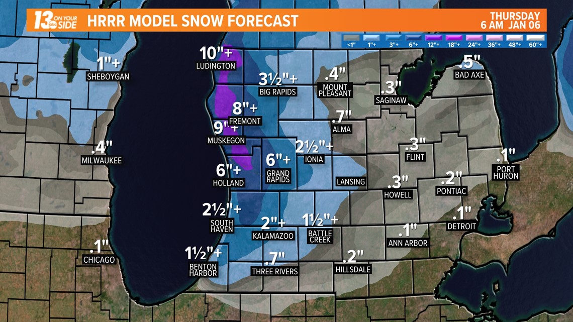
The heaviest snowfall is expected late Wednesday into early Thursday near/westward of US-131. Snowfall rates of 1”+ per hour are more than doable, leading to treacherous travel conditions, including the evening commute on Wednesday.
Traditional lake effect snow bands will become commonplace on Thursday, even lasting into Friday. It’ll be more hit or miss across West Michigan, but there will be locations where impacts linger.
In all, totals of 6"+ are expected in counties under a Winter Storm Warning, with localized higher amounts closer to the lakeshore. Totals of 3”+ are expected for counties under a Winter Weather Advisory, as a result of less lake effect snow. Measuring snow will be a difficult task, with blowing snow more noticeable.

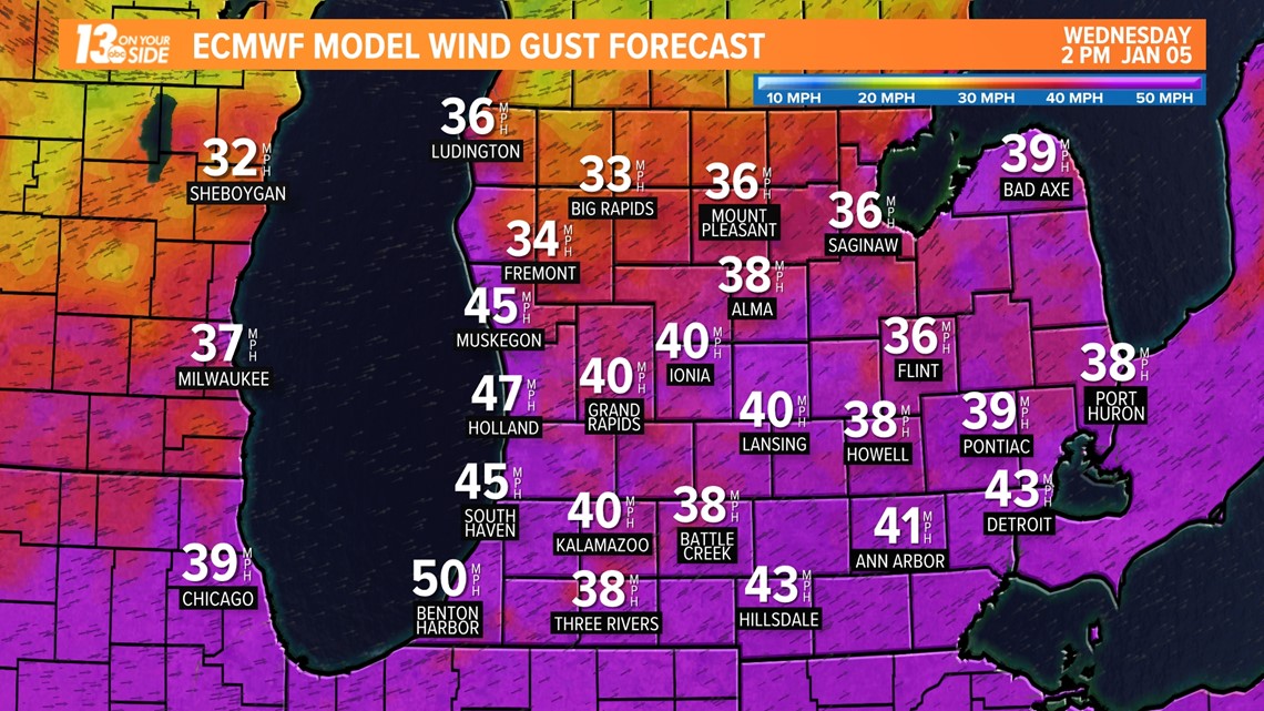
WIND
Southwest winds will pick up overnight Tuesday into Wednesday, gusting upwards of 40-50 MPH. This alone will be hazardous, via scattered power outages, but the combination with snow will lead to whiteout conditions. Winds will gradually weaken during the late overnight hours Wednesday into Thursday, turning to the north-northwest.

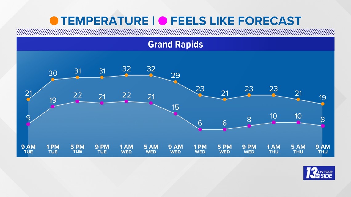
COLD
Temperatures will be around 30F early Wednesday before dropping into the lower 20s to upper 10s by the afternoon as colder air ushers into West Michigan. The falling temperatures will quickly lead to icy roadways, even in locations that don’t experience as much snowfall. No surprise with the strong gusts, wind chill values will fall into the single digits, creating frostbite on exposed skin within 15-30 minutes.

WRAP-UP
It’s time to be weather-ready the next few days with the combination of snow and wind. Travel will be discouraged, especially during the evening commute Wednesday and morning commute Thursday. Stick with the 13 ON YOUR SIDE weather team as this winter event arrives.