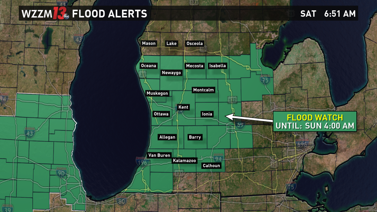
Several rounds of rain could generate flooding across West Michigan through early Sunday. A nearly stationary front will stall across West Michigan. It will become the focus for very heavy rain which will take aim at the region through Sunday morning.
Make sure your storm drains are clear of any debris or leaves. Poor drainage areas adjacent to small streams could become trouble spots as the heavy rain lingers.
►More: 13 on Target Weather
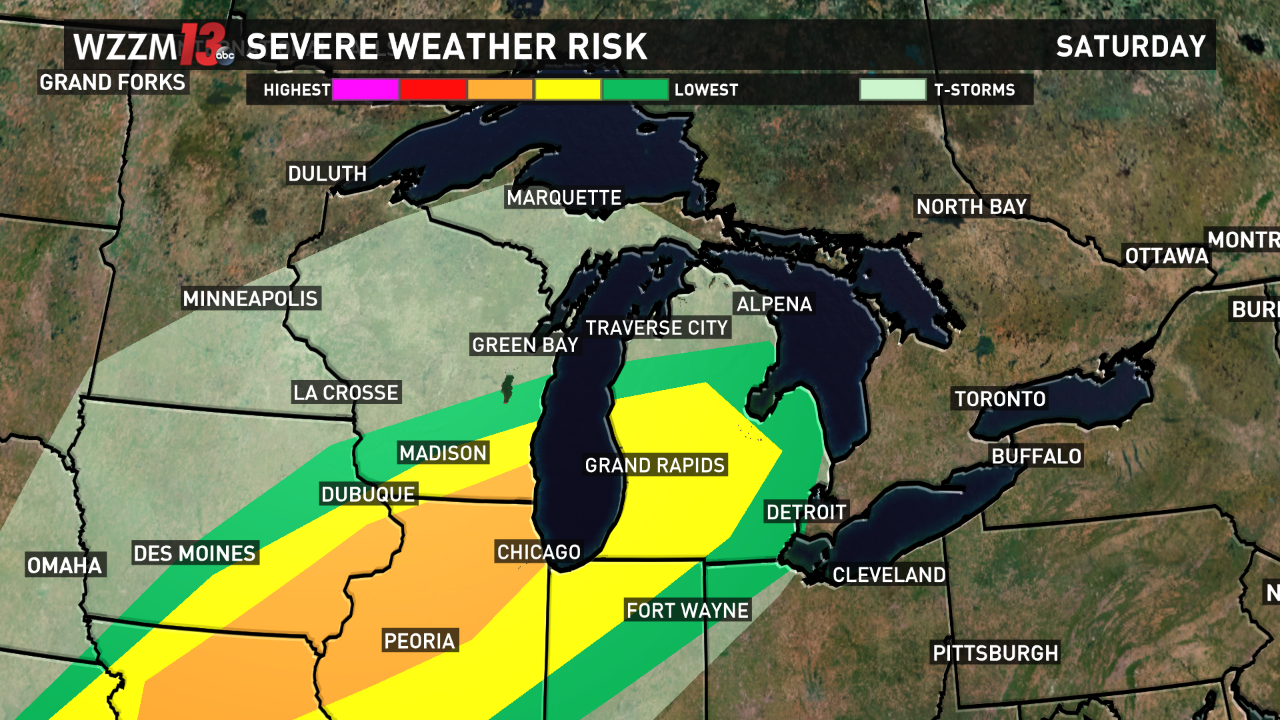
A cold front will sweep across the area Saturday evening. It could be accompanied by a line of severe storms. The main threats from these will be from very heavy rainfall and lightning. A few of the stronger cells could contain strong, damaging wind gusts and even a weak tornado.
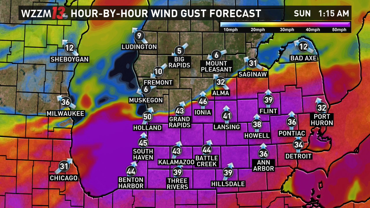
Behind the front, temperatures will plunge on Sunday. It will become breezy and cool with periods of lake-enhanced showers. Winds gusts over 40 miles per hour could lead to power outages on Sunday. Gigantic waves are likely with 7-11 foot waves on Lake Michigan.
►Make it easy to keep up to date with more stories like this. Download the WZZM 13 app now.
Have a news tip? Email news@wzzm13.com, visit our Facebook page or Twitter.