
A mess of wintry weather will spread into West Michigan starting Tuesday night. Once the system departs on Wednesday, several tenths of an inch of ice are possible, making travel very difficult with another round arriving late Wednesday night.


For the first system, a narrow band roughly following I-96 will see the greatest threat for freezing rain. A very thin layer of sub-freezing air at the surface with warmer air above it is the formula for ice. There is the potential for several hours of freezing rain in these communities.
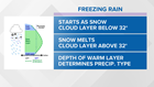
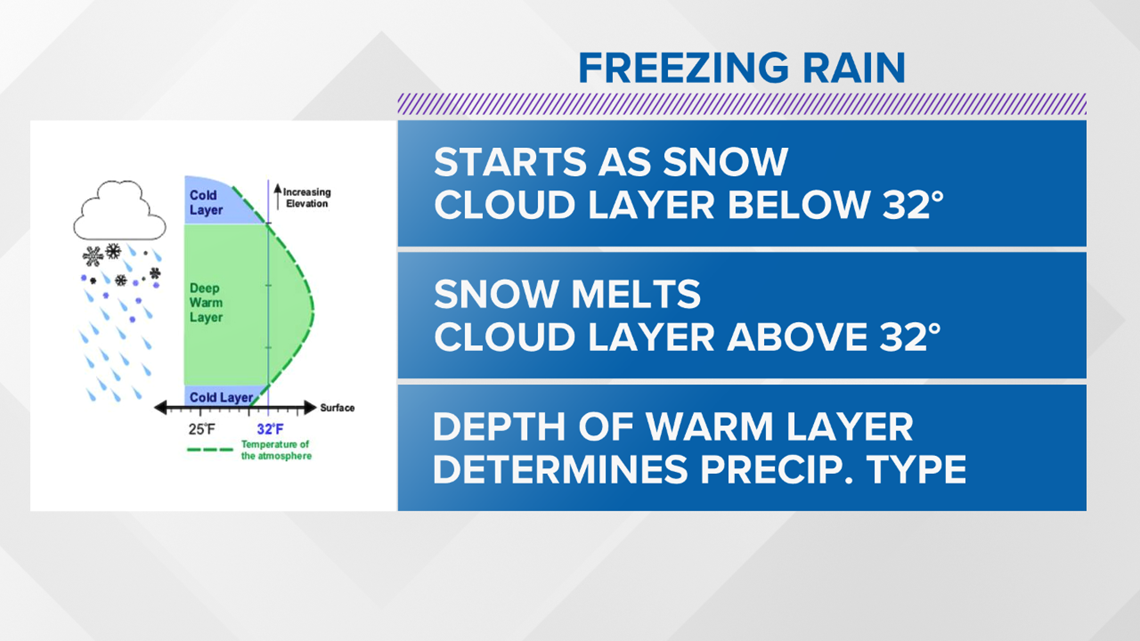
To the north of I-96 and especially north of M-46, there is a better chance for sleet and snow. The air above the surface in these areas should be sufficiently cold enough to prevent significant amounts of freezing rain.
Travel will become treacherous starting around 10 PM Tuesday. That is when the winter weather advisory begins.
The weight of the freezing rain could be significant enough to bring down tree branches and power lines. Temperatures will hover around freezing throughout most of the day on Wednesday, so conditions may be slow to improve.
The weather could result in power outages and downed lines in west Michigan. Consumers Energy announced Tuesday that it is mobilizing resources and making preparations to quickly respond to service interruptions.
Have a photo to share? We'd love to share it with everyone! Email your image to Weather@13OnYourSide.com or post it to our 13OnYourSide Facebook Page