
GRAND RAPIDS, Mich. — Winter has fully settled into West Michigan, with rounds of snowfall and the arrival of the coldest air of the season leading to frigid conditions around the region Sunday night!
Impacts will continue into the upcoming week, as arctic air pushes temperatures below zero at times, along with bouts of lake effect snow moving through the region as winds blow over still relatively warm lake waters. Over the weekend those waters helped contribute to record-breaking snowfall in Grand Rapids, with numbers that pushed up over two feet in some spots around West Michigan!
Below is a graph of our top 30 reports as of Sunday afternoon.


So what can we expect next? Let's take a look at the week ahead!
LAKE EFFECT:
The good news with the lake effect is that the heaviest is now behind us. The bad news, rounds of lake effect will continue throughout the week.
Scattered bands, sometimes heavy, of lake effect will continue from Sunday night all the way through Thursday. This snow will accumulate, but should not be nearly as heavy as what came through over the weekend. In general, we should expect the heaviest accumulation to stay west of US-131
As bands push through we will see fine snowfall that may reduce visibility at times creating hazardous travel. Accumulation will be on the order of an inch or two every 12 hours in the hardest-hit regions.
Below is a model snowfall forecast from Sunday night through Wednesday morning.


COLD AIR:
The exceptionally warm start to winter will be a distant thought over the next few days as an Arctic air mass spills into the Great Lakes.
High temperatures have only reached the middle 10s Sunday, well below average for this time of year by 15°+. Monday and Tuesday will see no improvement, with single digits to lower 10s for high temperatures. Overnight lows will range from the single digits above 0° to several degrees below 0°.


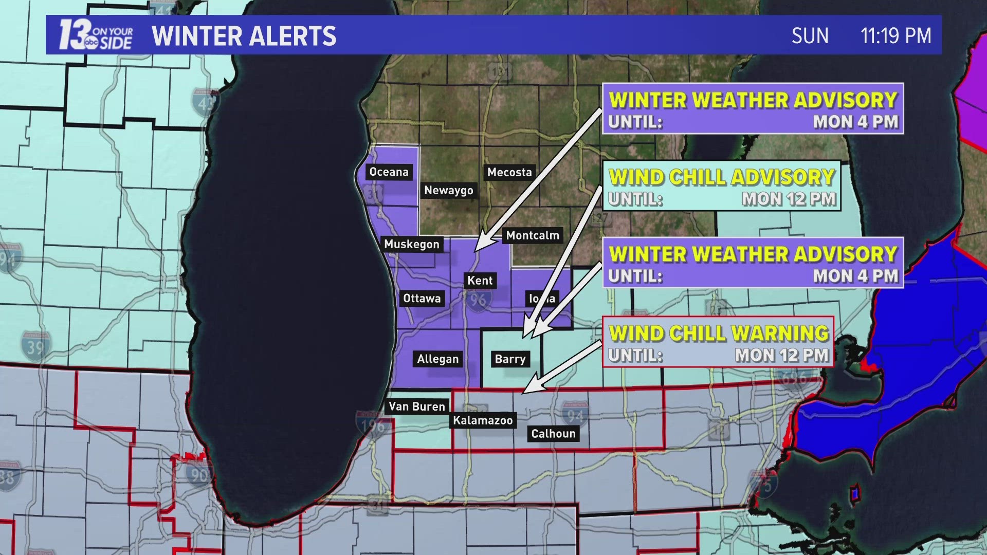
Factoring in the wind, which will continue to gust periodically at 20-30+ mph, wind chill temperatures will range from near 0 to well below 0 through most of the week. As a result, a Wind Chill Advisory will be in effect Sunday night through Monday for Barry, Van Buren, Kalamazoo, and Calhoun counties. This was upgraded to a Wind Chill Warning, the first since February of 2019 in West Michigan, for Kalamazoo County and Calhoun County.
Areas under Winter Weather Advisories should also expect sub-zero wind chills in addition to periodic lake effect snowfall.


These wind chills will not be something to mess with, as conditions were already widely feeling like -20 or colder around West Michigan Sunday night. Below is the 24-hour wind chill and temperature forecast for Grand Rapids.


Make sure you stay warm and stay safe this week West Michigan! We'll keep you up to date each day here at 13 On Your Side!
-- Meteorologist Michael Behrens
Follow me on social media! Facebook Meteorologist Michael Behrens, X/Twitter @MikeBehrensWX, and Instagram/Threads @MikeBehrensWX.
Email me at: MBehrens@13OnYourSide.com
Have a 30-second video or still photo to share? We'd love to share it with everyone! Email your image to Weather@13OnYourSide.com or post it to our 13OnYourSide Facebook Page.
►Make it easy to keep up to date with more stories like this. Download the 13 ON YOUR SIDE app now.
Have a news tip? Email news@13onyourside.com, visit our Facebook page or X/Twitter. Subscribe to our YouTube channel.