GRAND RAPIDS, Michigan — High pressure and sunshine will dominate your Wednesday afternoon, but clear skies and calm winds will linger overnight dropping temperatures to critically cold conditions. Clouds typically act like a blanket on the sky, but tonight clear skies and calm winds will allow temperatures to fall into the mid-20s to low 30s.
At this stage in spring, these are dangerous temperatures for sensitive vegetation. Because of that, the National Weather Service of Grand Rapids has issued a Freeze Warning from midnight Thursday through 8 a.m. Thursday.

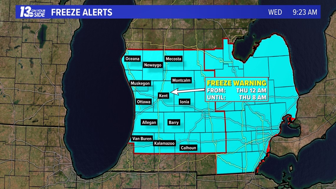

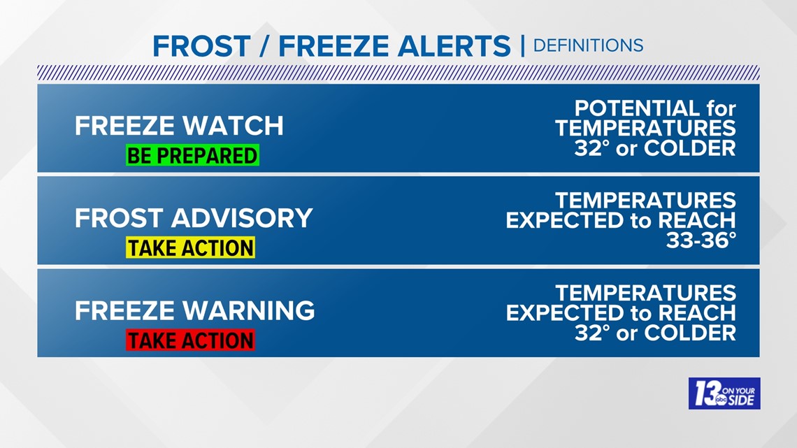
A freeze warning indicated that temperatures are expected to reach 32 degrees or colder. This can result in frost or freeze conditions that can harm or kill crops and sensitive flowers, and possibly damage unprotected plumbing.

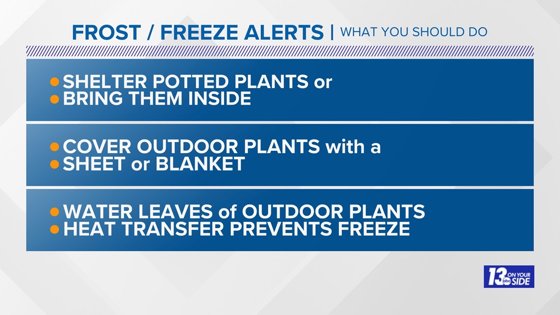
Steps can be taken to protect sensitive vegetation. This includes bringing potted plants inside, covering outdoor plants with a sheet or blanket, and spraying leaves with some water.

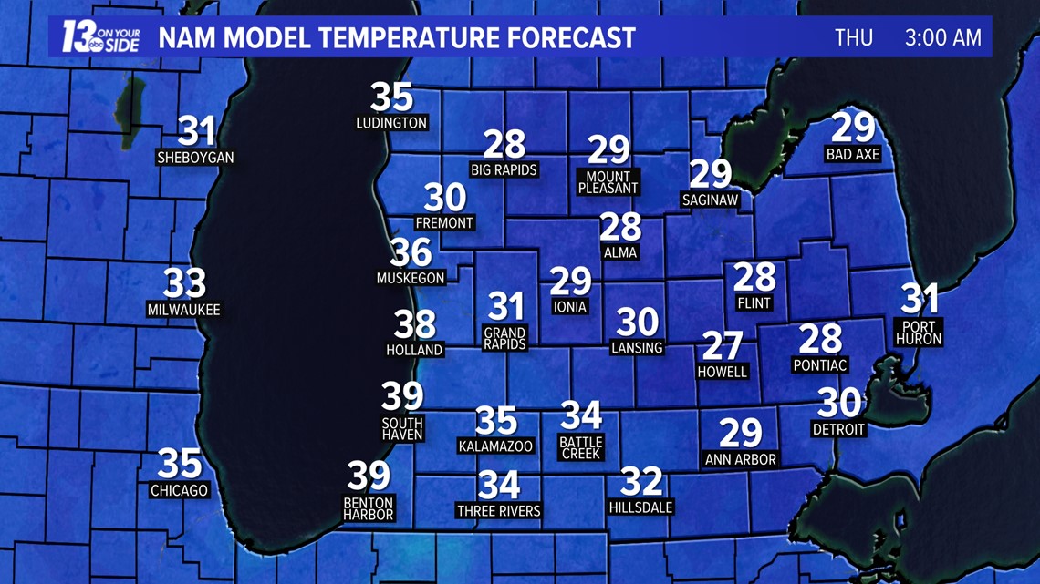

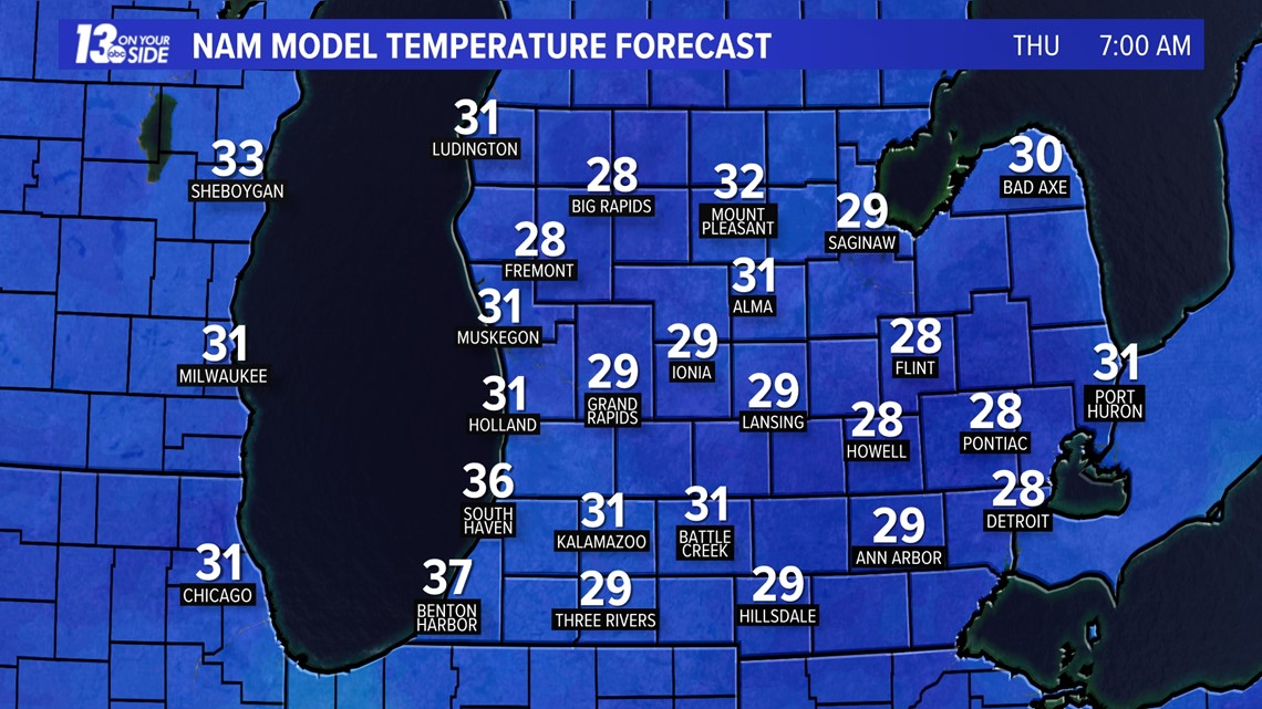
Temperatures are forecast to fall below freezing between 3 to 4 a.m. and stay below freezing through sunrise. This is especially concerning for fruit farmers, whose crops are in a sensitive growth stage. According to MSU extension's latest apple crop update, apple buds are currently at the pink stage and entering the king bloom stage. Thus, temperatures between 25 to 28 degrees could cause anywhere from 10% to 90% loss in the crop overnight. This will likely cause farmers to use extensive measures, such as frost fans and micro-sprinklers to avoid loss.
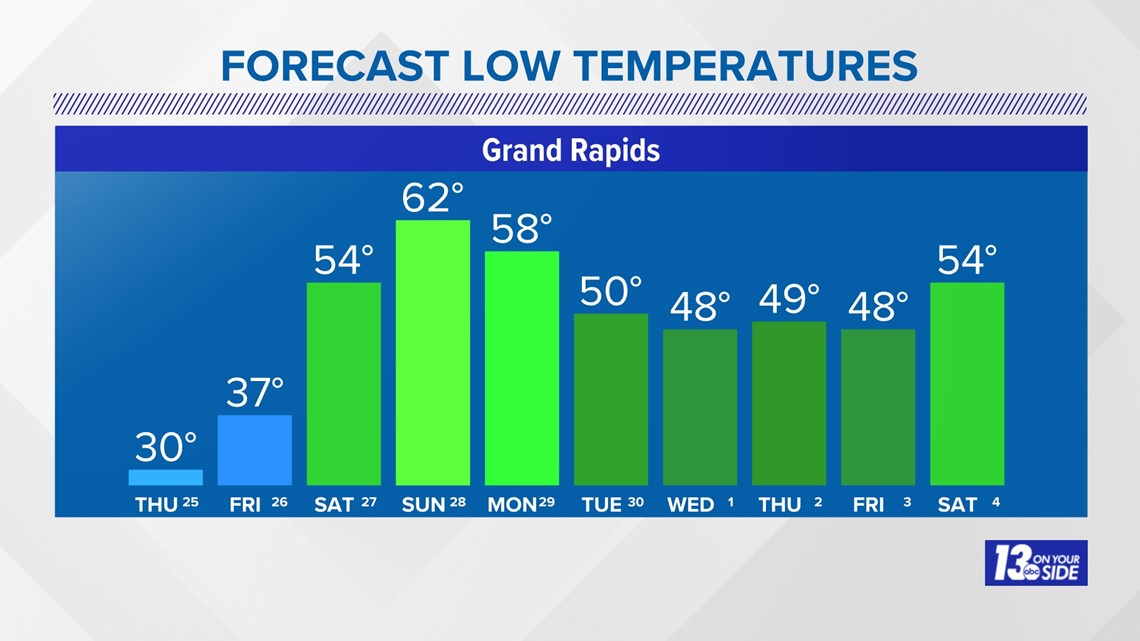
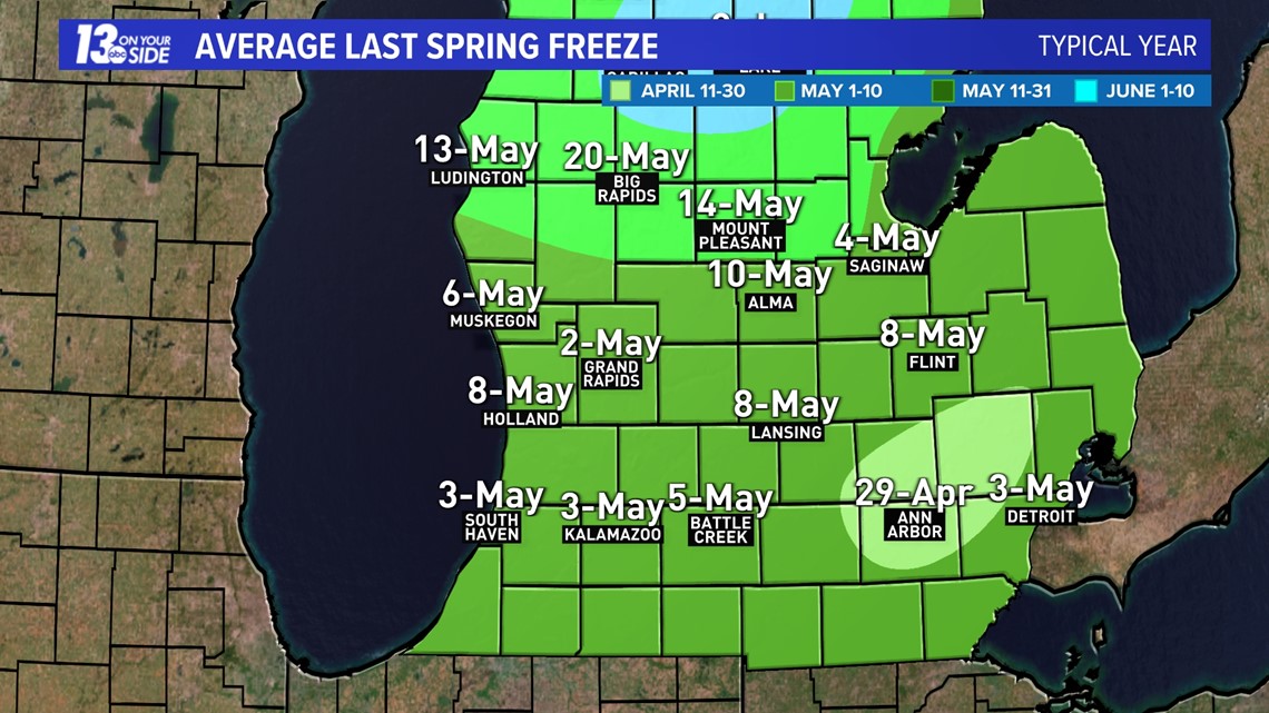
In more optimistic news, this looks to be the last below-freezing night for the next 10 days and temperatures are continuing to trend warmer. On average, our last spring freeze is typically between May 1 to May 10 in West Michigan. So, there is the potential that this is our last freeze warning of the season, although we all know how easily and quickly that could change.


6-10 Day Outlook
Mon. Apr. 29 through Fri. May 3 calls for above average temperatures and near average precipitation. Average highs are around 64-65° with an average rainfall of 0.68".
8-14 Day Outlook
Wed. May 1 through Tue. May 7 calls for above average temperatures and near average precipitation. Average highs are around 64-67° with an average rainfall of 0.93".
Have a 30-second video or photo to share? We'd love to share it with everyone! Share your images by texting your name and location to 616.559.1310 or email to Weather@13OnYourSide.com or post it to our 13OnYourSide Facebook Page
►Make it easy to keep up to date with more stories like this. Download the 13 ON YOUR SIDE app now.
Have a news tip? Email news@13onyourside.com, visit our Facebook page or Twitter. Subscribe to our YouTube channel.
Watch 13 ON YOUR SIDE for free on Roku, Amazon Fire TV Stick, and on your phone.