MICHIGAN, USA — The unseasonably warm weather that West Michigan is experiencing on Wednesday comes ahead of a strong low pressure system that will be tracking north of the lower peninsula Wednesday night into Thursday.
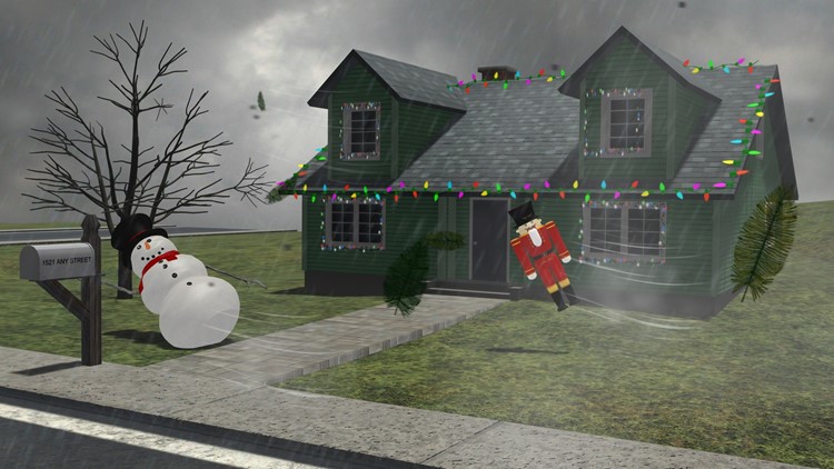
This system won't bring much in the way of rainfall to West Michigan, but will bring strong winds across the region that could result in power outages and downed tree limbs, along with likely blowing away any Christmas decorations that are not well attached.

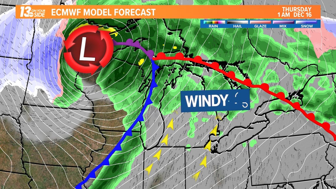
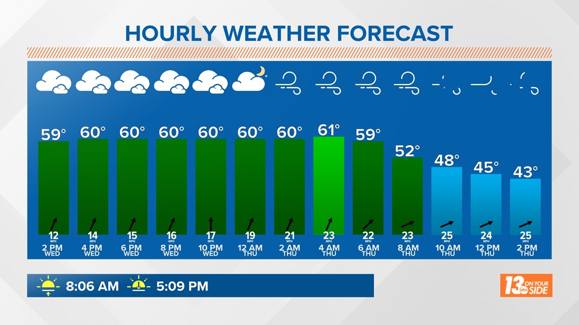
The system will bring its strongest winds from just around midnight through the morning hours of Thursday. Winds will remain gusty into Thursday afternoon as well.
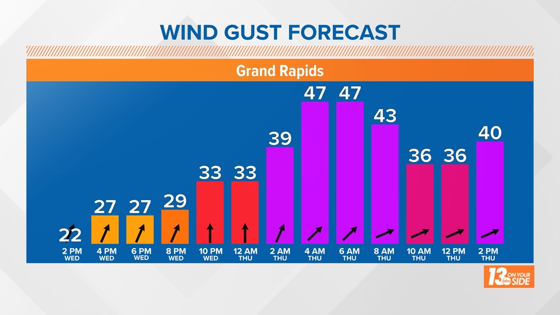
In Grand Rapids, wind gusts of 40-50 mph will be possible early on Thursday.

Wind gusts along the lakeshore could approach severe thunderstorm criteria, with 50-60 mph gusts possible overnight Wednesday into Thursday morning. These gusts will be highest from Ottawa County to the north and east.

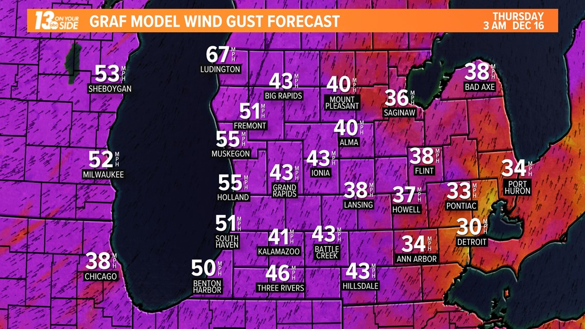
With these kinds of winds the National Weather Service in Grand Rapids is expecting "scattered to numerous" power outages to be possible in the areas with the highest wind gusts. Wind damage to trees, loose items, and holiday decorations are also possible.
The wind alerts for West Michigan can be seen below. If you are covered by a High Wind Warning, make sure you keep your phones charged heading into this evening in case of a power outage.


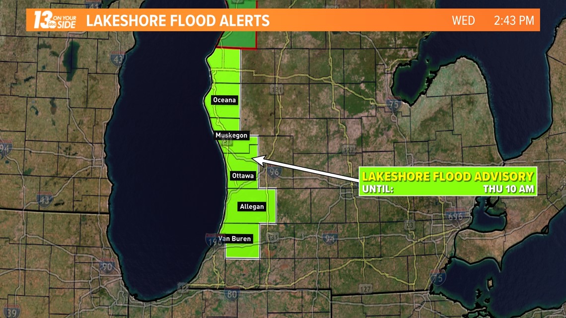
In addition to the wind threat, there will also be a risk for flooding along the lakeshore overnight and into Thursday morning. Waves of 10-15 feet will be possible and could result in minor flooding to roads and parking lots adjacent to the lakeshore along with minor beach and dune erosion.

One final impact from this weather system will be the unseasonably warm weather it is bringing to the region. Temperatures will stay in the upper 50s to low 60s as a result of the winds through early Thursday, then fall as we head into the daytime hours of the day.
Be ready for a very different drive home Thursday than the one you took to work temperature wise.

Make sure you stay with 13 On Your Side for the latest updates as we head through Wednesday evening and during the day on Thursday. We'll keep you covered!
-- Meteorologist Michael Behrens
Follow me on social media! Facebook Meteorologist Michael Behrens, Twitter @MikeBehrensWX, and Instagram @MikeBehrensWX.
Email me at: MBehrens@13OnYourSide.com
Have a 30-second video or still photo to share? We'd love to share it with everyone! Email your image to Weather@13OnYourSide.com or post it to our 13OnYourSide Facebook Page.
►Make it easy to keep up to date with more stories like this. Download the 13 ON YOUR SIDE app now.
Have a news tip? Email news@13onyourside.com, visit our Facebook page or Twitter. Subscribe to our YouTube channel.