
GRAND RAPIDS, Mich. — Round two was a minor snowfall event, which began late Wednesday night and lasted through much of Thursday morning. This produced light accumulations generally less than two inches, some of which melted with temperatures above freezing all day.
MAJOR WINTER STORM
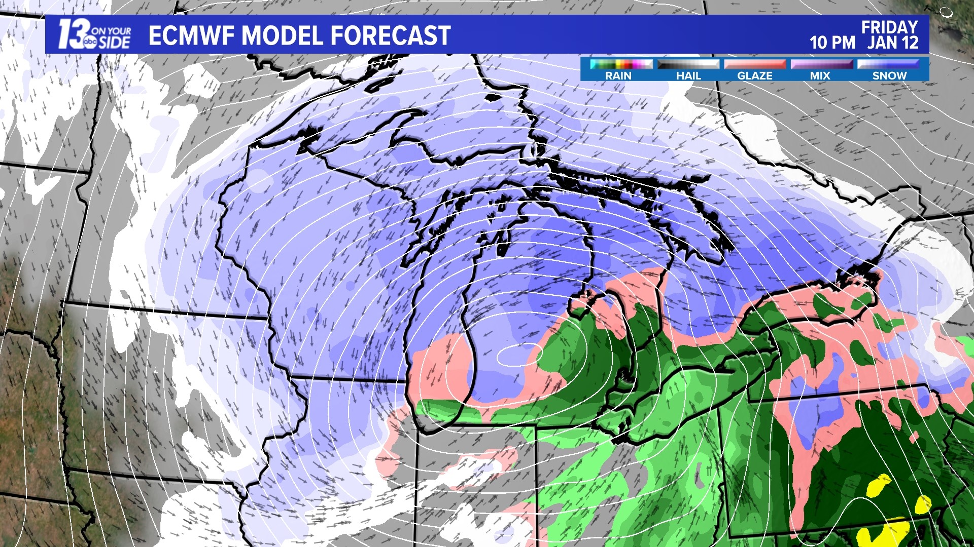
Round three will be a major winter storm for West Michigan, beginning around mid-morning Friday, and lasting through early Saturday. Several inches of heavy, wet snow is expected by early evening, followed by strong winds gusting to 40+ mph with considerable blowing snow Friday evening.
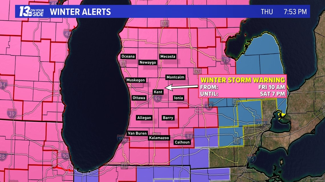
WINTER STORM WARNING
A Winter Storm Warning was issued Thursday afternoon for the expected winter storm Friday and Saturday. It goes into effect at 10 am Friday and is scheduled to end at 7 pm Saturday.

EXPECTED WINTER WEATHER IMPACTS
With the expected high winds and heavy snowfall the impacts are very high in all categories: low visibility, travel impacts and power outages.


WHAT YOU CAN DO TO PREPARE
- Always stay weather aware.
- Charge your electronic devices in case of power outages.
- If you need to travel, limit time spent on roadways; choose another time to go shopping.
- Have an alternative source of heat, if possible.
- If electricity goes out you could consider placing food and water outdoors.


THE STORM TRACK
The low-pressure system bringing Friday's wind and snow will intensify as it moves from New Mexico Thursday evening into SE Lower Michigan Friday evening keeping all precipitation in the form of snow. The rapid deepening of the storm will lead to wind gusts to 40+ mph from the NE.
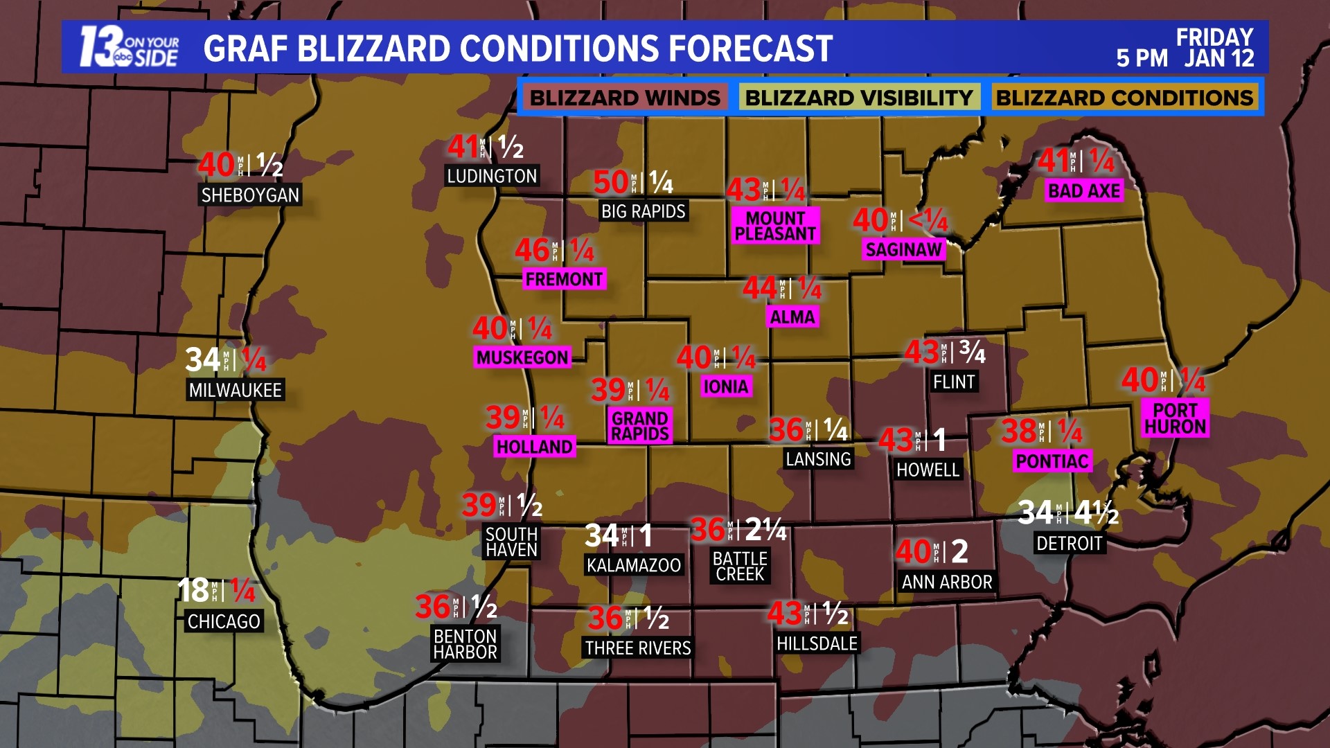
BLIZZARD-LIKE CONDITIONS
Our Blizzard Conditions Forecast shows blizzard conditions will be met for up to 3 hours in all West Michigan locations between 7 pm Friday and 1 am Saturday, likely just short of NWS Blizzard Warning criteria.
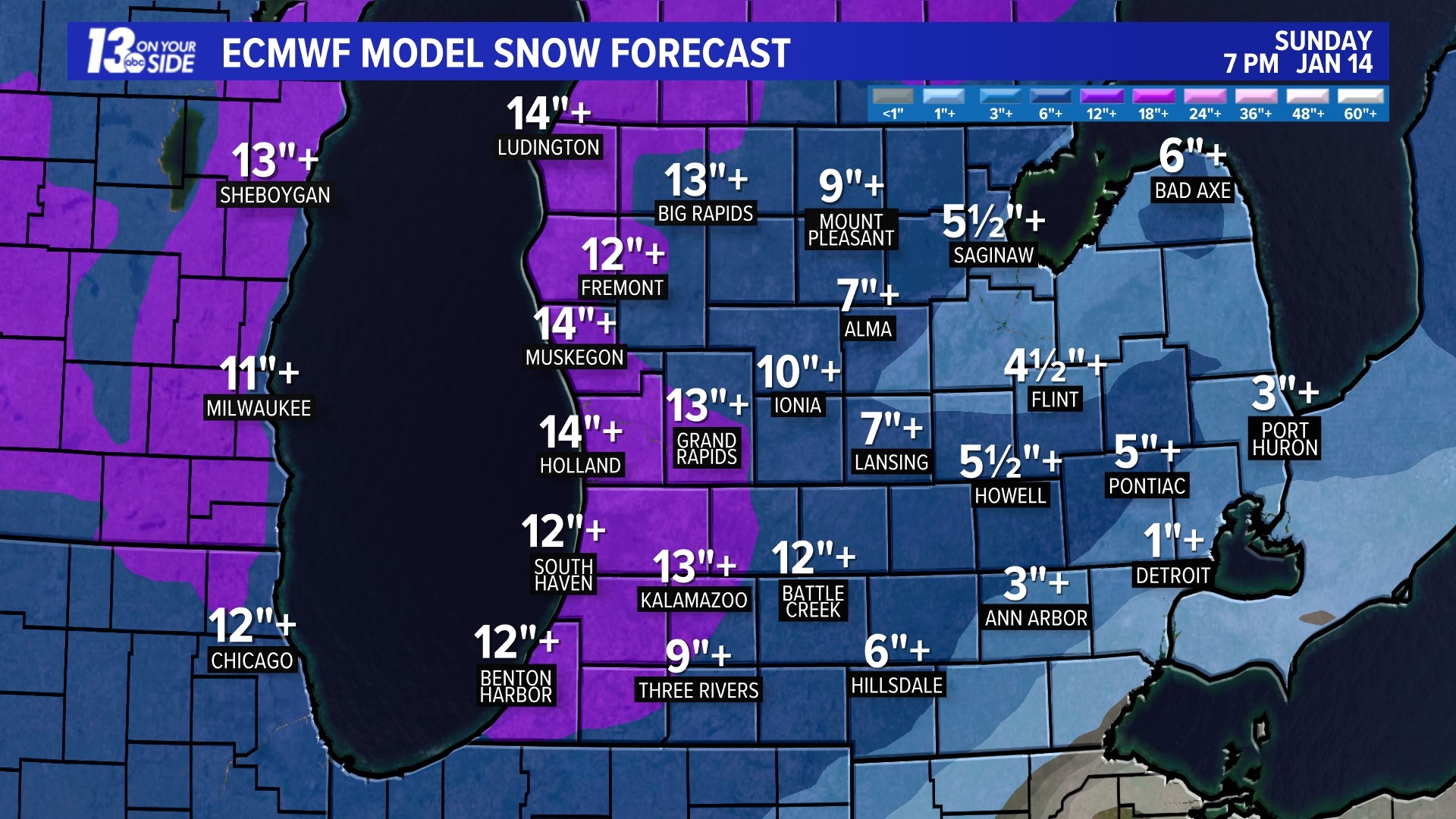
HIGH-IMPACT SNOWFALL
Tremendous amounts of snow will occur during the day Friday, with up to 8"+ expected between noon and 7 am Saturday and an additional 5"+ through Sunday. Additional snow will continue to fall most of next week with some areas getting close to 24+".
As always, get the most up-to-date, live weathercasts morning, noon, evening and night with West Michigan's most experienced team of meteorologists.


Chief Meteorologist George Lessens
George is a graduate of Penn State University working for 13 On Your Side for over 43 years. He is a Certified Broadcast Meteorologist (CBM), a thirteen-time MAB® Weathercast Award Winner, two-time EMMY® Award Winner, NATAS® Silver Circle Award Winner, and Weather-Ready Nation® Ambassador.
Contact me at: GeorgeLessens@13OnYourSide.com
Follow me on X/Twitter @glessens and Facebook GeorgeLessensWZZM
Have a 30-second video or photo to share? We'd love to share it with everyone! Share your images by texting your name and location to 616.559.1310 or email to Weather@13OnYourSide.com or post it to our 13OnYourSide Facebook Page
►Make it easy to keep up to date with more stories like this. Download the 13 ON YOUR SIDE app now.
Have a news tip? Email news@13onyourside.com, visit our Facebook page or Twitter. Subscribe to our YouTube channel.
Watch 13 ON YOUR SIDE for free on Roku, Amazon Fire TV Stick, Apple TV and on your phone.