
GRAND RAPIDS, Mich. — Next week, the weather pattern will become more winter-like with several rounds of system snow along with lake-effect snow.
This will impact all areas of West Michigan with enough snow to shovel and plow.
Timeline
- Late Monday night through Wednesday afternoon - system snow.
- Thursday night through next Sunday morning- lake-effect snow.
- Next Sunday into the week of January 15 - system snow plus lake-effect snow.
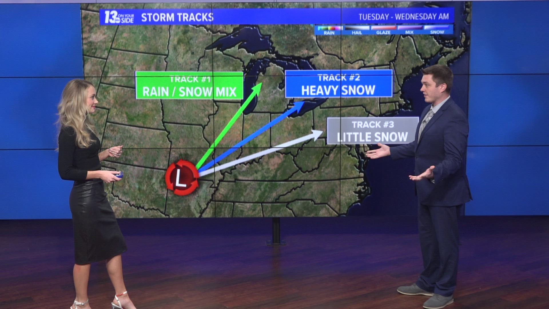
The Setup
The powerful southern jet stream will lift north into the middle of the U.S. bringing in moisture and energy from the Pacific Ocean and Gulf of Mexico.
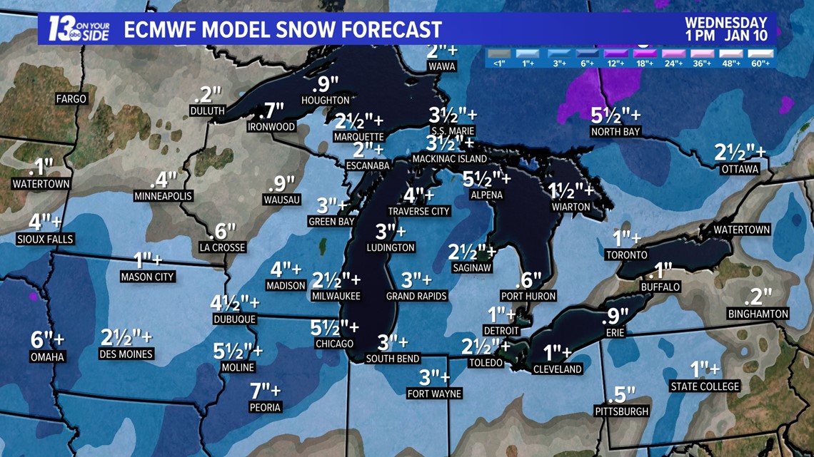
Late Monday Night through Wednesday Afternoon
The powerful southern jet stream will lift north into the middle of the U.S. bringing in moisture and energy from the Pacific Ocean and Gulf of Mexico. A strong wave of energy will bring periods of snow to West Michigan Tuesday, with some rain over the SE counties, then transition back to snow through early Wednesday. Here are some of the preliminary snowfall amounts from the Euro model.

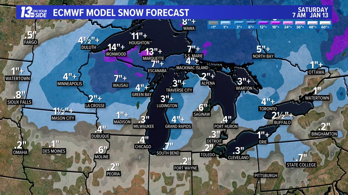
Thursday Night through Sunday Morning
As that system snow exits another strong wave of energy pulls the jet stream south tapping into colder air and spreading it into the Great Lakes region, generating lake-effect snow. Models may underestimate the amount of snow, so these additional snowfall estimates could be on the low side.

RELATED: Winter driving safety: 5 Fast Facts
Total Snowfall
The total amount of snowfall, subject to change, from Tuesday, January 9 through Sunday, January 14 is shown here.

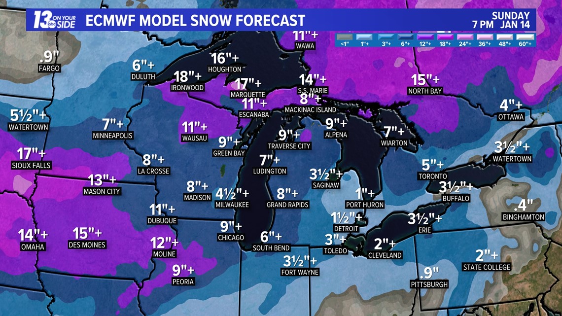
The amount of snow you may receive will depend on a number of factors: if you receive all snow with the first round of winter storms or if it mixes with rain, plus the wind direction and duration of lake-effect snow from Lake Michigan with the second round.
Continue to watch future forecasts from the 13 On Your Side team of experienced meteorologists for updates.


Chief Meteorologist George Lessens
George is a graduate of Penn State University working for 13 On Your Side for over 43 years. He is a Certified Broadcast Meteorologist (CBM), a thirteen-time MAB® Weathercast Award Winner, two-time EMMY® Award Winner, NATAS® Silver Circle Award Winner, and Weather-Ready Nation® Ambassador.
Contact me at: GeorgeLessens@13OnYourSide.com
Follow me on X/Twitter @glessens and Facebook GeorgeLessensWZZM
Have a 30-second video or photo to share? We'd love to share it with everyone! Share your images by texting your name and location to 616.559.1310 or email to Weather@13OnYourSide.com or post it to our 13OnYourSide Facebook Page