
GRAND RAPIDS, Mich. — This winter season has featured very little snowfall in West Michigan, and for that matter, all of the Great Lakes region so far. That may change with a potential winter storm next week. A storm system over the eastern Pacific Ocean will move onshore over the weekend and head towards the NE U.S.
THE SETUP
The predicted effects from a strong El Niño has resulted in the subtropical jet stream keeping the storm track south of Michigan, while the polar jet stream and relatively 'undisturbed' polar vortex north of Michigan. So far this is verifying our winter weather prediction published in November for warmer temperatures with less snowfall.


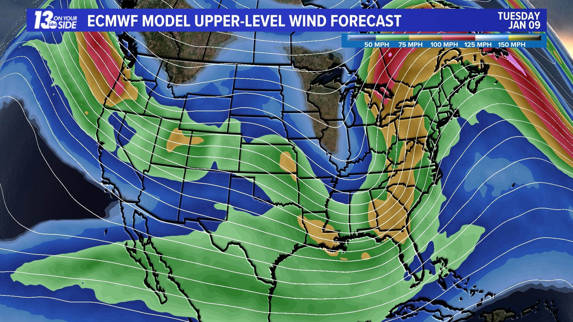
UPPER-LEVEL WIND FORECAST
Several waves of energy slide through North America over the next ten days with the strongest one moving into the NE U.S. and Great Lakes region next Tuesday and Wednesday.
Snowfall Predictions - Moderate Confidence
Many atmospheric and geographical factors influence when, where and how much snow falls. Computer models process hundreds of thousands of data points around the globe several times daily and each model run calculates what it thinks might happen. When most models agree with each other upon an outcome then confidence grows as to what may happen. Right now, there is only moderate confidence for a winter storm next Tuesday and Wednesday. Current model snowfall amounts for West Michigan range from 1"+ to 11"+.

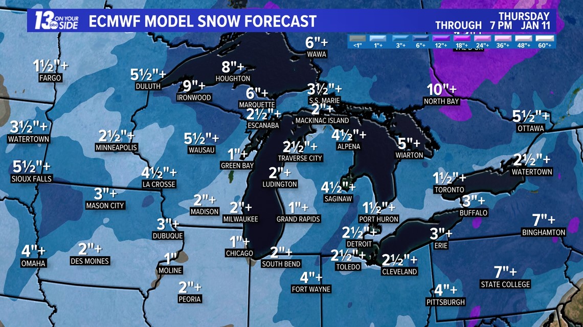


These widely-varying computer snow totals will (hopefully) converge to what the actual amounts may turn out to be. You will need to continue looking for updates throughout the week into the weekend with the 13 On Your Side Team of experienced meteorologists.


Chief Meteorologist George Lessens
George is a graduate of Penn State University working for 13 On Your Side for over 43 years. He is a Certified Broadcast Meteorologist (CBM), a thirteen-time MAB® Weathercast Award Winner, two-time EMMY® Award Winner, NATAS® Silver Circle Award Winner, and Weather-Ready Nation® Ambassador.
Contact me at: GeorgeLessens@13OnYourSide.com
Follow me on X/Twitter @glessens and Facebook GeorgeLessensWZZM
Have a 30-second video or photo to share? We'd love to share it with everyone! Share your images by texting your name and location to 616.559.1310 or email to Weather@13OnYourSide.com or post it to our 13OnYourSide Facebook Page