
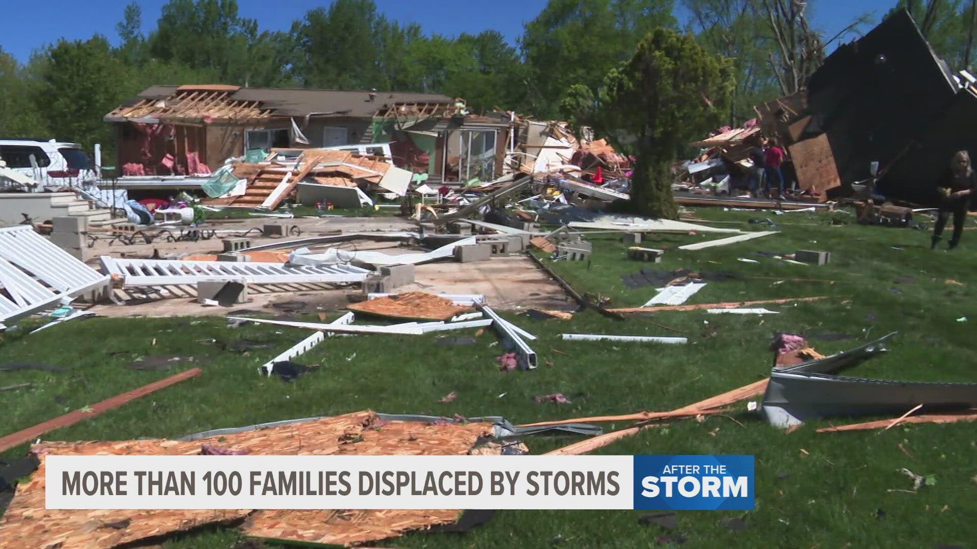
MICHIGAN, USA — Reports from the National Weather Service (NWS) are rolling in after severe weather and multiple tornadoes were spotted in Southwest Michigan on Tuesday.
So far the NWS has confirmed four tornadoes. Two of the four have been classified as EF-2s, and one of them was a multi-vortex tornado. They said they are continuing to assess the storms and will provide more updates as they have more information.
PORTAGE
The NWS said an EF-2 tornado hit the City of Portage. The tornado had an estimated peak wind speed of 135 mph, its path length hit around 11 miles and its width was approximately 300 yards.
The tornado started just before 6 p.m. on Tuesday. It first touched down near the intersection of South 10th Street and West R Avenue. It traveled east/northeast before lifting north of East N Avenue just west of 31st Street.
DOWAGIAC/TWIN LAKES
Shortly after 5 p.m. on Tuesday the NWS says an EF-1 tornado touched down in Cass County, MI. It's estimated peak wind speed was 95 mph. The length of its path was 11.83 miles and its estimated width was 950 yards.
The tornado touched down in a field just north of the Dowagiac Municipal Airport. It continued northeast and reached its maximum width in the Twin Lakes area. Eventually, it dissipated near the Cass/Van Buren County line.
UNION LAKE
In Union Lake a tornado touched down that the NWS has said was an EF-1 as well. Its max wind speeds were 95 mph. Its approximate path length was much shorter at just 1.09 miles and its estimated width was 100 yards.
The NWS described this tornado as much more brief, but said it still caused some damage in the area.
COLON/SHERWOOD
On Thursday the NWS confirmed a fourth tornado that hit southwest Michigan. The tornado in Colon/Sherwood has been classified as an EF-2. Its max wind speeds were 130 mph. Its approximate path length was 19.58 miles, giving it the longest path of the confirmed tornados in Michigan that day. Its width was approximately 950 yards.
This tornado touched town in St. Joseph County on the south side of Centreville before heading northeast, passing north of Colon and crossing into Branch County near Havens and Goodrich Lake. Eventually, the tornado weakened and lifted south of Union Lake. The NWS also confirmed this was a multi-vortex tornado.
EF Scale:
EF0...Weak......65 to 85 mph
EF1...Weak......86 to 110 mph
EF2...Strong....111 to 135 mph
EF3...Strong....136 to 165 mph
EF4...Violent...166 to 200 mph
EF5...Violent...>200 mph
The NWS said all of the information provided on the storms so far is preliminary and is subject to change.
►Make it easy to keep up to date with more stories like this. Download the 13 ON YOUR SIDE app now.
Have a news tip? Email news@13onyourside.com, visit our Facebook page or Twitter. Subscribe to our YouTube channel.
Watch 13 ON YOUR SIDE for free on Roku, Amazon Fire TV Stick, Apple TV and on your phone.