
GRAND RAPIDS, Mich. — We're all certainly looking forward to a reprieve from the cold weather and ahead toward those temperatures above freezing later this week, but before we can get there another blast of wintry weather has West Michigan in her sights!
This latest blast will come in a few waves, starting with light snow on Monday. From there we go into wintry mix and potential icing for Tuesday, so let's break it all down!
The Timeline:
The first round of snow will start to arrive by Monday morning and last through Monday afternoon, where it may briefly mix with some light wintry mix. This round is expected to drop some minor snowfall accumulations, with areas near the lakeshore likely to see the most due to some minor lake-enhancement.
Overall this round of snow may cause some briefly slowed travel, but impacts are likely to be limited.


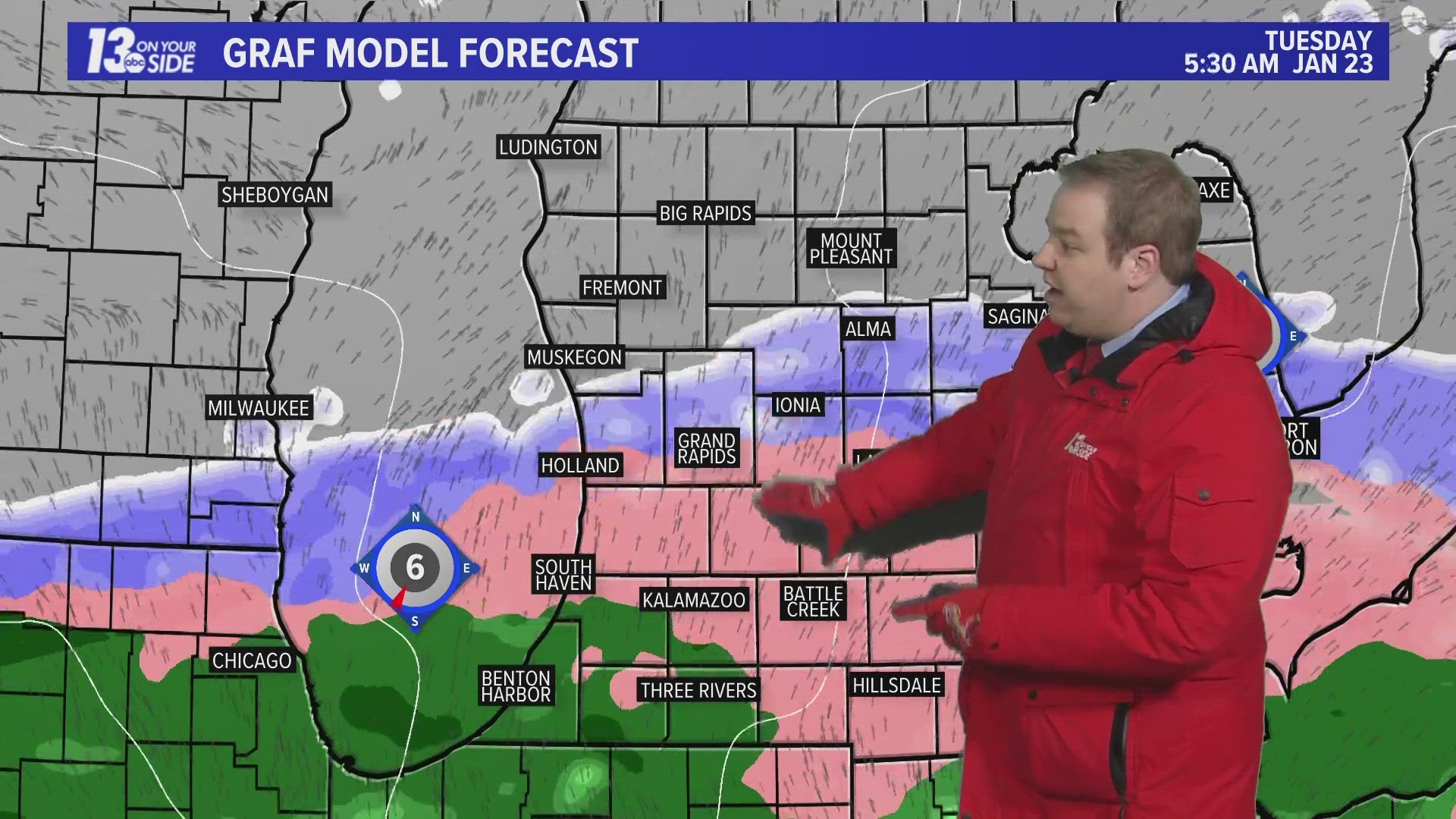
Following this a brief period of quiet will take over, before wintry mix becomes widespread on Monday night into Tuesday morning. This round of wintry mix will be heaviest along and south of the I-94 corridor. Areas north of I-96 will predominately see snowfall.


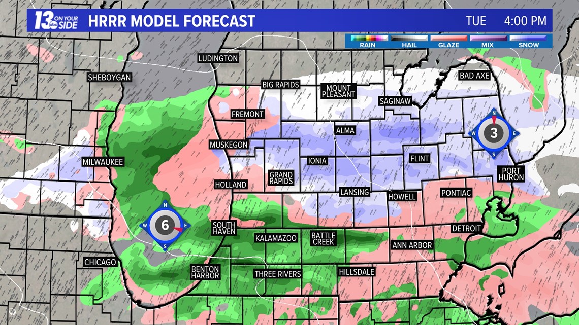
As we progress deeper into Tuesday, we are expecting a tighter transition line to set up between the rain and the snow. Areas south will move to primarily rainfall, with areas north moving to primarily snowfall.

The Impacts:
Those who stay with snow throughout the system will see additional accumulations that are likely to cause some impact to travel. With temperatures being close to if not above freezing, this will be a heavy and wet snowfall.
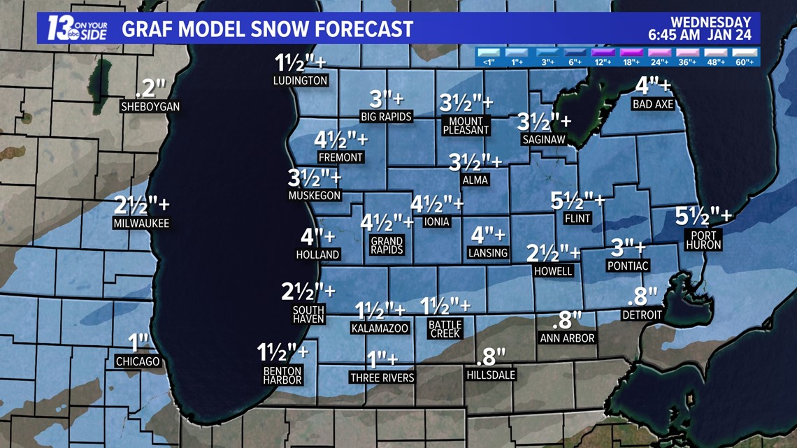
Snowfall totals in this region could be around 1-4+ inches. These totals will be less in areas that split time with wintry mix and rain.

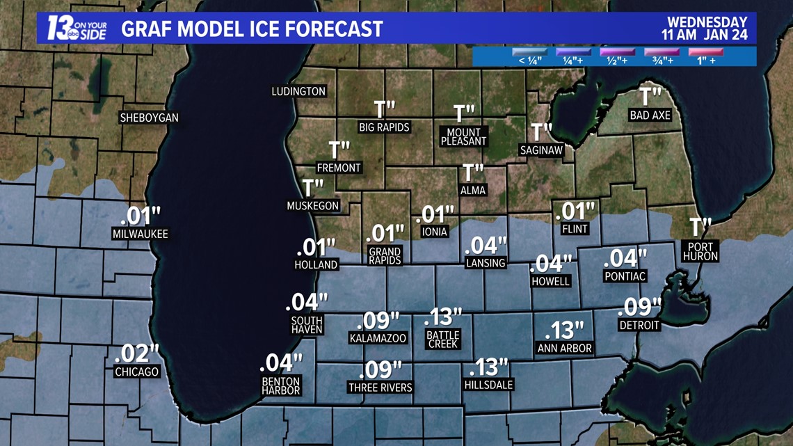
Ice accumulations will be most impactful along the I-94 corridor and south. Areas hardest hit on Tuesday morning will likely see very difficult travel.
Power outages may occur, but at this time icing doesn't look heavy enough to make them widespread.

The good news is temperatures will warm above freezing by Wednesday and region wide precipitation will shift toward rain. Keep in mind this week that any ice that has formed on local bodies of water is not likely to be deep and will only get weaker with warmer weather ahead.
Stay with the 13 On Your Side Weather Team for more updates as we head through this next round of winter weather!
-- Meteorologist Michael Behrens
Follow me on social media! Facebook Meteorologist Michael Behrens, X/Twitter @MikeBehrensWX, and Instagram/Threads @MikeBehrensWX.
Email me at: MBehrens@13OnYourSide.com
Have a 30-second video or still photo to share? We'd love to share it with everyone! Email your image to Weather@13OnYourSide.com or post it to our 13OnYourSide Facebook Page.
►Make it easy to keep up to date with more stories like this. Download the 13 ON YOUR SIDE app now.
Have a news tip? Email news@13onyourside.com, visit our Facebook page or X/Twitter. Subscribe to our YouTube channel.