GRAND RAPIDS, Michigan — The first week of spring is feeling more like winter with a snowstorm on the way. Four to 8 inches of system snow is expected by Friday night. This system will impact Friday's morning and evening commute, potentially causing school closures.
TIMING
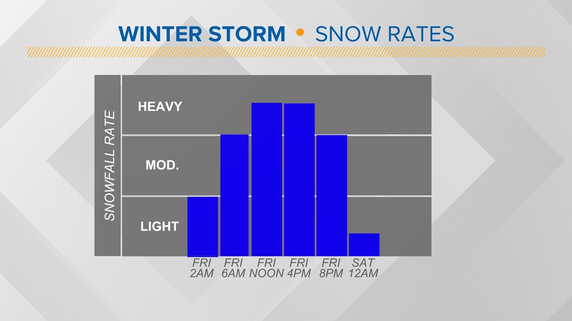
Snowfall begins by 3 a.m. along the lakeshore and expands to the east throughout the morning. Snow will taper off around 9 p.m. Friday. Snowfall rates will likely be the highest between the morning and evening commute.

SNOWFALL TOTALS
There will likely be changes to snowfall totals between now and Friday morning. There is still some discrepancy between where the strongest banding will be set up within the system. It is safe to say everyone along and north of I-96 will receive at least 4 inches of snowfall. This area will likely have 6+ inches of snowfall. It is not out of the realm of possibility that isolated areas receive 8+ inches of snow, depending on the banding that sets up within the storm. Especially if we see any lake enhancement develop in addition to the system snow. This would bring much greater impacts and we will be monitoring that setup closely.
Here is a look at the various model outputs as of 9 a.m. Thursday morning:

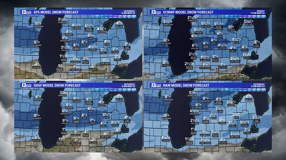
The ECMWF model likely has the overall placement correct but could be underestimating some of the banding that will potentially occur. I would not be surprised to see an additional area of 6+ inches from Allegan County to the Lansing region. That is something that we will be nailed down overnight.
Here is the 13 On Your Side tentative forecast. Adjustments will continue to be made to this map as needed.


IMPACTS
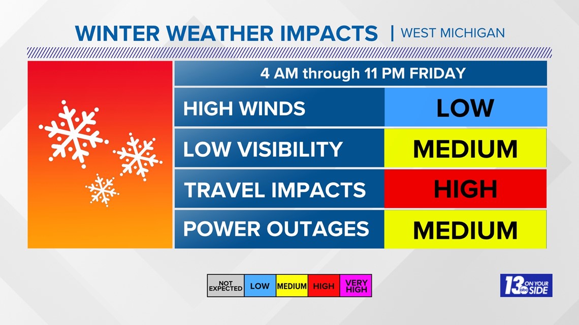
Impacts will be greatest during lunch time and the evening commute.
- High Winds - Low Impacts
- Reduced Visibility - Medium Impacts
- Travel - High Impacts
- Power Outages - Medium Impacts

You can get weather updates, snowfall reports, and more by texting 'WEATHER' to 616-559-1310 or by scanning the QR code below.


Have a 30-second video or photo to share? We'd love to share it with everyone! Share your images by texting your name and location to 616.559.1310 or email to Weather@13OnYourSide.com or post it to our 13OnYourSide Facebook Page
►Make it easy to keep up to date with more stories like this. Download the 13 ON YOUR SIDE app now.
Have a news tip? Email news@13onyourside.com, visit our Facebook page or Twitter. Subscribe to our YouTube channel.
Watch 13 ON YOUR SIDE for free on Roku, Amazon Fire TV Stick, Apple TV and on your phone.