
GRAND RAPIDS, Mich. — Plenty of moving parts weather-wise across West Michigan with summer-like warmth, a brief period of windy conditions, and opportunities for showers and thunderstorms.

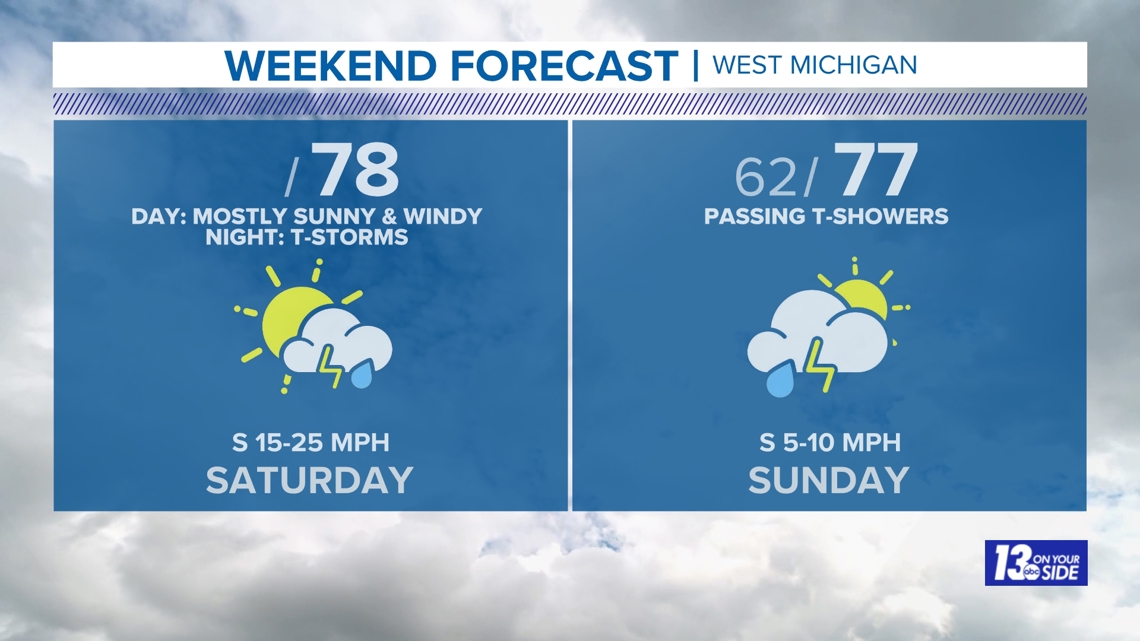
SATURDAY – SATURDAY NIGHT
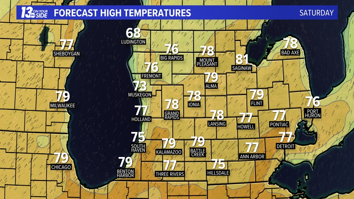
A warm front lifting north of West Michigan will allow temperatures to soar into the middle to upper 70s away from the immediate lakeshore. Putting this in perspective, average high temperatures are in the lower 60s for late April. It’ll also be slightly humid – by W. Michigan standards – as dew point temperatures climb above 60°.

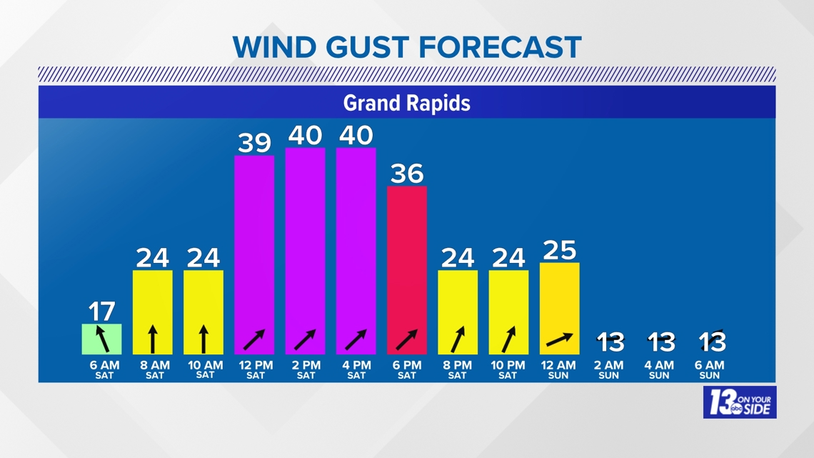
The main impact of the day will be the wind. Southerly winds will become gusty throughout the day. Sustained winds of 15-25 mph are expected, with gusts upwards of 40 mph.

Following scattered showers early Saturday, dry conditions will prevail much of the daytime hours. The expectation is for clouds to scurry out, with mostly sunny skies for many this afternoon into the early evening. Despite the summer-like warmth and moisture, the atmosphere will remain ‘capped’, which will inhibit thunderstorm development during the day.
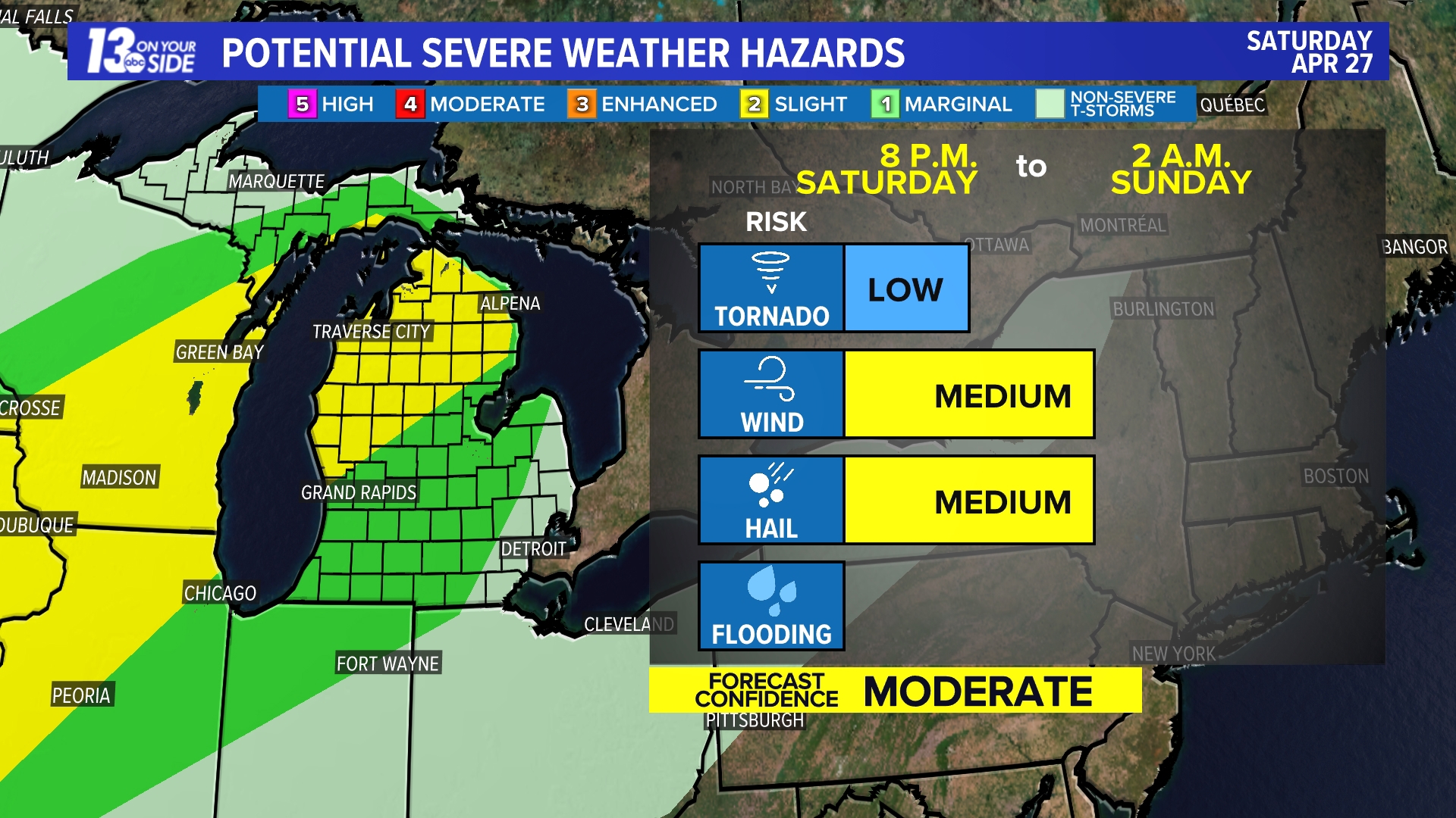
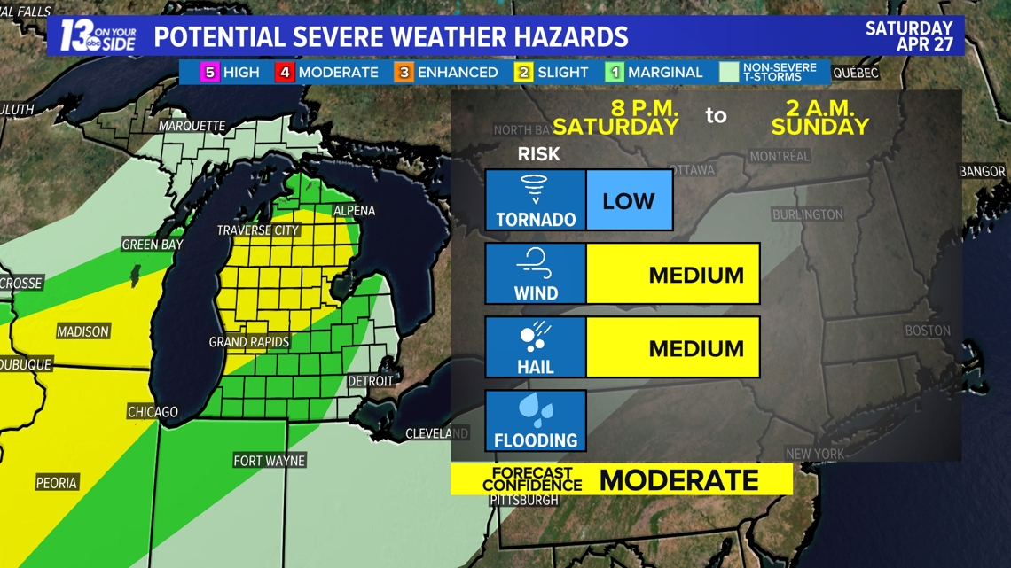
The opportunity of thunderstorms will increase this evening – past 8 p.m. – into the nighttime hours as a cold front presses into the Great Lakes, removing any inhibiting factors. Thunderstorms will develop across Northern Michigan and progress southward into West Michigan. These storms will have the potential to produce strong winds and large hail.
The greatest risk of severe weather is where a slight (level 2 out of 5) risk of severe weather is in place. Here, thunderstorms will have the greatest amount of instability and moisture to work with. Elsewhere, a marginal (level 1 out of 5) risk is currently in place.

SUNDAY
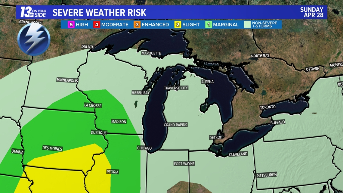
It’ll remain warm, and slightly humid, with additional thunderstorm chances into Sunday. For now, there is no severe weather risk across West Michigan for Sunday, but any thunderstorm may produce frequent lightning and heavy rain, which can impact outdoor plans.
Temperatures will settle in the 70s once again on Sunday, with enough moisture present for humidity to be noticeable.

Stay with the 13 On Your Side Weather Team for the latest updates on the forecast.
Have a 30-second video or photo to share? We'd love to share it with everyone! Share your images by texting your name and location to 616.559.1310 or email to Weather@13OnYourSide.com or post it to our 13OnYourSide Facebook Page