
GRAND RAPIDS, Mich. — Heavy rainfall is expected to bring flooding concerns to West Michigan. Because of this, the National Weather Service has issued a Flood Watch through 2 a.m. This watch includes the following counties: Newaygo, Muskegon, Montcalm, Gratiot, Ottawa, Kent, Ionia, Clinton, Allegan, Barry, Eaton and Ingham.
WHEN
After midnight, showers and storms will move out and drier skies are expected tomorrow.
AMOUNTS
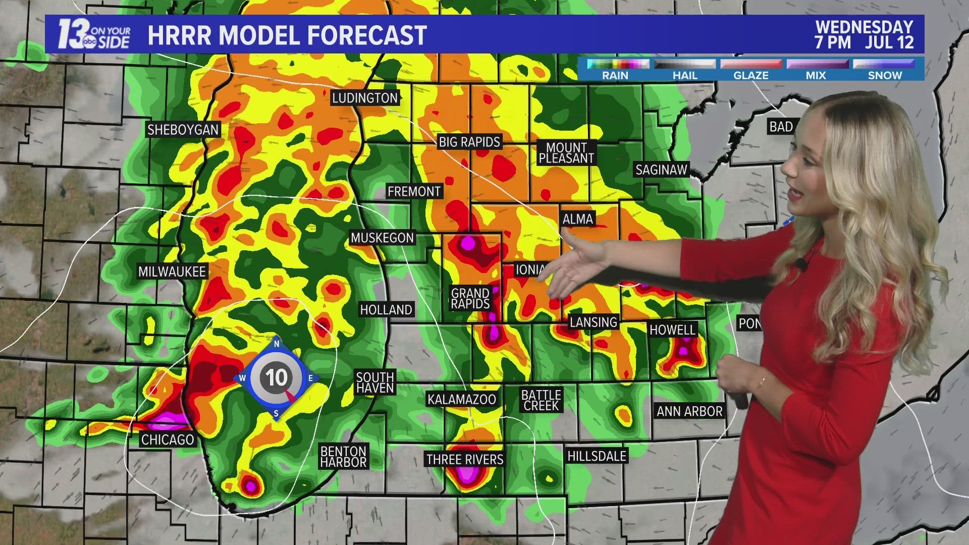
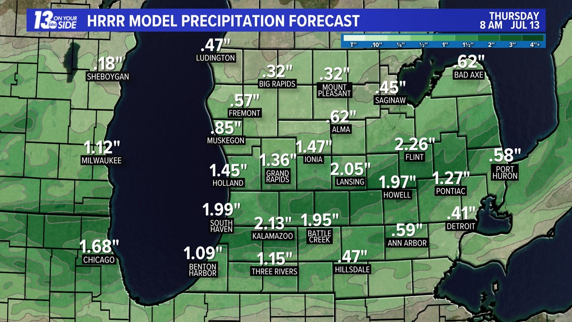
Thunderstorms and rainfall could bring anywhere from 1 to 2"+ of rain to the region, with potentially localized heavier amounts. The heaviest rainfall will likely set up between I-96 and I-94. This means that areas prone to flooding, such as low-lying land and roads, will likely flood. This is especially concerning after dark.

ACTION
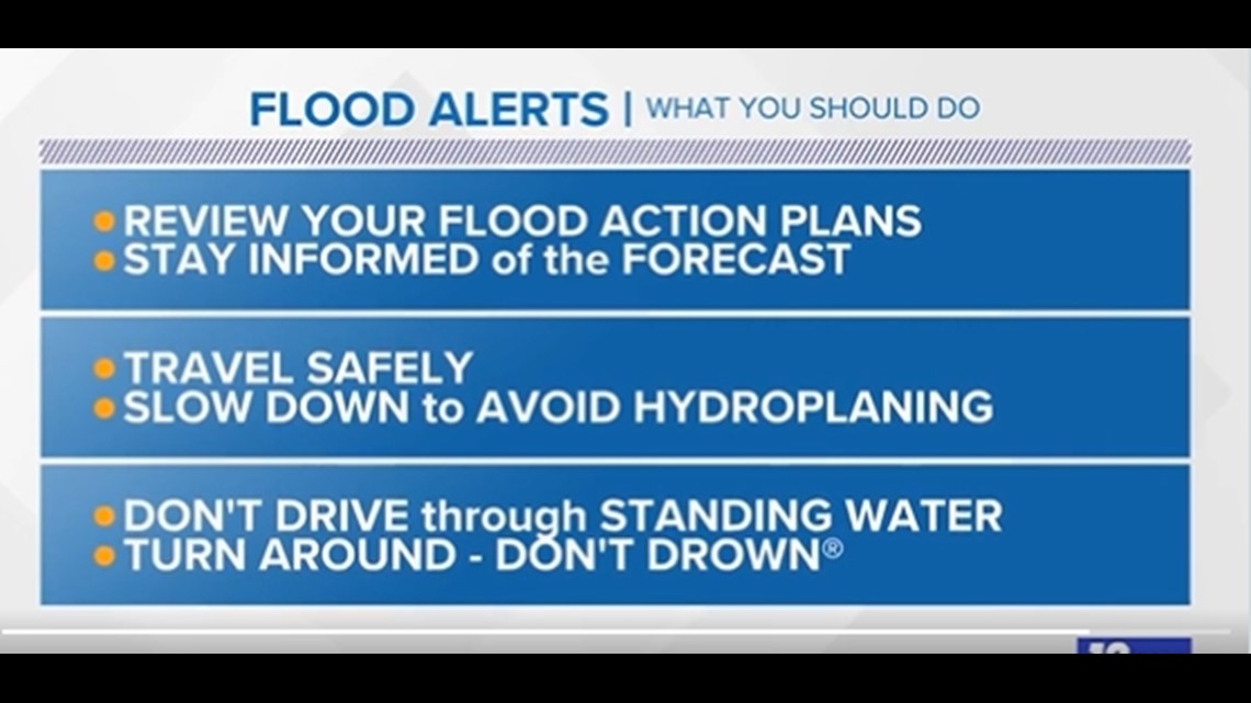
At this point, one should continue to monitor for Flood Warnings to be issued. If you live in a flood-prone area, you should prepare. If a Flood Warning is issued or you see flooding, make sure to drive carefully. You should never drive or walk through standing water as the water could have broken up the ground beneath it. Be cautious of possible downed powerlines. And always remember the saying, "Turn Around, Don't Drown."

Have a 30-second video or photo to share? We'd love to share it with everyone! Share your images by texting your name and location to 616.559.1310 or email to Weather@13OnYourSide.com or post it to our 13OnYourSide Facebook Page
►Make it easy to keep up to date with more stories like this. Download the 13 ON YOUR SIDE app now.
Have a news tip? Email news@13onyourside.com, visit our Facebook page or Twitter. Subscribe to our YouTube channel.