
GRAND RAPIDS, Mich — It's time to dust off the snow blowers and prepare the snow shovels!
Three rounds of messy weather are expected this week, all with varying impacts. Let's begin with the first system.
WHAT
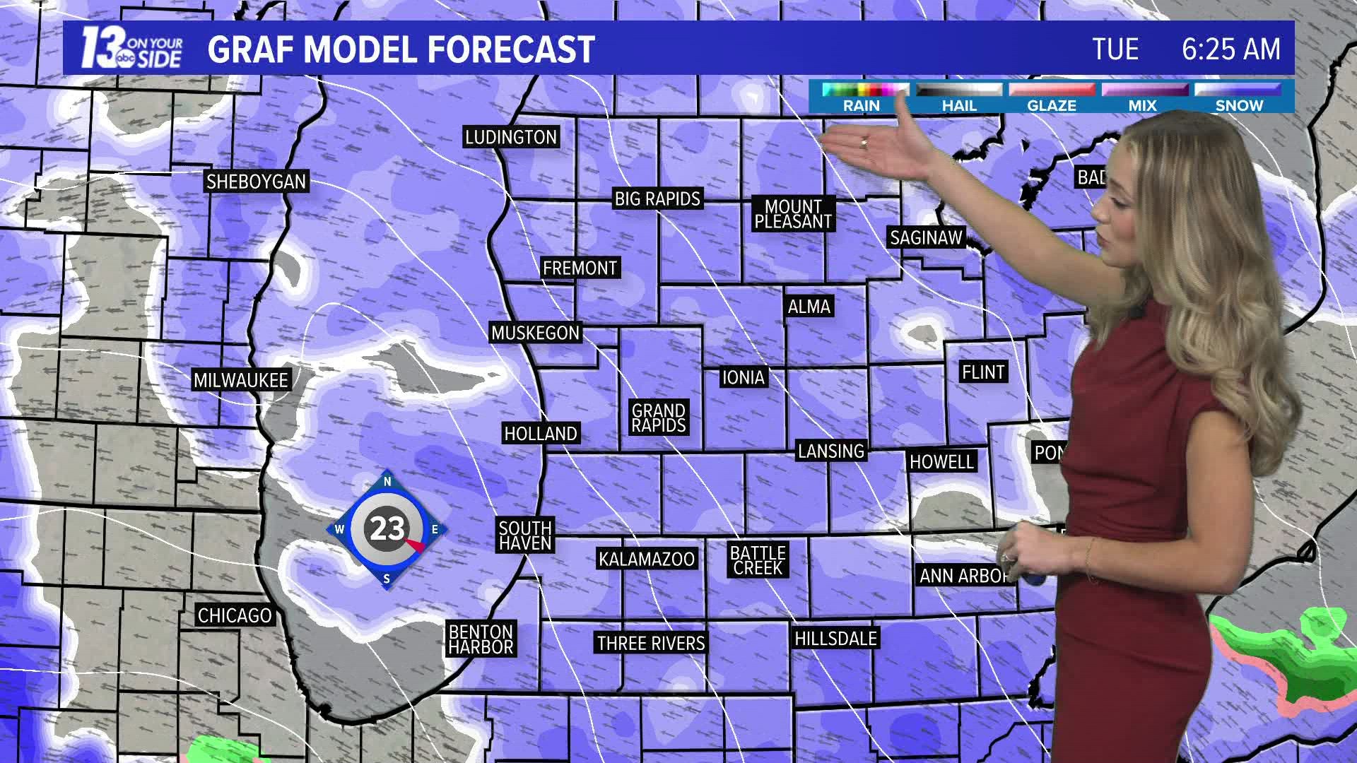
A low-pressure system is moving into the plains and will bring snow, rain, and gusty winds to West Michigan overnight Monday into Tuesday morning. This system will be rich in Gulf moisture, bringing wet, dense snow to start your morning commute, switching to rainfall along and south of M-46 by noon, and transitioning back to snow overnight Tuesday into Wednesday. The highest impacts are expected in Mason, Lake, Osceola, Clare, Oceana, Newaygo, Mecosta, and Isabella counties. This is where 6"+ of snowfall is expected with 35+ mph winds.


HOUR-BY-HOUR
The system will arrive overnight from Monday into Tuesday morning, bringing widespread snowfall and likely causing travel concerns on Tuesday morning.


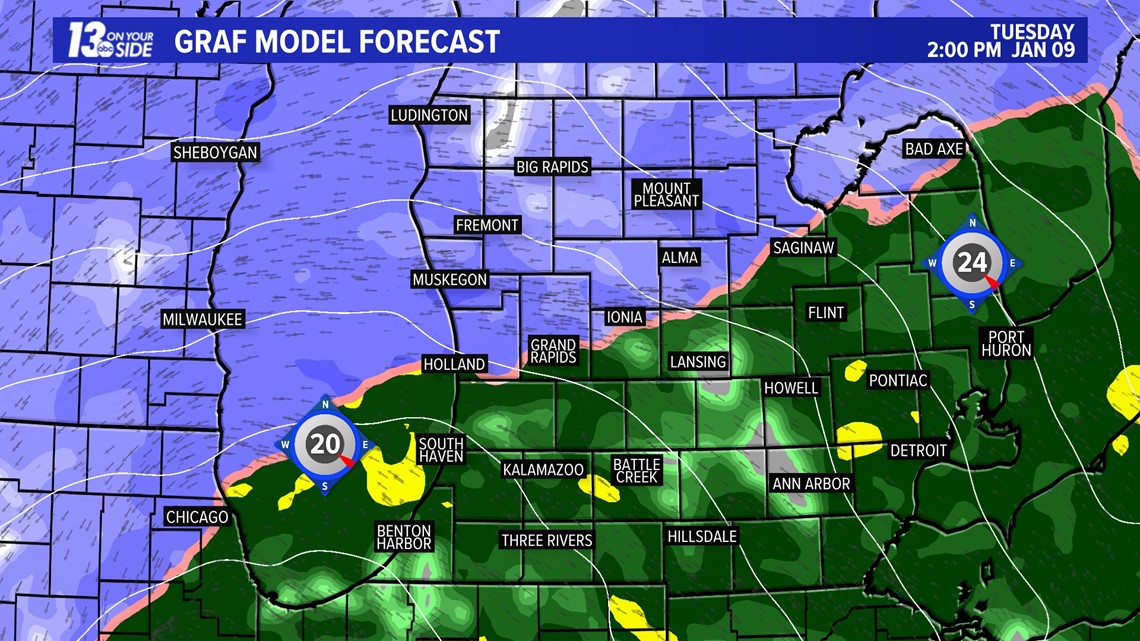
By 10:00 am on Tuesday, above-freezing temperatures will move in from the south, initiating the transition of snow to rain from south to north. This will lessen impacts along the I-94 corridor by noon and eventually extend to I-96 by 2 pm.


Precipitation type will persist as snowfall from M-46 to the north through the afternoon and evening, continuing to cause travel impacts in those areas.

The low pressure system exits Michigan and cooler air wraps in.


This fires off lake effect snow overnight Tuesday into Wednesday morning.


Snow ends by early Wednesday afternoon.
SNOWFALL TOTALS


The highest snowfall totals are expected in Mason, Lake, Osceola, Clare, Oceana, Newaygo, Mecosta, and Isabella counties, with these areas likely experiencing 6+ inches of snow. Those from M-46 to I-96 are expected to see 4+ inches of snowfall. South of I-96, lower totals are anticipated due to the switch from snow to rain in the afternoon hours.


It's important to remember that this will be a heavy and dense snowfall, meaning that water concentrations will likely cause the snowfall totals to compact to lower amounts. Areas south of I-96 will also see the afternoon rain quickly melt their morning snow, or at least turn it slushy.
IMPACTS


Prepare for periods of hazardous travel and reduced visibility, especially for those located in the Winter Storm Watch area.
WHAT'S NEXT
There will be two additional systems this week. The second system is expected to arrive on Wednesday into Thursday, bringing a quick burst of snowfall and causing minor impacts.


The third system arrives Friday afternoon through Saturday morning. This system looks to be the strong of the week bringing high impact snowfall and strong winds to the region.


Continue to watch future forecasts from the 13 On Your Side team.
►Make it easy to keep up to date with more stories like this. Download the 13 ON YOUR SIDE app now.
Have a news tip? Email news@13onyourside.com, visit our Facebook page or Twitter. Subscribe to our YouTube channel.
Watch 13 ON YOUR SIDE for free on Roku, Amazon Fire TV Stick, Apple TV and on your phone.