
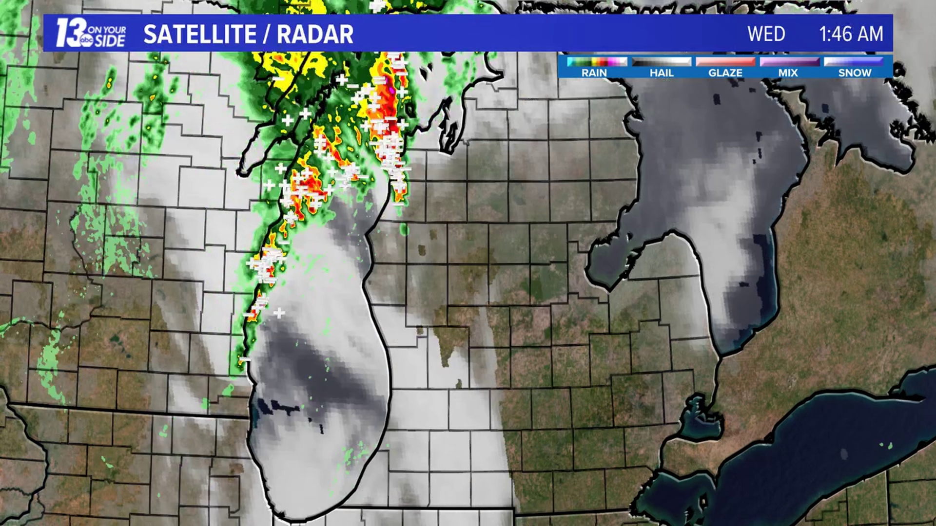
MICHIGAN, USA — A line of thunderstorms was expected to cross Lake Michigan overnight Tuesday into Wednesday morning.
While the storms did cross the lake, they did not impact us in West Michigan.
A wave in the atmosphere caused a slight shift in the track of the storms and drove them in a fairly unusual West to North East track over Lake Michigan, rather than a typical West to East flow.
This caused the initial line of thunderstorms to shift north of the West Michigan region.
Any lingering storms that tried to cross Lake Michigan between 2 to 4 a.m., were then too weak to survive the trip.
We always say that severe weather is very similar to baking a cake and without all the ingredients, you can't get a cake to rise.
In this case, we had all the elements to create a severe storm in our atmosphere, but without the rain, there were no storms to develop.
It's worth mentioning, that this track of precipitation was noted and mentioned by early Tuesday afternoon, but due to the having all the other "ingredients" in our atmosphere and the rareness of storms moving across the lake in that manner, we remained on alert through the overnight hours.
On Wednesday, winds are making for dangerous swimming conditions along most of the lakeshore.
►Make it easy to keep up to date with more stories like this. Download the 13 ON YOUR SIDE app now.
Have a news tip? Email news@13onyourside.com, visit our Facebook page or Twitter. Subscribe to our YouTube channel.
Watch 13 ON YOUR SIDE for free on Roku, Amazon Fire TV Stick, Apple TV and on your phone.