
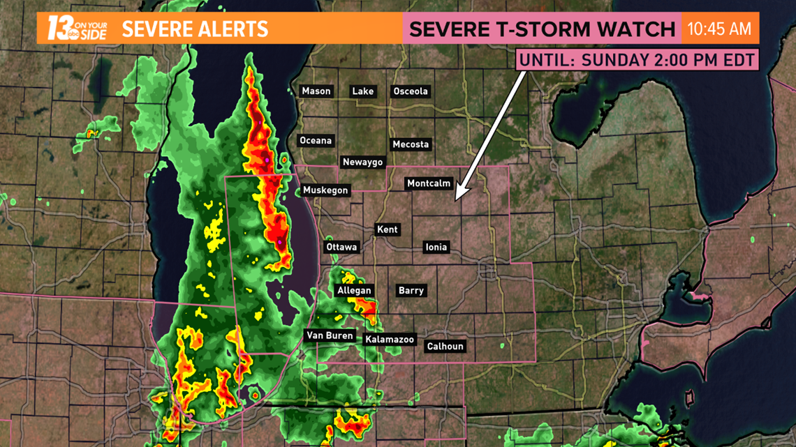
A line of thunderstorms raced across West Michigan on Sunday bringing strong winds, dangerous lightning and torrential rains.
The storms were associated with a warm front pushing north into West Michigan. The front is the dividing line between much warmer and more humid conditions to the south.
After 3 p.m. Sunday, West Michigan should dry out. This will make for a quiet but steamy evening with dewpoints surging into the upper 60s and low 70s.

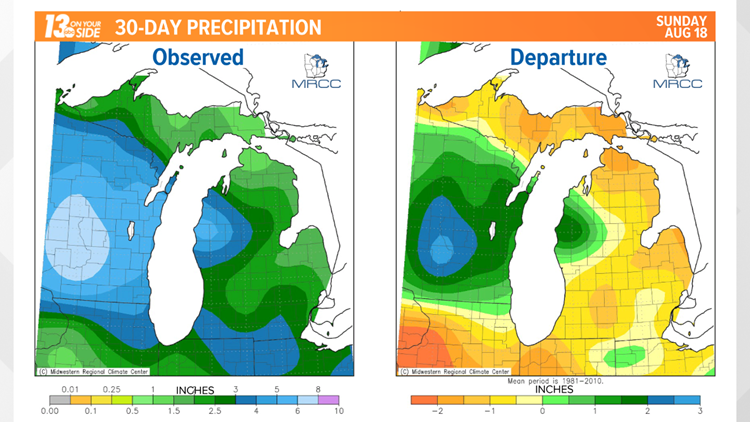
Parts of West Michigan, particularly along and south of I-96, are running a rainfall deficit. Some communities are more than an inch behind normal over the last 30 days. So this rain is coming at a good time.
The start to the week will feature warm and very humid conditions for West Michigan with very little rain. After Monday, chances for precipitation will be few and far between.
Consumers Energy is warning customers that the high winds, primarily south of M-46 between Muskegon and Saginaw, could knock out power.
Take a look at the outage map here.
►Make it easy to keep up to date with more stories like this. Download the 13 ON YOUR SIDE app now.
Have a news tip? Email news@13onyourside.com, visit our Facebook page or Twitter.