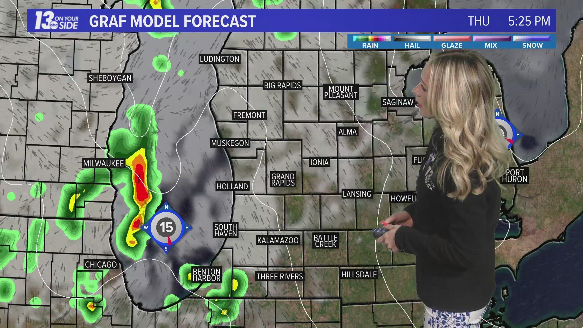
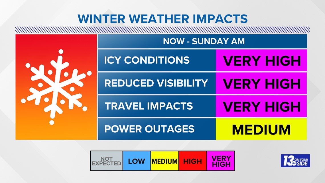
GRAND RAPIDS, Mich. — Several inches of fresh snowfall had already fallen around West Michigan by 9 p.m. on Thursday, and traffic was being slowed by crashes and poor driving conditions. The bad news, this is just the beginning and blizzard conditions have not even started yet.
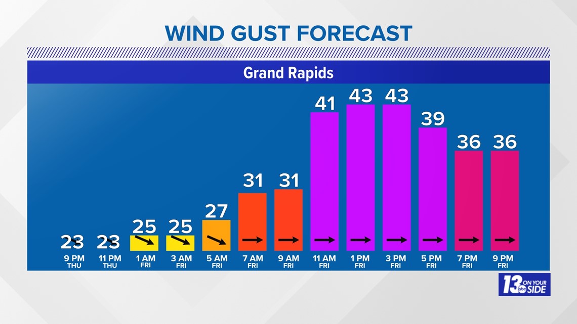
As of 9 p.m., Thursday winds were already gusting up into the 20-30 mph range, but we need consistent wind speeds at or above 35 mph to hit blizzard conditions. Those will be on the way as we head into Friday.
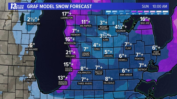
More bad news, additional forecast snowfall on top of what has fallen remains to be measured in feet and not inches.

As we head into the overnight Thursday and early Friday, a brief lull in the snowfall is expected to occur. This lull will start to fill back in as we head toward sunrise on Friday, with winds and lake-enhanced snowfall overspreading the region.

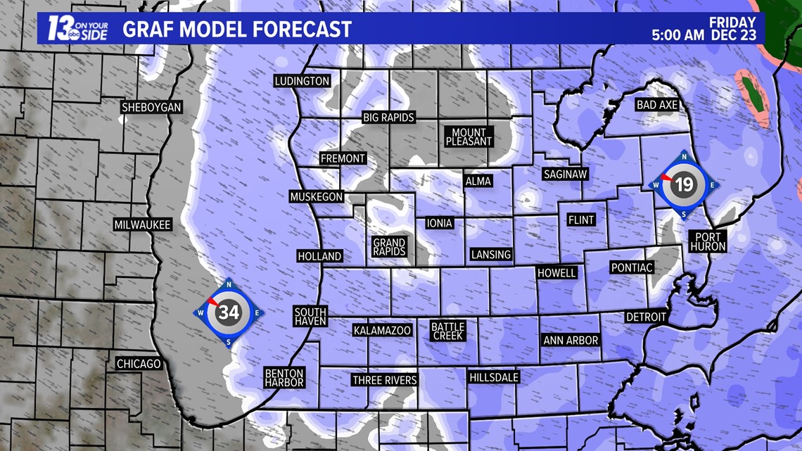
This snowfall will continue through the day on Friday, with additional lake-effect expected to fall through Saturday. This means on top of the snowfall we have already seen here in West Michigan, another 8 to as much as 20 inches may fall in portions of the region.


This snowfall will be made worse by howling winds that will only just begin to peak as we head into Friday. Gusts will increase from 20-30 mph to 30-40 mph by Friday morning. During the day on Friday, wind gusts of 40-50+ mph are expected, which will cause widespread and severe blowing and drifting snow.

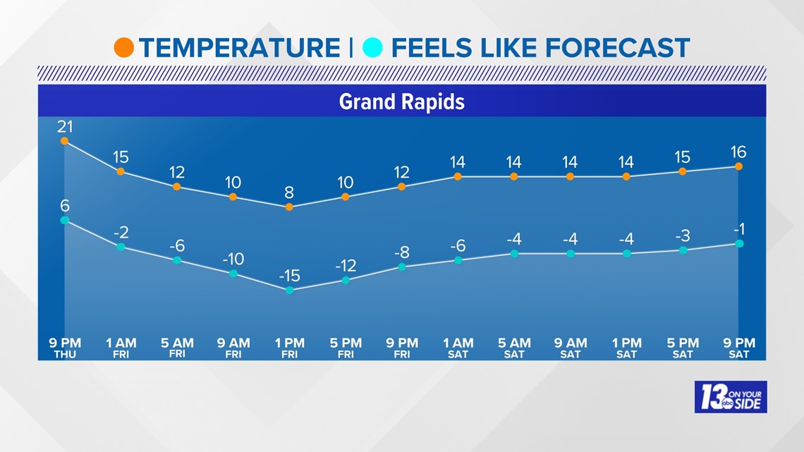
These winds will bring with them another threat, frigid artic air. Temperatures are expected to be in the teens for highs as we head through Friday and into the weekend.
If this wasn't bad enough, when you factor in the winds, "feels-like" conditions will be in the negatives, with negative-teens expected for Friday.

All in all, this storm is going to remain dangerous for many reasons over the next 48+ hours. Make sure you are staying with 13 ON YOUR SIDE throughout for the latest information.
-- Meteorologist Michael Behrens
Follow me on social media! Facebook Meteorologist Michael Behrens, Twitter @MikeBehrensWX, and Instagram @MikeBehrensWX.
Email me at: MBehrens@13OnYourSide.com
Have a 30-second video or still photo to share? We'd love to share it with everyone! Email your image to Weather@13OnYourSide.com or post it to our 13OnYourSide Facebook Page.
►Make it easy to keep up to date with more stories like this. Download the 13 ON YOUR SIDE app now.
Have a news tip? Email news@13onyourside.com, visit our Facebook page or Twitter. Subscribe to our YouTube channel.