A potent cold front will sag south into West Michigan late Tuesday. It will be the focus for a burst of snow.

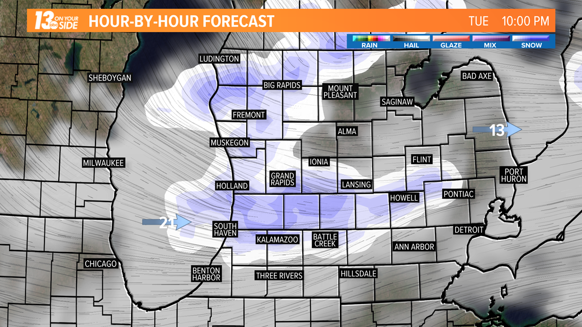
Some areas could pick up a quick 1-2 inches of accumulations from the cold front. Travel could become treacherous overnight Tuesday into Wednesday morning.

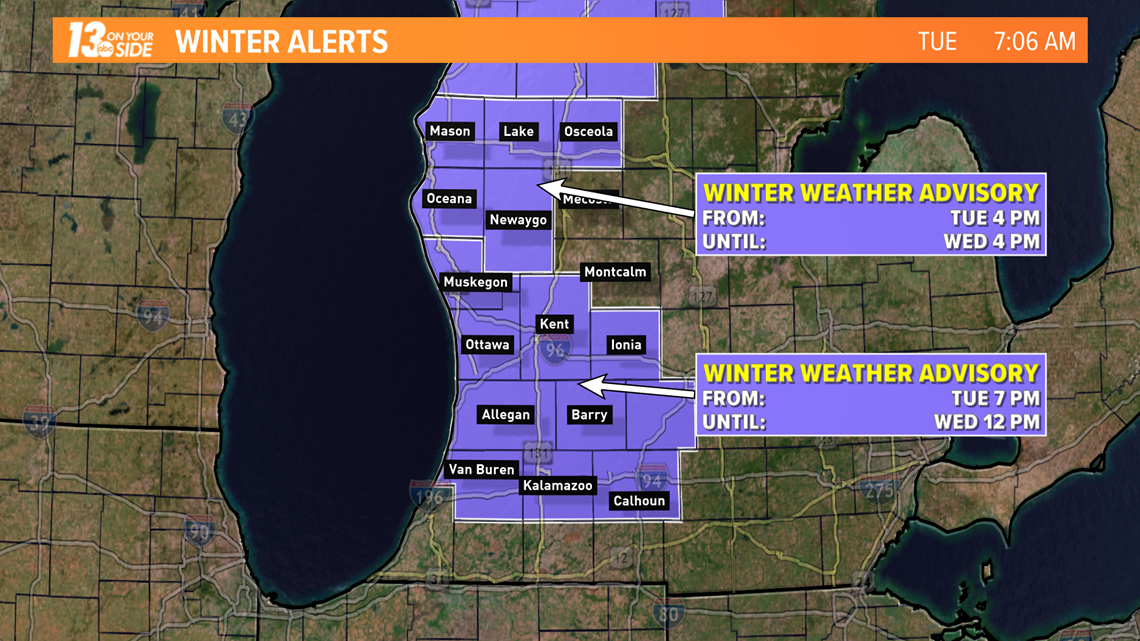
Lake-effect snow showers will continue at times Wednesday. Additional light accumulations are likely with the greatest totals staying northwest and southwest of Kent County.
Behind the front, much colder air will pour into West Michigan. Wednesday will be the coldest day in the next week and a half with temperatures hovering in the teens and low 20s. Wind chill values will make it feel even colder than that.
The cold air won't be hanging around for too long. By Thursday, winds will turn around to the south. Temperatures should bounce back into the 30s by Thursday and into the 40s by this weekend.
More from 13 ON YOUR SIDE:
RELATED VIDEO:
►Make it easy to keep up to date with more stories like this. Download the 13 ON YOUR SIDE app now.
Have a news tip? Email news@13onyourside.com, visit our Facebook page or Twitter. Subscribe to our YouTube channel.