

GRAND RAPIDS, Mich. — The weekend left over a foot of snow in West Michigan, with many people doing their best to dig out. The bad news for those who want to see an end to the white stuff, another potentially high impact winter storm is looking set to target West Michigan later this week.
It's important to remember that the details of this system will likely change in the following days, but as of right now, ingredients seem right to create a very impactful winter system arriving Thursday and lasting into the weekend. This system will likely create hazardous and slow travel that may leave people stranded in parts of the Great Lakes region.


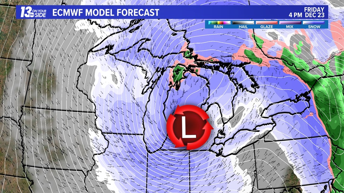
Starting Thursday and going into Friday a low pressure system will track through the Great Lakes region. Right now models are split on the exact track of this system.
In one scenario, the low tracks further to the north are bringing us warmer temps and wintry mix on Thursday, followed by heavy snow on Friday. In the other low tracks, further to the south are bringing us two days of heavy snowfall.
In both scenarios, heavy lake enhanced snow will continue into Saturday before dissipating on Sunday.

It's too early to give totals yet, as these will change in the days ahead. (Keep this in mind when you see pictures circulating around social media.) However, we can say this will be a potential high impact snow storm that may leave behind as much or more snow than we saw these past few days.
Travel will be impacted and any trips should be planned knowing that extra time and or delays are to be expected.
In addition to this snowfall, winds gusting over 30 mph and temperatures falling into the teens to single digits will be possible in the Great Lakes region.
So, what should you do now?
Make sure you are closely watching the forecast each day to see the latest changes and make sure your plans can be flexible to change with the forecast. 13 ON YOUR SIDE will keep you covered through this storm and the rest of the winter as well!
-- Meteorologist Michael Behrens
Follow me on social media! Facebook Meteorologist Michael Behrens, Twitter @MikeBehrensWX, and Instagram @MikeBehrensWX.
Email me at: MBehrens@13OnYourSide.com
Have a 30-second video or still photo to share? We'd love to share it with everyone! Email your image to Weather@13OnYourSide.com or post it to our 13OnYourSide Facebook Page.
►Make it easy to keep up to date with more stories like this. Download the 13 ON YOUR SIDE app now.
Have a news tip? Email news@13onyourside.com, visit our Facebook page or Twitter. Subscribe to our YouTube channel.