
Meteorologists began observing a strong El Niño signature almost six months ago when the Pacific waters off the western coast of South America began to warm up.
Those warmer readings can produce a catastrophic ripple effect on the rest of the globe -- from intense typhoons in Asia to unprecedented rainstorms in portions of North America.
Full forecast: 13 On Target Weather
Here in West Michigan, we tend to be stuck in the middle, with less snow and warmer temperatures than an average winter. While the trend has held for most of this winter, March is often a volatile period as the transition from winter to spring occurs.
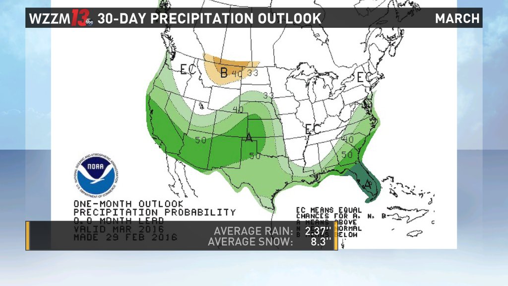
Jim Maczko, the warning coordination meteorologist for the Grand Rapids National Weather Service office explains: "El Niño is weakening slightly right now and is expected to continue to weaken slightly in the next couple of months. What that typically means for us in March is that we have a warmer than normal March and a slightly drier than normal March.
"So, more of the same pattern that we expected this winter, we would get in the next month or so. ... Typically, because we're a little bit warmer, there's still cold air trying to work it's way down here from Canada which is typical for March. Because we're warmer, the contrast between warm and cold makes us more vulnerable for an active early spring with regards to severe weather."
Essentially, what that means is that most of March will remain quiet and dry. However, the occasional storm may gain enough strength and momentum to force it's way into West Michigan, leaving us with a big mess of snow that will likely melt within a few days.