Cool air over the warmer Great Lakes waters may lead to waterspouts, especially over Lakes Erie and Huron, according to the icwr.ca.

Waterspouts are common in the summer due to the warm waters of Lake Michigan and ‘light’ winds, while cold-air funnels are more common in the autumn when the lake waters are a little colder and wind shear is stronger.

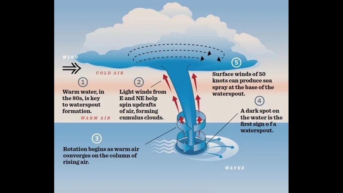
Unstable air: colder, heavier air aloft and warmer, lighter air at the surface allows for rapid ascent of air, leading to cumulus cloud formation.
A land breeze flowing offshore: cooler, sinking air inland flows from the land to the lake where the air over the water is warmer.
The prevailing north-northwest wind in the region meets up with the land breeze and the resulting convergence of air masses forces the air upwards into the unstable air.
The winds from both directions must be just the right speed or waterspouts will be unable to form: too light and there is not enough convergence; too strong and any waterspout trying to form would be torn apart by wind shear (wind changing direction or speed with height).

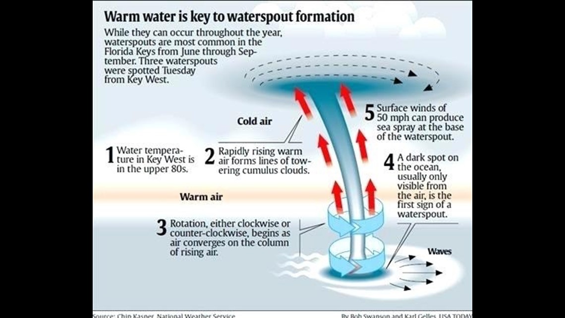
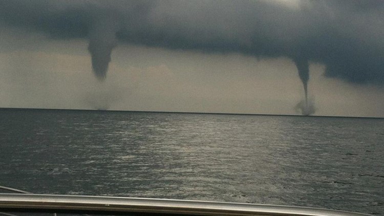
- Simply put, a waterspout is a tornado over water. How they form is still being researched but here is what we think is happening: very warm surface water coupled with warm and humid temperatures helps air to rise. As the water vapor condenses it releases more heat and the air rises even faster, creating clouds up to 18,000 to 22,000 feet. Offshore winds help ‘line up’ the clouds, creating convergence and upward motion.
- The first sign of a waterspout is usually seen from the air – a dark spot on the water, moving in a circle. Boaters may begin to experience the second stage of waterspout formation – a wind shift or increase in speed at the surface, with a developing funnel from a cloud overhead.
- In the third stage, winds up to 40 mph kick up a ‘spray vortex’ on the water while the funnel lengthens from the cloud above. The fourth, or mature stage, is when the funnel reaches all the way down from the cloud to the water. Some studies have shown waterspout wind speeds up to 190 mph.
- Finally, in the fifth and final stage, the spray vortex weakens and the funnel becomes shorter, or dissipates. This usually occurs when rain begins to fall – cool air brought down by the rain cuts off the rising air that helped create the waterspout.
Chief Meteorologist George Lessens
George is a graduate of Penn State University working for 13 On Your Side over 40 years. He is a twelve-time MAB® Weathercast Award Winner and two-time EMMY® Award Winner.
Contact me at: GeorgeLessens@13OnYourSide.com
Follow me on Twitter @glessens and Facebook GeorgeLessensWZZM
Have a 30-second video or still photo to share? We'd love to share it with everyone! Email your image to Weather@13OnYourSide.com or post it to our 13OnYourSide Facebook Page