
GRAND RAPIDS, Mich. — We've seen several hours of heavy sleet, snow, and freezing rain around West Michigan, leading to numerous traffic accidents, and over 170,000 power outages, mostly along I-94 and to the south.
The bulk of the moisture has already pushed through West Michigan, but the next several hours will still bring plenty of impactful weather to the region. Additional icing and snowfall are both expected from now through the early AM hours of Thursday morning, with continued lingering effects north of I-96 on Thursday.
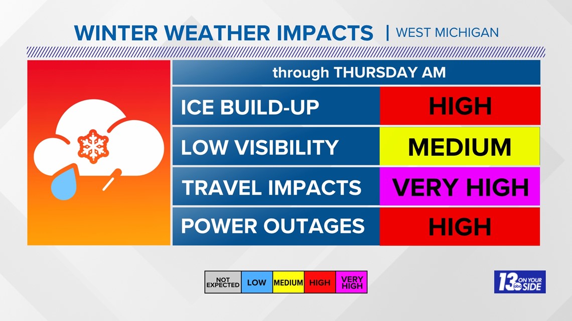
Impacts will remain very high for travel through the overnight hours, with high risks for ice accumulation and power outages, especially south of I-96.

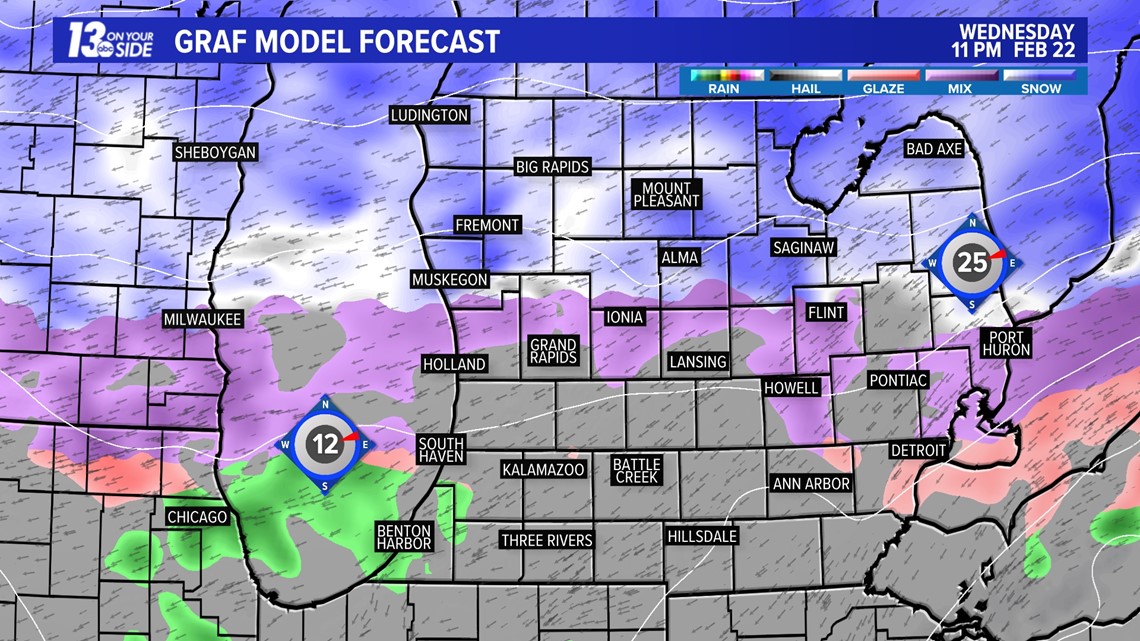
As for the timing of what's to come, the heaviest will fall between now to around and after midnight. This is when driving conditions will be at their worst and ice build up will be most likely. As we get past midnight, coverage in our southern counties will start to dissipate, with snowfall in our northern zones remaining steady.

Things will then start to weaken as we head into the early AM hours of Thursday.

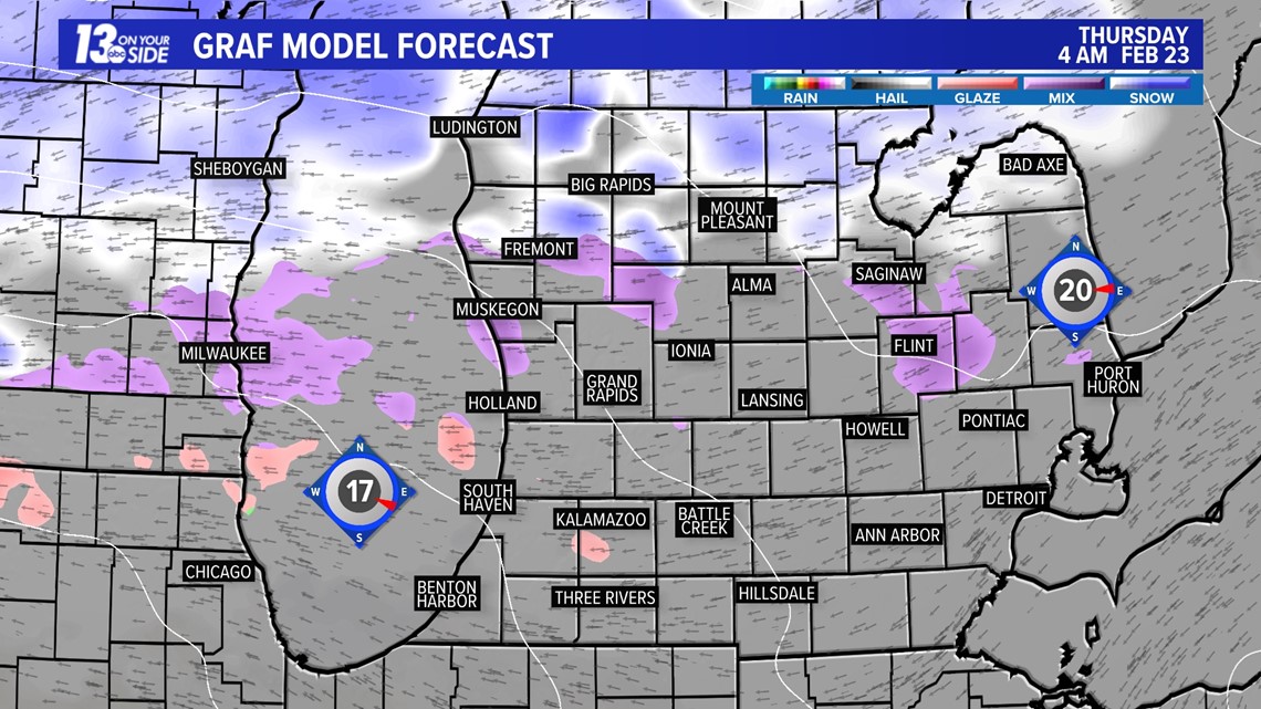
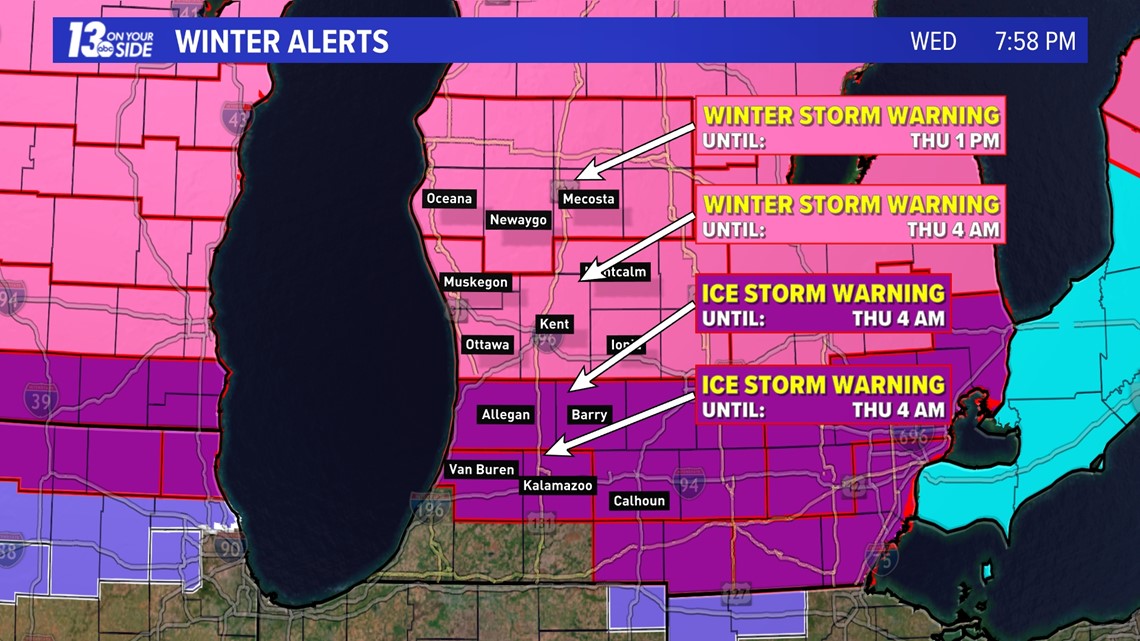
Impacts on Thursday will mostly be felt north of I-96, with winter storm warnings remaining in effect for our northern counties until 1 pm on Thursday. All other alerts will expire at 4 am on Thursday morning.

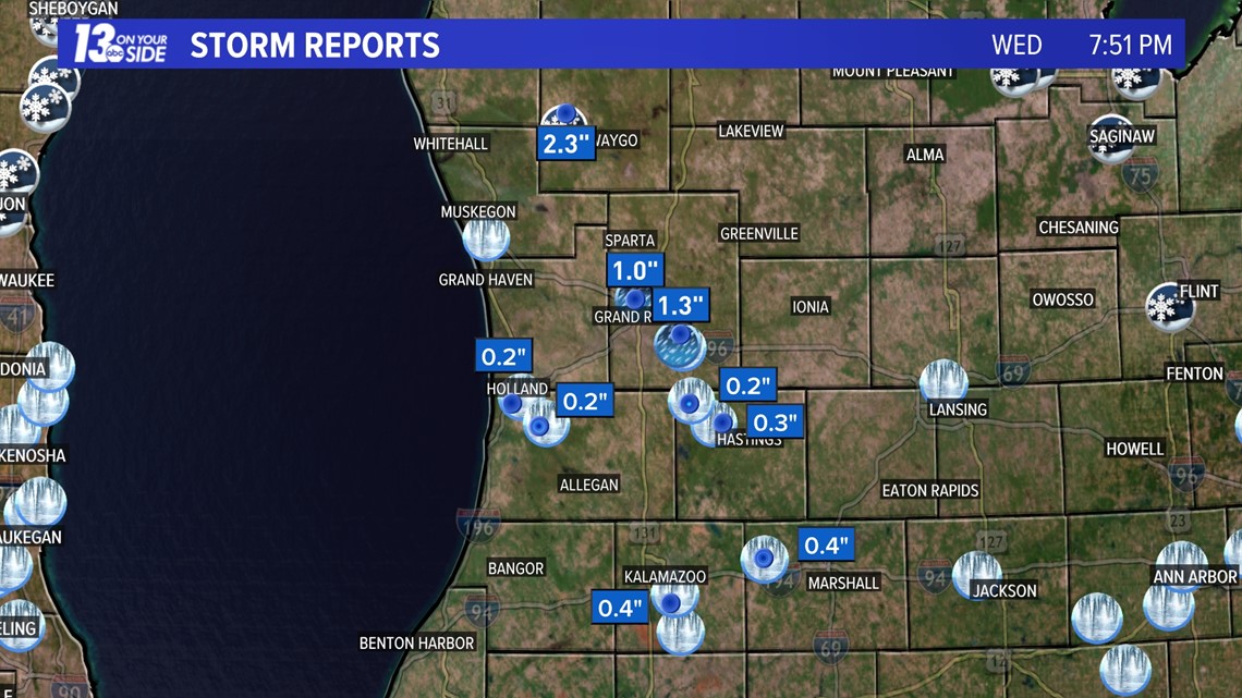
We've already seen a fair amount of ice, sleet, and snow on Wednesday, with over an inch of sleet being felt in Kent County, over 2 inches of snow to the north, and closing in on a half inch of ice in Kalamazoo.

Through the next several hours an additional 0.1 to 0.2 inches of ice accumulation may be felt across West Michigan. This will mean power outage potential will keep rising, especially with gusty winds remaining in the forecast.


In our northern zones and additional 1 to 3 inches of snowfall may fall by Thursday afternoon.


Stay safe out there West Michigan, and make sure you are staying weather aware and with 13 On Your Side for the latest!
-- Meteorologist Michael Behrens
Follow me on social media! Facebook Meteorologist Michael Behrens, Twitter @MikeBehrensWX, and Instagram @MikeBehrensWX.
Email me at: MBehrens@13OnYourSide.com
Have a 30-second video or still photo to share? We'd love to share it with everyone! Email your image to Weather@13OnYourSide.com or post it to our 13OnYourSide Facebook Page.
►Make it easy to keep up to date with more stories like this. Download the 13 ON YOUR SIDE app now.
Have a news tip? Email news@13onyourside.com, visit our Facebook page or Twitter. Subscribe to our YouTube channel.