
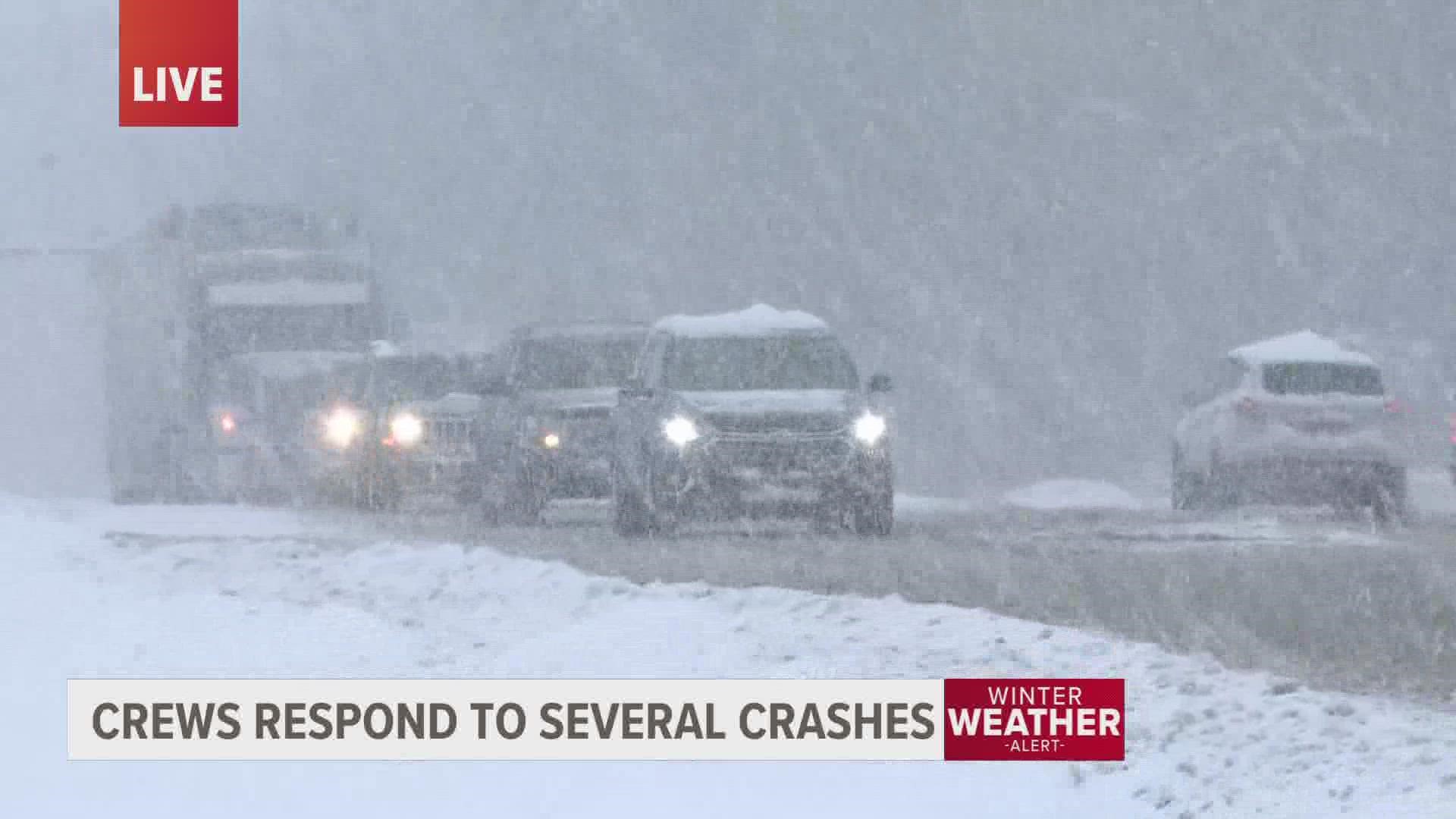
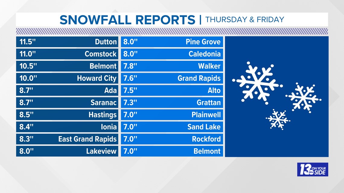
GRAND RAPIDS, Mich. — Snowfall totals of up to nearly a foot have already fallen around West Michigan since Thursday, and more snow remains in the forecast as we head into Friday evening and into the weekend as well.
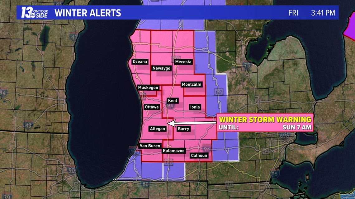
Winter Storm Warnings have been expanded into Muskegon, Oceana, Newaygo, Mecosta, and Montcalm Counties, with all counties under the alert in West Michigan seeing the expiration extended until 7 am on Sunday morning. Like over the last 48 hours, it won't be snowing everywhere all the time, but everyone has a chance to see snow at any time.
See the latest alert map in the image below.

As far as a breakdown of the event goes, we are looking at continued moderate to heavy lake-effect snow bands through Friday evening and into Friday night. These snow bands can be heavy at times, and possibly create whiteout conditions from time to time, but they will take a break as we head toward sunrise.
A break in the snow will last through about noon on Saturday, when snowfall bands again pick up, leading to more accumulation and traffic impacts through Saturday afternoon and evening. Anyone planning on travel should plan to allow plenty of extra time.
See the latest forecast hour-by-hour below.
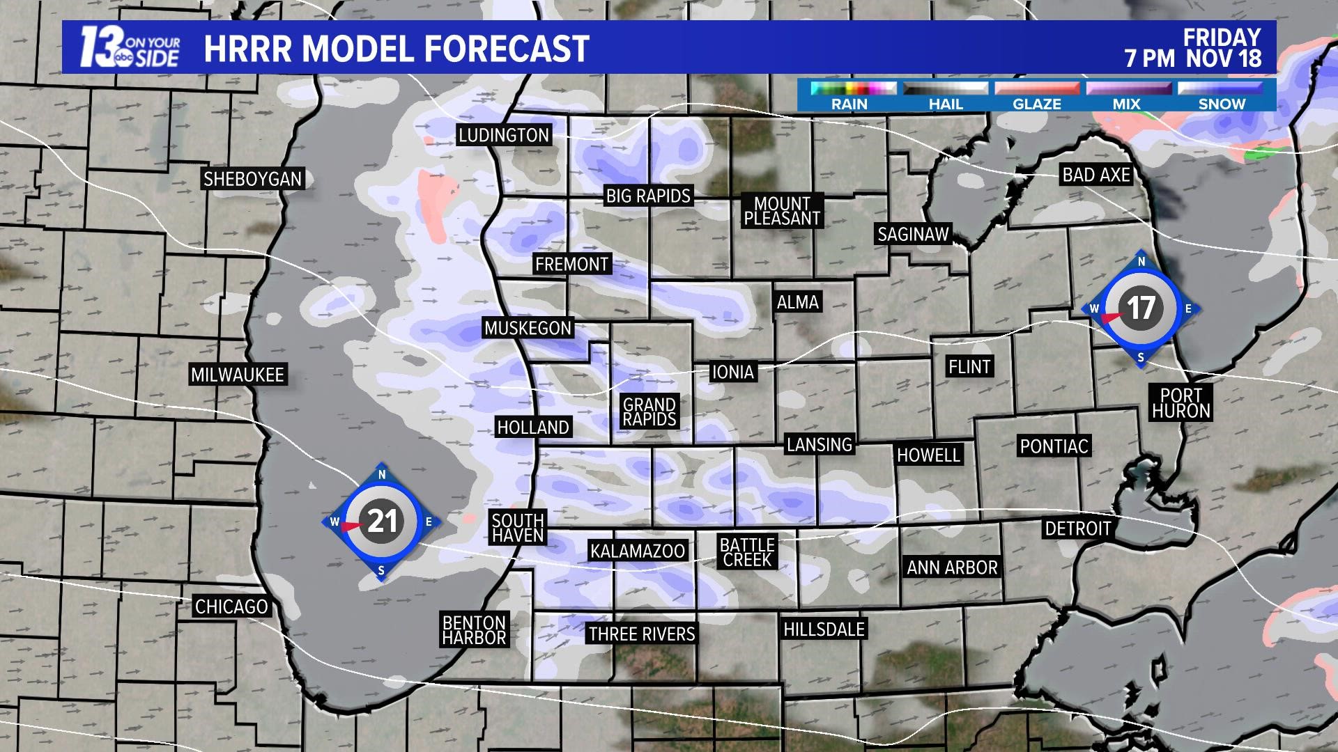
This will leave behind potentially up to 2-3+ inches of additional snowfall by early Saturday morning. Blowing and drifting of existing snow will be a concern overnight as well with winds gusting 20-30 mph.
North/south roads will be most impacted.

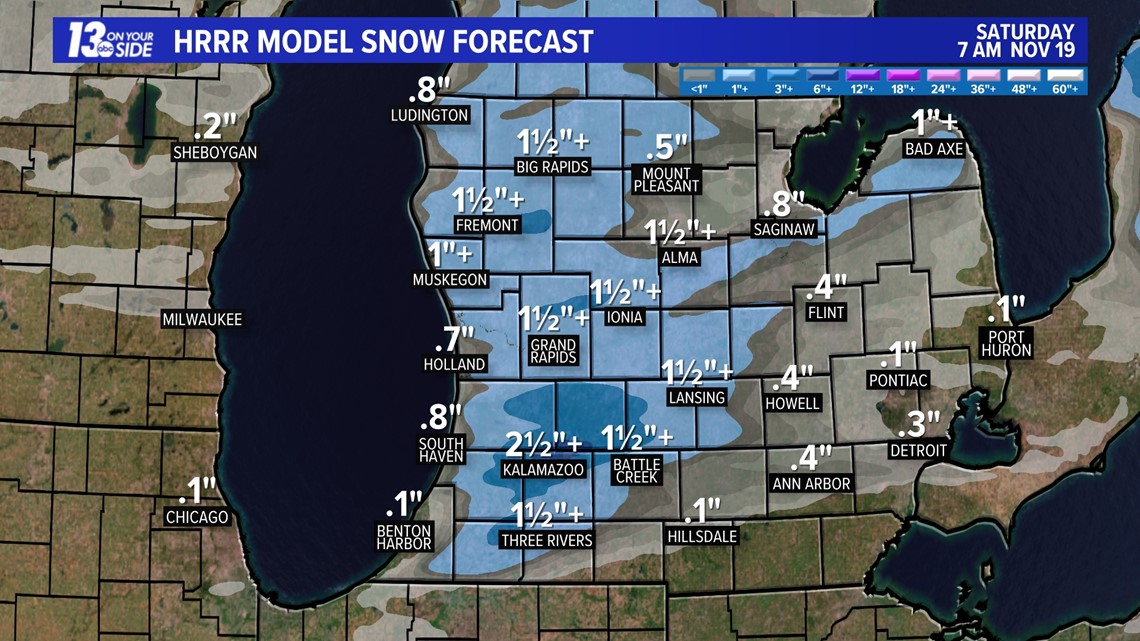
After the break through the Saturday morning hours, additional, heavy at times, snowfall will pick back up on Saturday afternoon and evening. This could leave behind an additional 6-7+ inches on top of what has fallen by Friday afternoon.

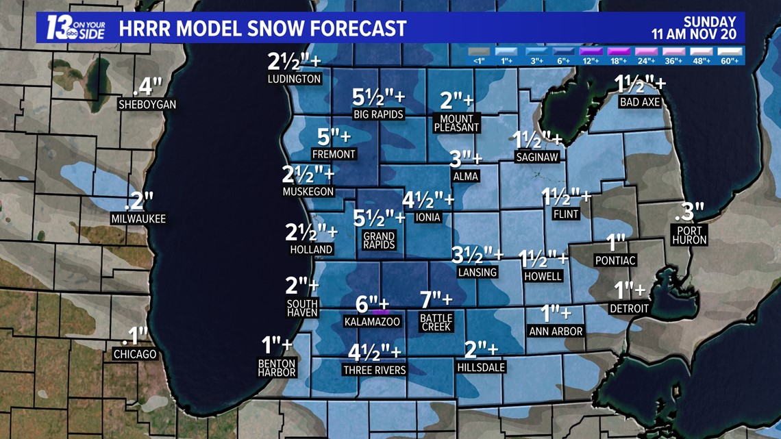
Keep in mind, many areas around West Michigan have already seen snows up close to a foot. This additional snowfall could push some locations up to 15 to 20 inches, if not a few that go even higher for storm totals.

Stick with 13 On Your Side as we head into the weekend and we will keep you up to date on the very latest as it develops!
-- Meteorologist Michael Behrens
Follow me on social media! Facebook Meteorologist Michael Behrens, Twitter @MikeBehrensWX, and Instagram @MikeBehrensWX.
Email me at: MBehrens@13OnYourSide.com
Have a 30-second video or still photo to share? We'd love to share it with everyone! Email your image to Weather@13OnYourSide.com or post it to our 13OnYourSide Facebook Page.
►Make it easy to keep up to date with more stories like this. Download the 13 ON YOUR SIDE app now.
Have a news tip? Email news@13onyourside.com, visit our Facebook page or Twitter. Subscribe to our YouTube channel.