
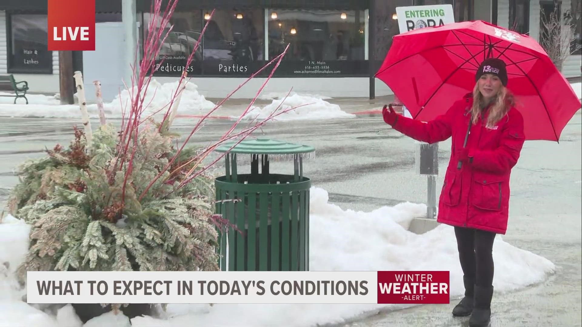
MICHIGAN, USA — Coming off the heels of last weeks ice storm, another round of messy wintry weather will impact much of West Michigan Monday. This time around, however, the location and magnitude of the wintry weather will be different.
OVERVIEW:
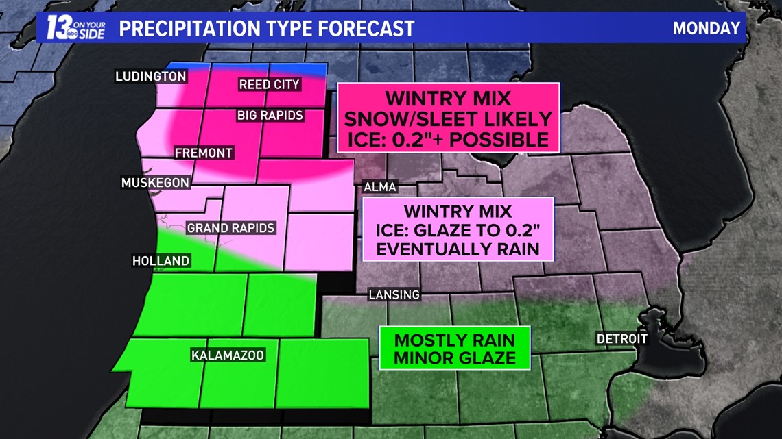
Throughout the morning hours Monday, precipitation will be on the increase in a southwest to northeast fashion (I-94 will see precipitation first, reaching US-10 last). I-96 is appearing to be the middle ground of the messy weather, with location northward having the greatest potential of a wintry mix, while locations southward mostly dealing with an all-rain event.
Widespread precipitation will come to an end by Monday evening, with scattered snow showers and some wintry mix that may linger overnight Monday into early Tuesday.
It doesn’t appear the freezing rain will be as significant as Wednesday’s ice storm, but any amount of ice can be problematic. Those near I-94, which saw the worse of the ice, will likely not deal with any significant impacts.

NORTH OF I-96
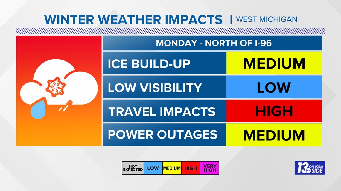
Precipitation, in the way of a wintry mix, will arrive after the morning commute Monday. The concern is for a several hours-long stretch of this wintry mix, which will fall as sleet and/or freezing rain. This prolonged wintry mix, if it comes to fruition, will lead to messy travel and the potential of power outages.

As of now, the greatest likelihood of measurable freezing rain will be centered between M-46 and US-10. This includes locations such as Fremont, Big Rapids, Howard City, Reed City and surrounding communities. In this zone, freezing rain accumulation of 0.2” or greater is possible.
There remains the potential of sleet to be the prominent precipitation type, which would be helpful to negate power outage concerns, but travel will still be impacted.


Closer to I-96, the initial wintry mix will likely transition over to rain as temperatures slowly climb above-freezing. The question remains on how quickly this transition will take place, which will be crucial to the amount of ice that can build up.
For now, a glaze to 0.2” of freezing rain is forecasted, which will be dependent on the transition to rain. As mentioned above, if sleet becomes the prominent precipitation type before switching to rain, that’ll cut back on the severity of impacts.
Either way, impacts to travel are expected on Monday morning, and most of the 13 On Your Side viewing area will be under a Winter Weather Advisory on Monday.


When it comes to power outages, some may be possible in areas with the heaviest icing. Factoring in wind gusts of 30-40 mph out of the east-southeast could further these impacts.


SOUTH OF I-96
Impacts will be much less southward of I-96, as precipitation will be mostly rain throughout the entirety of the event. The good news is that the hardest hit areas from Wednesday’s ice storm will escape the wintry impacts.
Outside of a brief, initial wintry mix, temperatures will quickly rise above freezing as the morning goes on, allowing rain to take over. Rain amounts will be impressive for late February standards, with 1”+ of rain expected.


STAY UPDATED WITH THE FORECAST
Ice, especially freezing rain, is one of the hardest variables to forecast. A slight deviation in temperature, from ground-level to a few thousand feet in the atmosphere, can lead to drastic changes in precipitation type and resultant impacts.
Stick with the 13 ON YOUR SIDE forecast for the latest updates.
-- The 13 On Your Side Weather Team
Have a 30-second video or still photo to share? We'd love to share it with everyone! Email your image to Weather@13OnYourSide.com or post it to our 13OnYourSide Facebook Page.
►Make it easy to keep up to date with more stories like this. Download the 13 ON YOUR SIDE app now.
Have a news tip? Email news@13onyourside.com, visit our Facebook page or Twitter. Subscribe to our YouTube channel.