LAKE, MICHIGAN, Mich. — It's been just about two weeks since the last major accumulating snowfall along the West Michigan lakeshore, but as we head into Wednesday evening that has the potential to change.
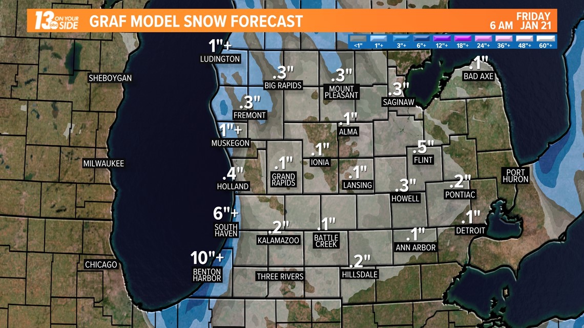
While this will not be the heaviest snowfall we have seen so far this year, it will add another several inches to our winter totals, with the highest totals being along the immediate lakeshore. The highest impacted areas, likely South Haven and south, could see in excess of 6 inches in some isolated areas.
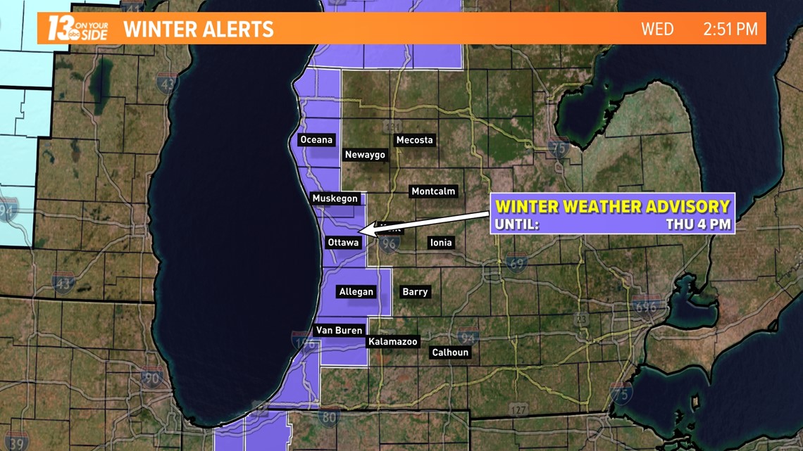
With this new snowfall expected to impact travel and possibly Thursday morning commutes/school days, a Winter Weather Advisory will be in effect for the lakeshore counties from now through 4 p.m. Thursday afternoon.

The good news for travelers is that this snowfall will come over a prolonged period of time and consist of finer snowflakes than previous events. This will likely allow crews to manage impacts in all but the hardest-hit areas, though you should be prepared for areas of rapidly reduced visibility and slick roads.
The timing of this event will be from Wednesday evening through the first half of Thursday. Snowfall will ramp up Wednesday night and start to wrap up into Thursday afternoon.
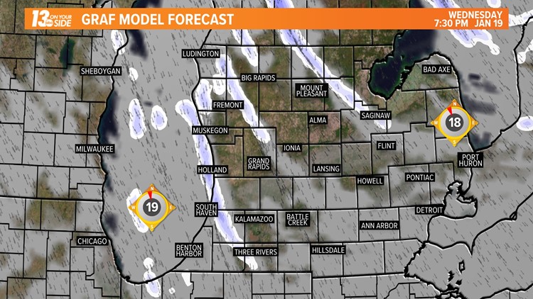
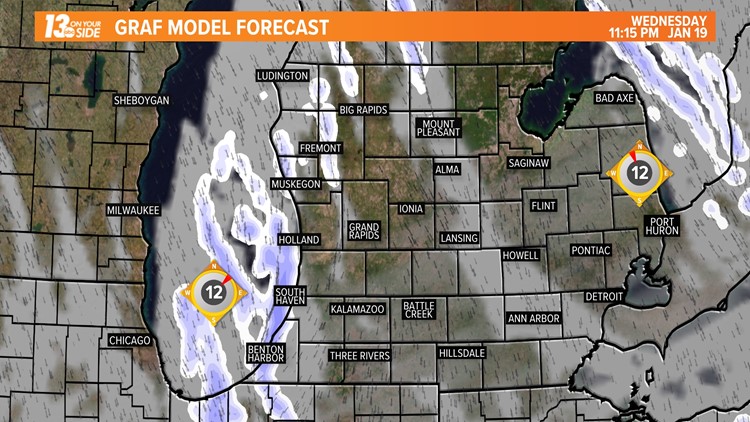
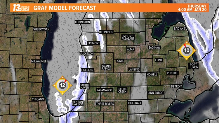
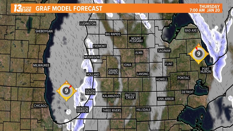
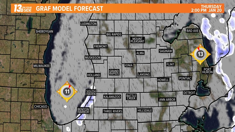
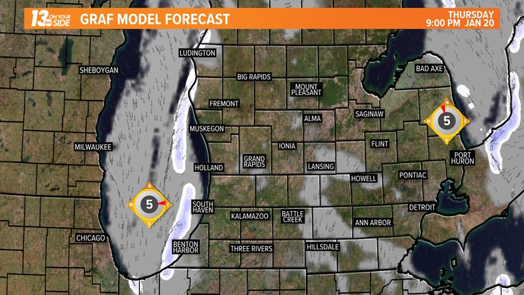
Below is an hour-by-hour walk-through of this snow event.
Hour-by-Hour Lake-Effect 1/19/22


Snowfall totals will be relatively minor away from the lakeshore, with an area of higher totals north of Muskegon. The totals from Muskegon to just about Holland will be lower, with totals south of Holland being the highest.
Below is a model depiction of expected snowfall from this event.

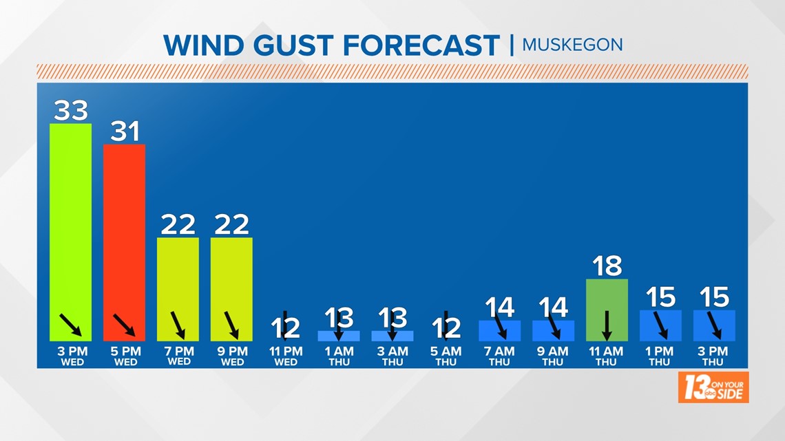
Another concern with this system will be the potential for blowing and drifting snow, along with sub-zero wind chills overnight. Winds will gust at times over 30 mph Wednesday evening, with gusts of 10-20 into the day on Thursday.

While this won't be the most impactful snow all year, it will be one that could prove disruptive for some, especially along the immediate lakeshore. 13 ON YOUR SIDE will keep you covered through this system and all winter long!
-- Meteorologist Michael Behrens
Follow me on social media! Facebook Meteorologist Michael Behrens, Twitter @MikeBehrensWX, and Instagram @MikeBehrensWX.
Email me at: MBehrens@13OnYourSide.com
Have a 30-second video or still photo to share? We'd love to share it with everyone! Email your image to Weather@13OnYourSide.com or post it to our 13OnYourSide Facebook Page.
►Make it easy to keep up to date with more stories like this. Download the 13 ON YOUR SIDE app now.
Have a news tip? Email news@13onyourside.com, visit our Facebook page or Twitter. Subscribe to our YouTube channel.