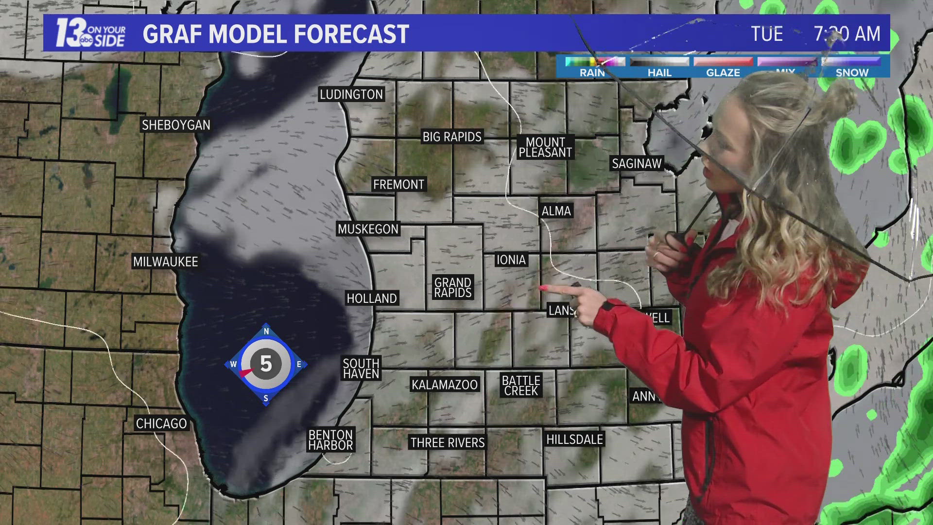
GRAND RAPIDS, Mich. — We are gearing up for a major winter storm tomorrow afternoon through Thursday morning. The latest guidance continues to suggest impactful ice, some accumulating snowfall, and strong gusty winds.
Timeline
The system arrives in West Michigan by the mid-afternoon Wednesday and intensifies during the late afternoon to early evening hours. The system will weaken overnight and wrap up by the late morning hours on Thursday. Both the Wednesday evening commute and Thursday morning commute will be highly impacted by this system.
Amounts
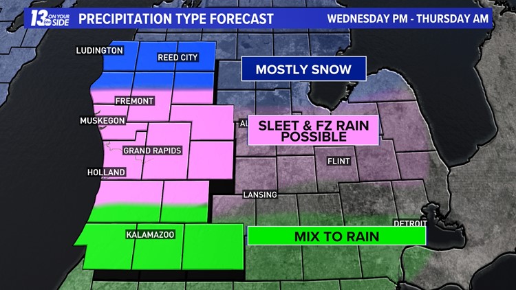
Heavy snowfall continues to push further north into Central and Northern lower Michigan. Those along US-10 could see 4+ inches, with those south of that likely seeing more sleet and freezing rain than snow, but this could shift slightly.
Ice totals look to be the most dangerous surrounding I-96. The closer you get to I-94, the more warm air will be present and the higher the likelihood of freezing rain mixing with rain becomes.
These are estimated totals and will likely fluctuate once the actual system arrives.
Impacts
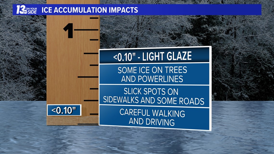
Just a thin layer of ice can cause difficulty when driving, but heavier amounts can create very dangerous travel, power outages, and even damage trees.
A glaze of ice will cause some low-end concerns, such as slick spots and difficult driving. We will likely exceed this amount of ice for a large portion of the region.

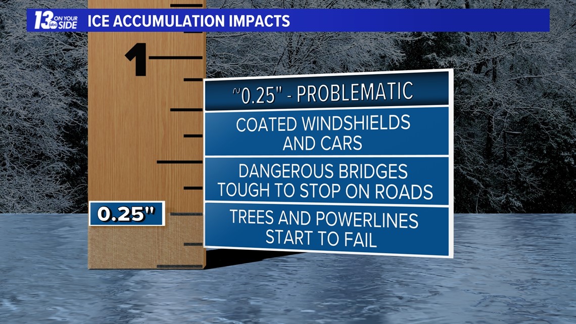
Anything near a quarter inch or more becomes problematic. This is when cars become coated in ice, it becomes very difficult to stop on roads and bridges, and power begins to fail. This outcome is looking increasingly likely for portions of West Michigan.

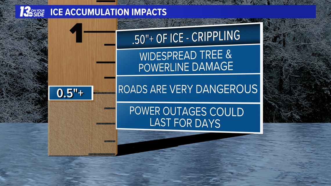
Ice becomes crippling anytime a half inch or more is reached. This could cause widespread power outages for numerous days, tree damage, and extremely dangerous travel. This is not out of the realm of possibilities, but we are still trying to nail down this portion of the forecast.

Of course, impacts are expected to be great as ice accumulation will likely be closer to the second or third case.
Stay safe and continue to check in for updates in the coming days. Also, you can download our 13 On Your Side Weather App for continuous updates on watches, warnings, and advisories as well as a real-time radar.
►Make it easy to keep up to date with more stories like this. Download the 13 ON YOUR SIDE app now.
Have a news tip? Email news@13onyourside.com, visit our Facebook page or Twitter. Subscribe to our YouTube channel.