GRAND RAPIDS, Mich. — Mother Nature is gearing up for a weather whiplash across the Great Lakes, including here in West Michigan. From the 40s and rainfall to sharply colder air and the potential of significant snowfall, there are plenty of forecast details that need to be addressed.
Tranquil February weather will prevail the rest of Tuesday, with near-average temperatures (in the 30s) for this time of year. Increasing southerly winds via an approaching warm front, however, will continue to boost temperatures to near 40F overnight Tuesday into the start of Wednesday.
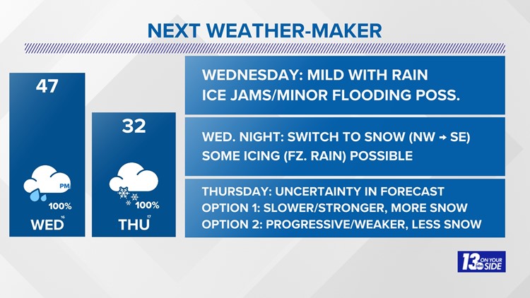
Wednesday kicks off the weather whiplash as mild February temperatures take hold, along with an increasing chance of steady rain. While the combination of 40s and rain will not impact travel much throughout the day, there is a concern for ice jams and/or minor river flooding.
Both the Grand River and Muskegon River basin have enough ice to break up and potentially jam. Forecasting ice jams are highly unpredictable, meaning a close eye is needed near the banks of both river basins on Wednesday.
A cold front arrives overnight Wednesday into early Thursday, dropping temperatures below freezing, along with a brief switch over to a wintry mix. Travel may be impacted during the Thursday morning commute as the rainfall/melting from Wednesday starts to refreeze.
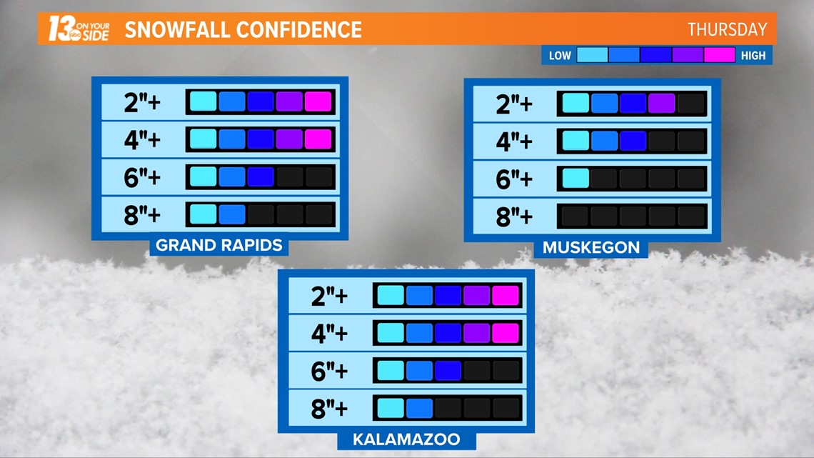
The uncertainty of the forecast revolves around Thursday, with the potential of significant snow across much of West Michigan. The culprit would be a robust low-pressure system taking a track along the above-mentioned cold front into the Great Lakes throughout Thursday.

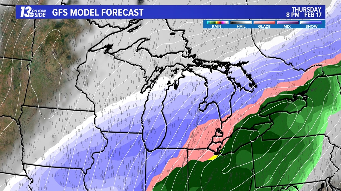

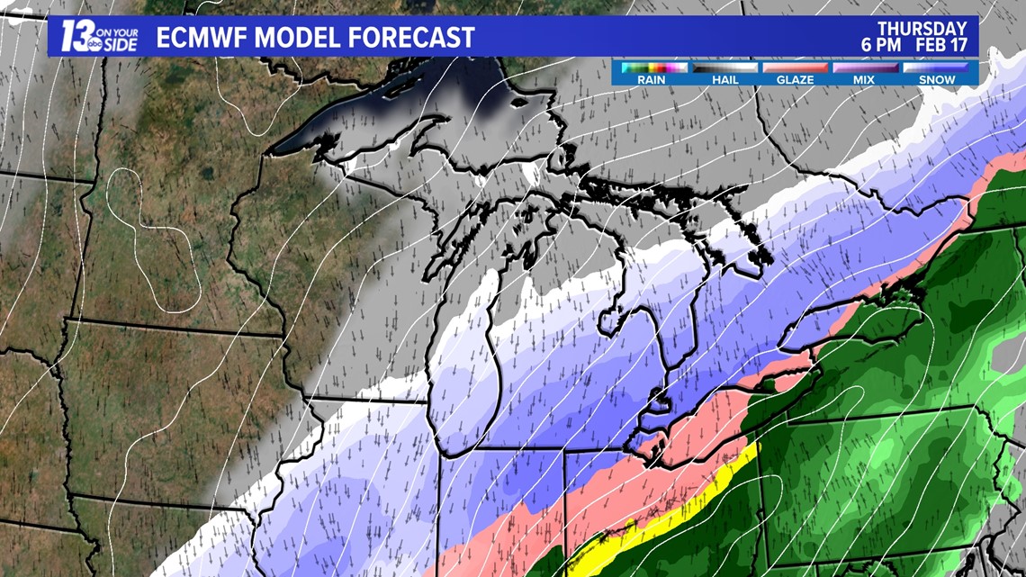
Model guidance is struggling with the evolution of this low-pressure system, with two distinct solutions. The first solution would be a slower, more northerly track of low-pressure, putting West Michigan in a favorable zone for significant snowfall (6” +). The second solution would be a progressive, southerly track of low-pressure, situating significant snow southeastward of West Michigan.
At this point of the forecast, the greatest probability of significant snow/impacts will be roughly from a Holland – Grand Rapids – Greenville line to the south and east. There’ll likely be some adjustments to this forecast as confidence builds with model guidance.
Stick with the 13 ON YOUR SIDE weather team as the fine details become clearer.

►Make it easy to keep up to date with more stories like this. Download the 13 ON YOUR SIDE app now.
Have a news tip? Email news@13onyourside.com, visit our Facebook page or Twitter. Subscribe to our YouTube channel.